Venice Then and Now. 1600th Anniversary of the City
This exhibition from our rich Map Collection celebrates the 1,600th anniversary of Venice's founding. The Queen of the Adriatic has a centuries-old history which can be traced through cartographic materials of the 16th-21st centuries. On display are rare ancient maps with colourful titles, lavishly decorated with narrative illustrations. They are followed by modern tourist maps and practical guide books. Most of the maps provide bird’s eye views of the city, made from some high point. These panoramic maps created very detail, complete and vivid images of the city. That's why, panoramic mapping is still popular today. We can enjoy the views of the floating city that was built in a lagoon of water on islands separated by canals, but connected by bridges. The maps depict city blocks, palaces, cathedrals and bell towers soaring high into the skies.
The 16th century maps portrayed a city that had already formed and had changed little over time. We see a prosperous European city, the major centre of commerce and production in the world, an important crossroads for trade routes. Venice's wealth and power and the Venetians' passion for luxury were reflected in a timeless beauty of the city's architectural marvels. As a place built on water, it was a center for architectural innovation and the best construction solutions. But its greatest days were over.The sixteenth century is the beginning of Venice's gradual decline.
The 18th century maps show Venice that ceased to be the dominant maritime power in the Mediterranean, but did not lost its innumerable riches. The city became the capital of entertainment and arts, famous for theaters, masquerades and regattas. The capture of Venice by Napoleon in 1797 marked the end of the Gallant Age for it.
The 19th century maps witness another rise of Venice, when a newly-built port gave impetus to tourism activities. This is the time of the final transformation of the city into an open-air museum, which halted the construction of new buildings.
Today, the city has become a magnet for tourists. Each year, more than 15 million people visit Venice. Illustrated tourist maps, containing information on the top attractions, transportation, walking routes as well as travel phrases, are available to visitors in all major languages.
The greater part of the exhibited maps can be found in the Digital Library, but some can be viewed only in the Maps Reading Room.
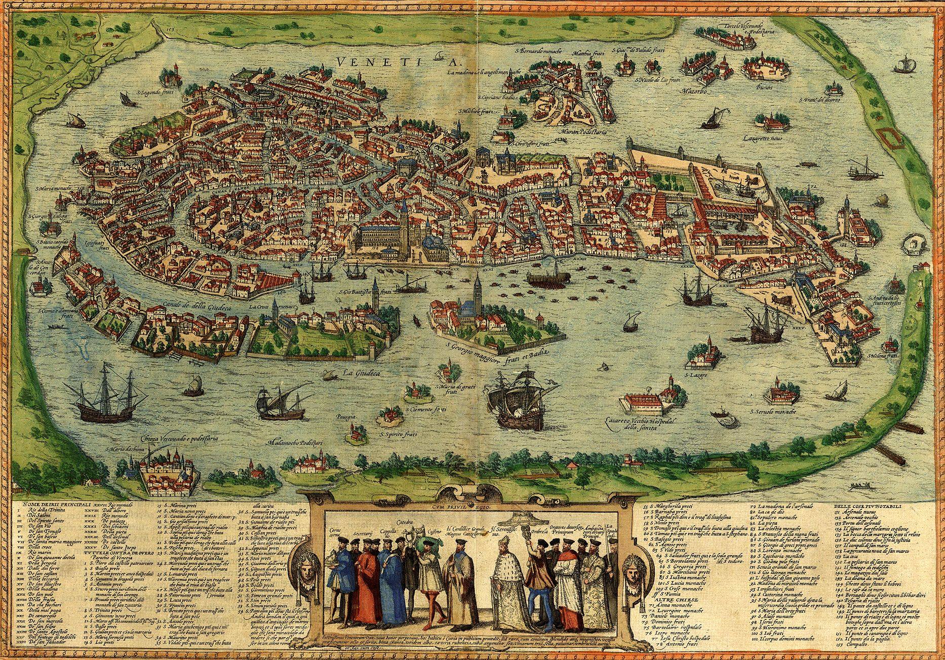
The most magnificent bird's eye view of Venice appeared in the first volume of the Braun & Hogenberg's City Atlas, published in Cologne in 1572 (for more details about the first city atlas, see the Virtual Wander through Ancient Cities).
The earliest map in the Map Collection of the NLR portrays Venice as a key economic and cultural center of Europe. We can view all islands in the Venecian Lagoon and the city's architectural landmarks. St. Mark’s Square and Basilica, the Old Library and Doge’s Palace stand out at the heart of Venice. The numerous ship-building facilities are visible on the right. Small islands around the city are also shown and labeled. Notable among them are San Giorgio, home to a beautiful Palladian church and monastery, and the island of Murano, a renowned center for the local glass industry. The Grand Canal and harbour are embellished with ships, boats and gondolas. The vignette in the center illustrates a magnifcent procession of the Doge (the ruler of the city) and dignitaries with the Doge's attributes. Inscriptions above the officials identifies their titles or roles. The bottom index lists the canals (in Roman numerals), as well as the most important churches, monasteries, palaces, hospitals, arsenals, bridges and so on.
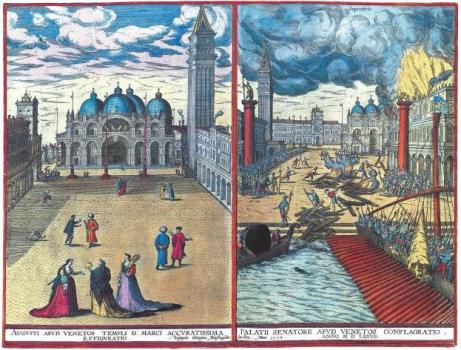
Braun and Hogenberg’s volume 5 depicts two views of Venice on a single plate. They were created by the engraver Joris Hoefnagel, as the most maps in the atlas.
St. Mark’s Basilica and Square can be seen at left. At right, the Old and New Procurators’ Offices overlook the St. Mark's Square engulfed in flames. This is a depiction of one of two great Venetian fires of the 16th century, at which the Doge's Palace was seriously damaged.
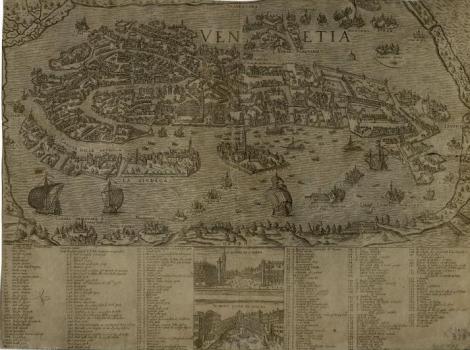
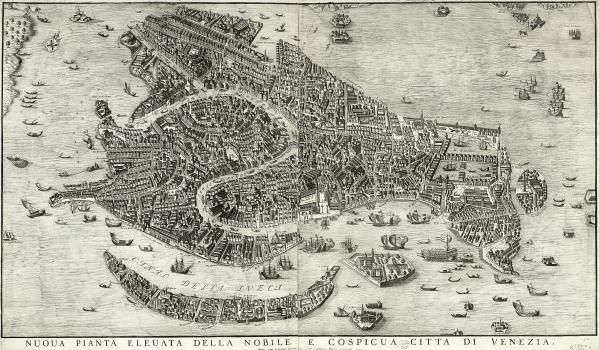
Bird's eye View of Venice, published by D. Bertelli presumably in 1580 (according to other sources in 1566). Individual buildings and structures are shown, the names of the islands and the Grand Canal are labled. Below is a detailed index of canals, bridges, churches, monasteries, palaces, squares and other important places. Illustrations feature the harbour full of sailing ships, fishing boats and gondolas.
Donato Bertelli (1558-1623) was a Venetian publisher and bookseller. He published a collection of pictorial 3-D views of cities in Europe, Asia and Africa, by various authors, containing this plan of Venice.
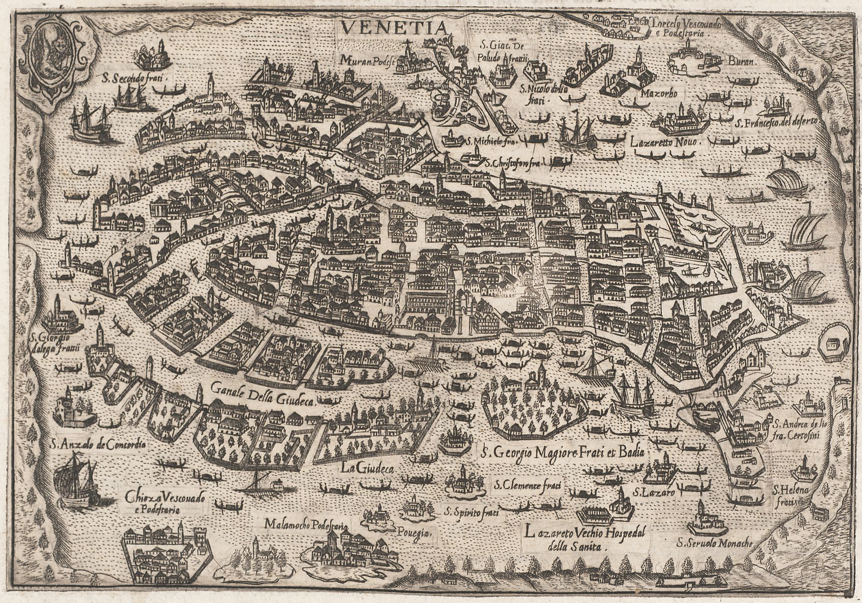
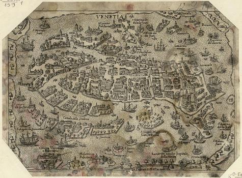
Bird's eye View of Venice in the atlas Theatrum urbium italiacarum, published by P. Bertelli in Venice in 1599. The Theatrum (Spectacle of the Cities of Italy) is a series of maps of the most famous Italian cities.
The main buildings and structures are shown, the islands of the lagoon are labeled. The Grand Canal and harbour are decorated with ships, boats and gondolas.
Pietro Bertelli (1571? -1621?) wass a publisher active in Venice, Vicenza and Padua, bookseller in Padua.
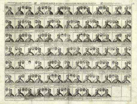
Portraits of the 89 Doges of Venice from Paolo Lucio Anafesto (? -717) to Mario Grimani (1532-1605, elected in 1595) with personal coats of arms and brief comments. It is part of the atlas of city plans by various authors.
Pietro Bertelli (1571? -1621?) was a publisher active in Venice, Vicenza and Padua, bookseller in Padua.
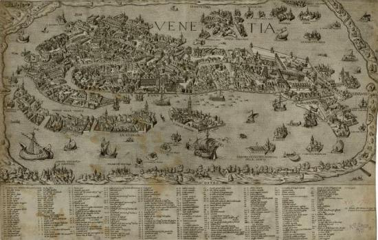
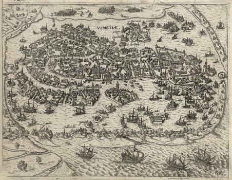
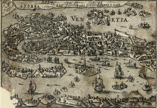
Bird's eye View of Venice, created by G. Keller in 1607. The main buildings and structures are shown, all the islands of the lagoon are labeled. At the top, we can see a view of the battle on land. The harbour is decorated with ships, boats and gondolas.
Georg Keller (1576-1640) was a German painter and printmaker. Born in Frankfurt am Main, he was trained with wood engraving under J. Ammann in Nuremberg. Between 1595 and 1628, he worked as an engraver in Frankfurt am Main, including at the Messrelation – one of the first periodicals. (The Messrelation was the predecessor of modern magazines and newspapers, which reported news about political and military events.) Keller also made illustrations for military books, produced topographic plans and views, images of battles. G. Keller's works are a bibliographic rarity, because they were usually supplements to newspapers or magazines and, therefore, survived in small numbers.
Bird's eye View of Venice, engraved and issued by F. Valegio in the early 17th century. It is based on earlier representations of Venice, published in 1565 and 1597. The map shows buildings and other structures. Islands and canals are labeled. The bottom index lists landmarks and other places of interest. Illustrations depict ships, boats and gondolas in the Grand Canal and harbour; below are views of St. Mark's Square and the newly-built Rialto Bridge.
Francesco Valegio (1560? -1640?) was an Italian painter, engraver and publisher active in Venice between 1598 and 1627. In addition to sheet prints, he released a townbook entitled Raccolta di le piv illustri et farmose citta di tutto il mondo [Collection of illustrious and famous cities from around the world] (Shelfmark: K 0-Mir 7/198). Published in Venice around 1595, the townbook is considered a real masterpiece of the art. It consists of 235 beautiful plates depicting the main European cities. The Collection became a bibliographic rarity.
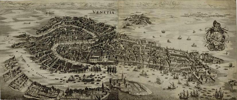
Bird's eye View of Venice, produced by M. Merian the Elder in the mid 17th century. Individual buildings and structures are shown both on the plan of Venice and on the surrounding islands of San Giorgio, Murano, Burano, Torcello and so on. Canals and churches are labeled. The Adriatic and canals are embelished with numerous sailing vessels, boats and gondolas. On the right is the coat-of-arms of Venetian Republic, crowned by the Doge's cap, and the Venetian Lion at center.
Matthäus Merian the Elder (1593 – 1650) was a Swiss-born engraver, artist and publisher. Born in Basel, Merian studied engraving in Zürich. He then trained in engraving in Nancy, Paris and Strasbourg. In 1617, he settled in Frankfurt, where he worked for the publisher Johann Theodor de Bry. Merian married de Bry's daughter and inherited his publishing house after the death of his father-in-law in 1623. Merian is best known for his highly detailed city plans and views, created in his own unique style. They are a valuable chronicle of European life in the first half of the 17th century.
Bird's eye View of Venice, issued in Padua in the mid 17th century by M. Cadorin. The view features major landmarks, the islands are labeled. The Grand Canal and harbour are embellished with ships and gondolas.
Matteo Cadorin, known by the nickname Bolzetta (16 ?? - 16 ??) was a publisher, printer and bookseller active in Padua from 1639. Cadorin published top quality plans, vedute (prints of cityscapes), maps, vignettes and portraits.
Bird's eye View of Venice and surrounding islands, published presumably ca. 1670, either for an atlas or as an illustration in a book. The map shows important buildings and other structures. The Grand Canal and harbour are decorated with ships and gondolas.
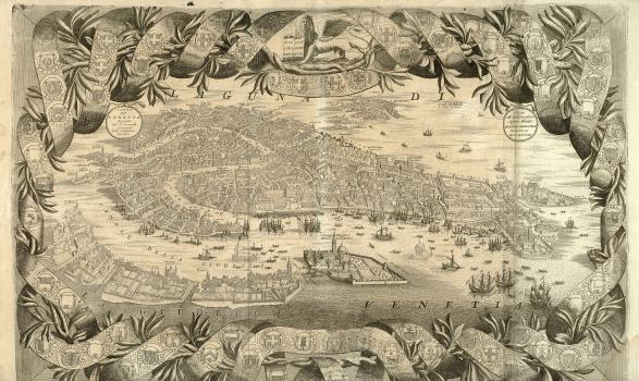
Bird's eye View of Venice from the world atlas Isolario del Atlante Veneto by V. M. Coronelli. The view is attributed to Coronelli, but there is no evidence of his authorship. It is an updated 1636 map by M. Merian. The later date of its creation is confirmed by mapping the Church of Santa Maria della Salute on the view. The church was built by Venetians in 1631-1687 in thanksgiving to God for the deliverance from the plague of 1630. The map was included by Coronelli in Corso Geografico Universale and later in Isolario del Atlante Veneto. Individual buildings and structures are shown both on the canals of Venice and the surrounding islands of San Giorgio, Murano, Burano, Torcello, etc.; the canals and churches are labeled. The view of Venice is framed with a garland, intertwined with a ribbon and including the symbolic lion of Venice. This ribbon is decorated with the arms of cities within the Republic of Venice.
Vincenzo Maria Coronelli (1650-1718) was an Italian historian, cosmographer and cartographer, encyclopedist and publisher, Franciscan monk and theologian. Coronelli was born and spent most of his life in Venice, where he was awarded the title of Cosmographer of the Venetian Republic. He was famous for impressive globes of the earth and sky. Coronelli was commissioned to construct a pair of gigantic globes by the French king Louis XIV (they are now kept in the National Library of France). Coronelli's most significant work was Atlante Veneto, a monumental atlas, intended as a continuation of the Blaeu Atlas Maior. Besides up-to-date map, the Atlante Veneto contained information about ancient and modern mapmakers and geographers, together with astronomical and historical data. The last part of the atlas deals with hydrography (the oceans, rivers, lakes) and ends with a description and depiction of ships. The Isolario del Atlante Veneto was released as the second volume of Atlante Veneto. Coronelli is also known as the founder of the Accademia Cosmografica degli Argonauti, the first geographical society in the world.
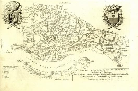
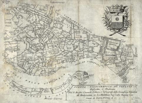
Plan of Venice, first published in V. Coronelli's atlas Citta, Fortezze e, Isole, e Porti principlai dell'Europa … (Cities, Fortresses and Islands, as well as the Major Ports of Europe…). It was issued by D. Padovani in 1689 in Venice ( second edition of 1690), and was also included in the 1696 world atlas Isolario del Atlante Veneto. The plan features islands, canals, churches, theaters and hospitals. Some of the objects are labelled with names, some with numbers (no key). Cartographic symbols are given at bottom left. The coat of arms of the Venetian Republic is depicted at top left. At top right is the arms of the Venetian family Ruzziniс and the dedication to Carlo Ruzzini (1653-1735, Venetian diplomat and statesman, 113th Doge of Venice).
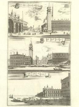
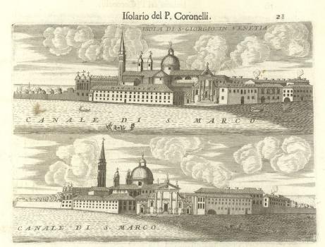
Illustrations show views of Venice from the world atlas Isolario del Atlante Veneto: St Mark’s Square toward the Sea; Clock Tower; Piazzetta; San Giorgio Island.
(изо-MA38075)
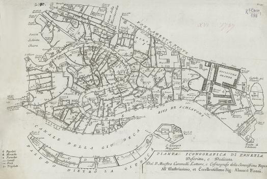
One of the variants of V. Coronelli's View of Venice, published at the end of the 17th century. The copy is defective: left part with the coat of arms of the Venetian Republic and cartographic symbols are missing.
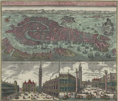
Bird's-eye View of Venice, issued by M. Seutter separately, or as part of his Atlas Novus (New Atlas of the World). Buildings and structures are shown, canals and islands are labeled. Illustrations feature the coat of arms of the Venetian Republic, crowned by the Doge's cap, and the Venetian Lion at center; ships and gondolas in the harbor. Below are two views of St. Mark's Basilica and the Doge's Palace, depicting scenes of the city life and gondolas.
Matthäus Seutter (1678-1757) was a prominent German engraver and mapmaker, founder of his own publishing house. He trained as an engraver under Johann Baptist Homann, a famous Nuremberg cartographer whose style had a great influence on Seutter. Seutter was one of the most prolific publishers of his time; in 1727 the German Emperor Charles VI honored him with the title of "Iimperial Geographer". After the founder's death in 1757, the Seutter publishing company continued under Seutter’s son Albrecht Carl.
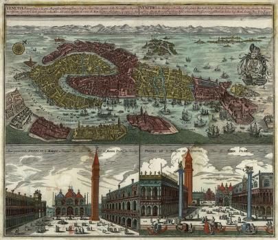
Bird's-eye View of Venice by M. Seutter. It is almost the same as the previous one, but uses different colors. The view was published as part of a composite atlas of cities.
One of the variants of V. Coronelli's View of Venice. It is different from the original in having another dedication and no coats of arms. Presumably, it was published in Venice in the 18th century.
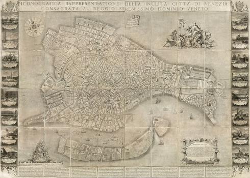
L. Ughi’s 1729 Map of Venice. (There is little known about the mapmaker Lodovico Ughi.) The wall (large-scaled) topographic map of Venice is the first map of the city to be based on field surveys. The map was first published in 1729 by D. Baroni, a founder of the guild of engravers in Venice. After his death, the Venetian publisher L. Furlanetto acquired the printing plates and repeatedly reproduced the map (the NLR copy was published no later than 1779). In the next century, the map was also frequently reprinted and served as a model for many other maps of the city.
The map feature the network of the city streets and canals, layout of parks and gardens. The shaded buildings on the map indicate churches. The churches, canals, streets and squares are labeled with their names. At bottom right, we can see a baroque cartouche, with the title and dedication to Alvise III Sebastiano Mocenigo, the Doge of the city at the time the map was made. The Grand Canal and harbour is embellished with sailing ships and boats. The compass rose at the upper left corner shows the 16 wind directions and their names, and 4 putti heads (allegories of the winds). The illustration at bottom left shows the coat of arms of Francesco Morosini, the last of the 'Warring Doges', surrounded by putti and military attributes. At top right is a fragment of a poem by the Italian poet J. Sannazaro, praising Venice in Latin, against the background of a cloth supported by a putto. Another right scene depicts an allegorical Venice, seated on the lion of St. Mark, sailing the sea, pulled by whales, along with the sea gods, putti and tritons. It symbolizes the union of Venice with the sea — the main source of wealth for the city.
Below is descriptions of the city, public transport, churches, parishes, hospitals, and other structures of architectural interest. The map is flanked on both sides by 16 colorful views of the major buildings and bridges of Venice: (at left) View of St Mark's Square from the Sea; View of St Mark's Square towards the Church of San Gimignano; New Prosecutor's Office by V. Scamozzi; Old Prosecutor's Office in St Mark's Square; St Mark's Basilica; View of St Mark's Square towards St Mark's Basilica; View of St Mark's Square towards Column with Lion, Symbol of St. Mark; Prison by J. Sansovino; (at right) Fish Market by J. Sansovino; G. Benoni's Customs House Viewed from the Sea; Arsenal Gate; Rialto Bridge by A. dal Ponte; Rialto Square; St. George's Church by A. Palladio; Church of Il Redentore by A. Palladio; Church of Santa Maria della Salute by B. Longhena.
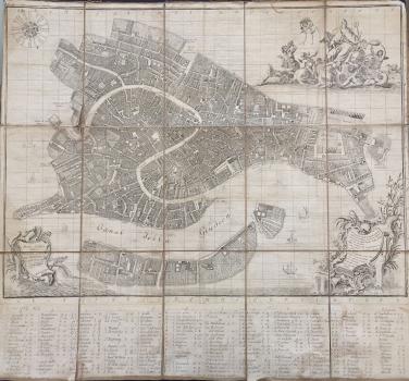
New edition of L. Ughi’s 1729 Map of Venice, published by L. Furlanetto, presumably in 1787.
Cartouches with the title and dedication, compass rose and pointer are changed. There are no views. The NLR copy is defective: the index is partially missing.
Ludovico Furlanetto is a publisher and printseller, active in Venice in 1766-1777. He specialsied in Venetian landscapes. In particular, he is known for series of plates, entitled Ducal Ceremonies and Festivals (Feste Ducali).
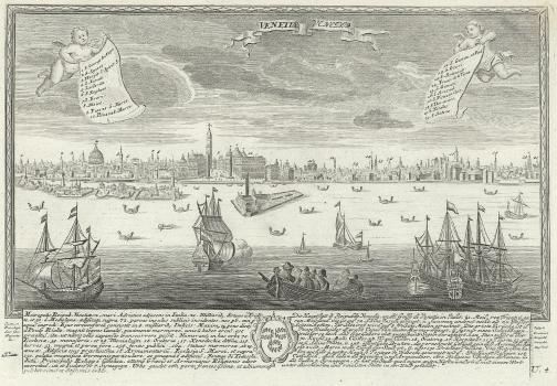
Bird's eye View of Venice towards St Mark's Square from the sea from the composite atlas of the world's cities by J. F. Leopold, published ca. 1730. In the foreground are sailing ships, boats and gondolas. At the top, angels hold scrolls that list the depicted buildings. Below is a text with explanations.
Joseph Friedrich Leopold (1668-1727) is a German engraver, printer, publisher and bookseller active in Augsburg. He engraved and published portraits of rulers, maps, city views, music, etc.
Bird's eye View of Venice, published by L. Furlanetto, a Venetian publisher and printseller. It was probably based on the 1677 view by the Venetian publisher S. Scolari. The map shows the city and the surrounding islands, buildings and other structures. The islands, canals and squares are labeled. The Grand Canal and the harbour are embelished with sailing ships, boats and gondolas. Illustrations depict the Venetians, constructing gondolas and chopping firewood.
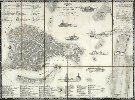
Topographic plan of Venice and surrounding islands was drawn and engraved by G. Garlato, in 1838, and published in Venice by G. Kier, in 1841. The map show a network of streets and canals, parks and gardens, city blocks. The public buildings are shaded in dark. The Grand Canal, squares, parks are labeled with their names. The index (1-197) lists churches, theaters, hotels, palaces of the Grand Canal, civilian and military institutions, barracks. The map is beautifully decorated with 7 views of the surroundings: Approach to the Island of Murano, Church of San Michele in Isola, Church of Sant'Elena, Fort of Sant'Andrea, View of the Island of San Servolo, View of the Saint Lazarus Island and San Nicolò Church.
The copy from the Map Collection of the National Library of Russia previously belonged to Count D. N. Sheremetyev. The evivence is the heraldic bookplates of his library, seen on the map and case.
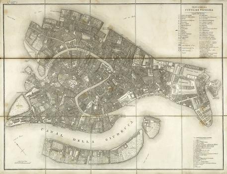
Map of Venice, published in the first half of the 19th century. The author and publisher are unknown. It shows a network of streets and canals, city blocks, churches, parks and gardens. Streets, canals, parks, squares are labeled. Indexes list: (1-30) churches and cathedrals indicated by 3 types of simbols (including abolished ones); (A-L) important public, military and educational institutions; (1-24) barracks.
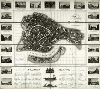
Map of Venice, drawn by Bertoja, engraved by A. Lazzari and published by D. Gallo in 1831. It shows a network of streets and canals, city blocks, gardens and parks. Churches are shaded in dark. An index lists: parishes, civil institutions, prisons, government offices, theaters, hotels. Above the index is a dedication to "His Grace Count Domenico Morosini, Podestà of Venice" (D. Morosini - Podestà (Mayor) of Venice in 1827-1834, appointed by the Austrian Emperor Franz I. Morosini developed the city recovery strategies. Under the guidance of the engineer A. Boni, roads and bridges were repaired, canals were cleaned).
The map is famed with views of (at the top): Prison; St. Mark's Square; Piazzetta San Marco (part of St. Mark's Square from the Grand Canal to the bell tower); Interior of St. Mark's Basilica; Doge's Palace; St. Mark's Square; Promenade on Riva degli Schiavoni; (at the left): Church of Il Redentore; Rialto Bridge; Inner Courtyard of Doge's Palace; Arsenal Bridge; Basilica of Santa Maria Gloriosa dei Frari; Maritime Customs; Bridge to San Pietro di Castello; (at the right): Clock Tower; Rialto Bridge; Royal Gardens; Public Park; Basilica of Santi Giovanni e Paolo (known as San Zanipolo); Church of Santa Maria della Salute; Square in Front of the Church of San Giacomo di Rialto; (at the bottom): St. Mark's Basilica; Bucentaur (official ceremonial barge of the Doges of Venice); Venetian Gondola.
A. Lazzari (1798-1834) was an Italian painter and engraver, master of the aquatint technique.
View and Plan of Venice and Environs on a map [Plans of Italian Cities], published in Italian in Vienna, presumably in the 1870s.
The plan depicts the islands of the Venetian Lagoon, canals, city blocks. Point symbols show the location of churches in Venice. The islands and canals are labeled. The plan features the depths of the lagoon and canals (in Parisian feet). The plan's index lists the most important churches and cathedrals, public institutions, theaters. The index indicates also the number of buildings in the city - 8000, as well as the population - 113 525 people. Above is a view of Venice from the sea, with boats and gondolas in the foreground. The names of the depicted buildings are given under the view.
The map [Plans of Italian Cities] includes 11 plans of major Italian cities: Turin, Genoa, Venice, Bologna, Milan, Rome, Florence, Livorno, La Valetta, Palermo and Naples.
Map of Venice from the [Atlas of European Cities], presumably published in 1865. The author of the atlas and the place of publication are not known. The map shows the network of streets and canals, city blocks. Churches and cathedrals are shaded in dark. The islands, some structures, canals and squares are labeled. Indexes list: (1-8) main churches; (9-18) palaces and public institutions.
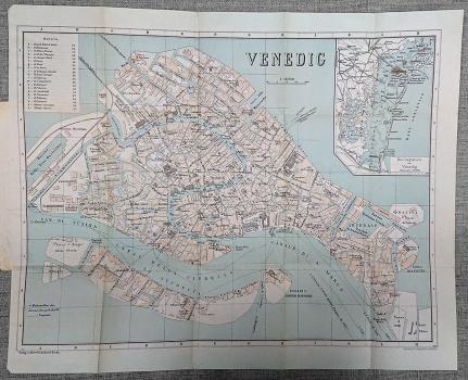
Travel Guide to Venice and Environs, from a German-language series of Grieben's Guide Books, published in Berlin in 1912 by Goldschmidt's Publishing Company. The guide includes all the necessary information about the city. It has a detailed city map showing the most popular landmarks. The map's index helps find the main hotels in the city. An aditional map depicts the Venetian Lagoon. T. Grieben founded the Grieben Travel Library in Berlin in 1853. It was designed to produce practical guide books with tourist maps and city plans. In 1863, the Berlin publisher Albert Goldschmidt bought the series and continued it.
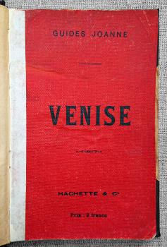
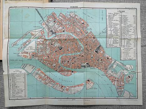
Venice City Guide in French, from the Guides Joanne series, published by the Hachette publishing company. The book offers a plenty of information about the city for tourist use. A detailed map of Venice is also included. Three map's indexes help viewers find palaces on the Grand Canal; religious and public buildings; the main hotels of the city. The Paris publishing house was established on the basis of the L. Hachette Company, founded in 1826. The company still has book publishing operations in many countries.
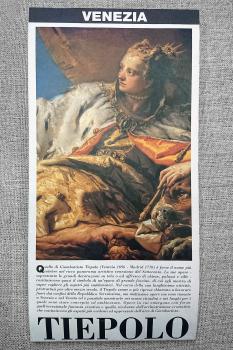
Venice: Tiepolo's City. It is a Venice trevel map, dedicated to Giovanni Battista Tiepolo. The map has a scheme of Venice public transportation. It does not only focuses on landmarks and useful tourist information but also gives a lot of interesting historical details about the artist as well as historical photographs of places associated with Tiepolo.
Giovanni Battista Tiepolo (1696 - 1770) is the greatest painter of the Italian Rococo, master of frescoes and engravings, the last great representative of the Venetian school.
The cover is beautifully illustrated with a fragment of Tiepolo's painting Neptune Offering Gifts to Venice.
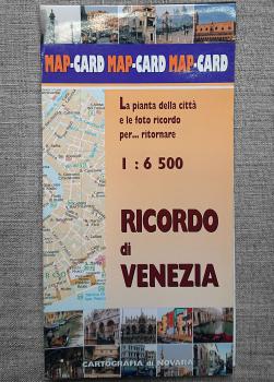
Souvenir of Venice is an Italian-language historical and cultural map. It includes maps of Venice, its environs and the islands of Lido, Murano and Burano. It also covers the city's waterways and water transportion. You will find historical information about Venice and the most popular sights, as well as many colorful photographs of landmarks.
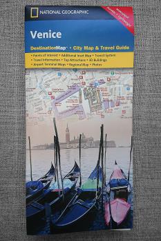
Venice City Map and Travel Guide by the world-renowned National Geographic Society. Inset maps cover the islands of Lido and Murano and Venice city surroundings. The guide has a water bus map and diagram of the Marco Polo Airport. Background information about Venice and its most popular landmarks, important travel information is also provided. An index helps find streets and points of interes. The book features many photographs of the city.
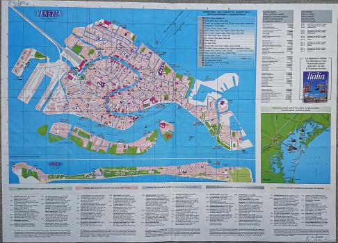
Italian-language Venice Tourist Map. It includes ancillary maps of the island of Lido and the Venetian Lagoon. The map has a list of emergency telephone numbers, public transport tables. An index helps find popular points of interest.
Venice Tourist Map. It also covers the city's waterways and water transportion. The most popular landmarks are shown in 3D.
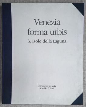
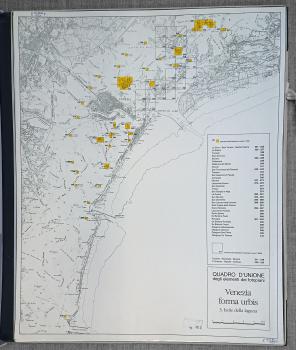
Detailed Photomap of Venice and Environs from the Venezia forma urbis series published in 4 volumes.The Map Collection of the National Library of Russia has only volume No. 3 of four, called Lagoon Islands.
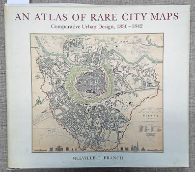
The atlas of maps–plans of forty cities in Europe, Russia, the United States and Asia was first published in the middle of the 19th century by the London Society for the Diffusion of Useful Knowledge. All maps–plans were produced over thirteen years, providing a good opportunity to compare urban development among 40 cities in 19 countries in the same period of time. In 1997, the renowned American urban planner and educator Melville C. Branch reprinted this atlas with his analysis and commentaries. Branch discusses the historical evolution of each city's urban design and demographic characteristics. Since its publication, this valuable collection has remained in high demand among architects, city planners and map lovers all over the world.
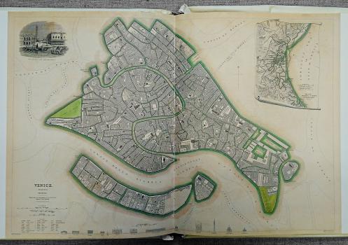
Venice in the atlas is represented by a plan engraved by B.R. Davies. It was based on a historical map drawn by W. B. Clarke and published in London in 1838. An additional map shows the environs of Venice and the Venetian Lagoon. In the upper left corner, the map is decorated with a vignette depicting the view of St. Mark's Sguare from the sea. At bottom left is a short glossary of Italian terms used on the map. Drawings of the city' most important buildings are provided below.
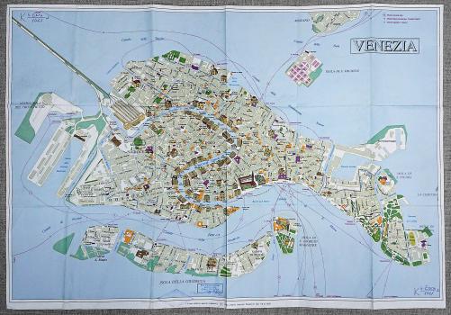
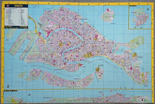
Venice Tourist Map. The map covers the waterways between the islands. The city's major attractions are colored. Many of the city's top landmarks are depicted in 3D. The map includes ancillary maps of the environs and the island of Murano. A detailed street index helps navigate in the city.
![View and Plan of Venice and Environs on a map [Plans of Italian Cities] View and Plan of Venice and Environs on a map [Plans of Italian Cities]](/ve/dep/artupload/ve/article/RA4544/s_NA44167.jpg)
![Map of Venice from the [Atlas of European Cities] Map of Venice from the [Atlas of European Cities]](/ve/dep/artupload/ve/article/RA4544/s_NA44166.jpg)
