19th Century Plans
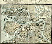
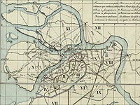 At the beginning of the 19th century, military cartographers began to play the leading role in mapping the city, as well as in the mapping of the entire country. For example, the «Plan of the City St. Petersburg», compiled by Major General I. Vitztum who headed a Department at the Military Topographic Service, was based on triangulation works made in 1808, under the direction of Lieutenant General Meder and on materials of the survey of Petersburg Province, which started in 1820 under the supervision of the infantry general Theodor Friedrich von Schubert.
 The «Detailed Plan of the Capital City of St. Petersburg», was the most large-scale and detailed plan of the city, published before 2003. It was a well-known public plan issued in 24 sheets in 1828. Its scale is 1:4200 or 1 centimeter to 42 meters.
The plan was compiled under the direction of the infantry general Theodor Friedrich von Schubert, the chief surveyor for Saint Petersburg Province and commander of the Russian military topographic service.
The Schubert's map shows detailed configuration for each building; yards, gratings, pavements, milestones, rivers, streams, channels, canals, ponds, swamps, plants, paths and flower-beds in parks and gardens, and even individual, probably, the most large puddles. The map includes house- and district numbers. It is of a great historical value as an outstanding specimen of 19th century cartography.
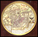
In addition to the scientific and practical purposes, maps were often used in interior decoration and were made not only on paper. For example, a miniature plan of St. Petersburg, diameter 8cm, was engraved on a porcelain plate rimmed with redwood. It is the precise replica of the Russian map of 1790. This plate was created by P.F. Tardier, the engraver in Paris, who also engraved a map of Moscow at the same time. The miniatures were purchased in Paris by the publisher Alexander Ilyin, the owner of the well-known A. Ilyin's Cartographic Establishment.
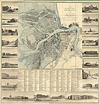 In the 19th century began to go out thematic plans Petersburg. They show the multifaceted image of the city, and events that took place in it.
In the celebrated Pushkin poem «The Bronze Horseman», the poet describes how the Neva river floods and destroys much of the city. To see a true picture of the famous flood, you can view the plan of 1825. It was created by the noted engraver and publisher A. Savinkov, who served in His Imperial Majesty's Maps Service (established by decree of Paul I in 1797).
Flooded places are marked with blue paint. On the frame there are depicted images of some of the remarkable sights of the city, among them are the first building of the Imperial (now National) Library, the equestrian statue of Peter I – "The Bronze Horseman", the Admiralty and others.
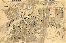 Public carriages appeared in 1847 and then carried passengers on journeys along the Nevsky Prospekt up to the Angliiskaia /English/ Embankment. The carriages were a great success. They determined the development of mass transportation, the building of other transport lines and the creation of appropriate maps. For example, the «Guide of Public Carriage Lines in St. Petersburg» shows the first public transport lines and indicates terminal stations.
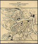 The «Plan of the Capital City of Saint Petersburg Showing Industrial Enterprises» of 1852 is the early special map showing contemporary industries in Petersburg.
In the 19th century, the government decrees regulated transfer of industrial units from the centre to the outskirts. The map indicates the typical distribution of industries in Petersburg at the time with most industrial enterprises located in Karetny, Narvsky and Vasileostrovsky districts.
Around the edges of the map is the table of works and factories including 319 enterprises, with their addresses and owner's names.
The plan was based exclusively on the materials provided by the Department of Manufacturing and Domestic Trade, which omitted information about the major metal works.
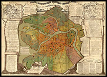 In connection with the judicial reform in Russia and the transformation in 1866, the Police Department of St. Petersburg was made the «Plan of the St. Petersburg Capital Judicial District». The plan shows 30 judicial units and boundaries of 38 police districts divided into 93 police sud-divisions. The frames contain address lists of police stations, post offices, city telegraph stations, notaries, bailiffs and court investigators, barristers at the District Court, city judges. The plan is supplemented by two maps: «Railways in Russia»; «Judicial Districts in Russia».
 In the 19th century, Saint Petersburg became one of the largest cities in Europe. In 1858, its population accounts for 496.6 thousand people. The population grew rapidly as an industry developed. It increased mainly due to the inflow of the peasantry. The population moved from one part of the city to another. The structure of the population, according to sex, estate or ethnic origin, changed.
To study these processes, a number of statistical studies were performed, the results of them were given in maps. An example of such work is the book «St. Petersburg. Research on History, Topography and Statistics of the Capital». Vol. 3. ( St. Petersburg, 1868) supplemented with 16 plans of different topics.
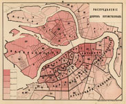
The plans illustrate the distribution of the population according to a number of demographic variables (gender, national origin, estate, religion, and others).
Thus, the plan «Distribution of the hereditary nobility» shows the proportion of the hereditary nobility in the population of the various districts of the city, numerals indicate the number of districts.
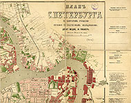 «Plan Showing a Sanitary Condition of St. Petersburg» was compiled in 1877, by Professor Y. Gubner, using the «Sanitary Map of St. Petersburg» made for his doctoral thesis published in 1872. The plan was included in his work on the problems of a sanitary condition of St. Petersburg. The plan shows death rate in the population of St. Petersburg for areas of the city. It also depicts medical institutions, alms-houses, orphanages, prisons, military barracks. The frame contains an addressed list of hospitals, orphanages and other institutions.
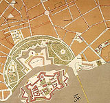 Since 1830, a new type of general plans of St. Petersburg came into practice – plans for regulated development of the city within the already already existing areas.
In 1874, the City Council established the Commission on the Regulated Development of the Streets in the City, which lasted until 1909. Special decrees defined such areas in which designs of all constrctions had to be directly approved by the Emperor himself. The first common project was a «Plan for Regulated Development of St. Petersburg». It was compiled using materials of the city survey conducted by Captain M. Savitsky in 1872. The plan shows: city borders, administrative units and police stations, built and projected streets with their width in sazhens (measure of length = 2.34 metres), building restriction lines, quarters with different regulations for brick and wood building, the borders of areas along the streets, and their numbers. There are also given designed and existed names of streets, squares, bridges, large ensembles and complexes, buildings and other.
Plan had several editions. All edtions, despite the differences in titles, contain explanatory texts and legends, very similar in their scale and basic contents. The differences relate, primarily, with newly designed and paved streets.