Maps of Imaginary Lands or "How to Get to Eldorado"
Quivira, Eldorado, Hyperborea – these names of mythical lands are familiar to everyone. However, few people know that genuine maps exist, where you can find these intriguing names…
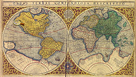
Since ancient times, people have sought to explore the outside world - a territory of their habitation, as well as distant countries. Results from these studies were represented on geographical maps. The path of knowledge has been long and difficult, therefore, along with real information, maps reflected wrong geographical beliefs. This was due to the imperfection of the methods of research, the use of false information, including myths and legends, to create maps, and, simply, errors in the interpretation of the available data.
The presented maps illustrate a number of geographical errors of cartographers from different times.
They can be divided into four groups:
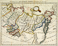
- Fabulous countries: Hyperborea, Quivira, Eldorado, the Prester John Reign, Lukomorye.
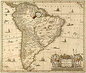
- Mythical islands: Frisland, St. Brendan, Brazil, Thule, Magnetic Island, Sannikov Land, Land of Glory of Russia, Maria Theresia Reef.
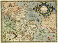
- Non-existent mountains: Riphean mountains.
- Non-existent lakes: Lake Parime.
A special group is formed by maps created before the existence of the objects depicted on them was proved. It consists of maps of the Unknown Southern Land (Antarctica) and the Strait Aniane (the Bering Strait)