Propaganda Maps
Maps with propaganda elements were very popular. During the war, on both sides of the front, there were distributed agitation material that attempted to raise the fighting spirit of soldiers and the population worked on the home front.
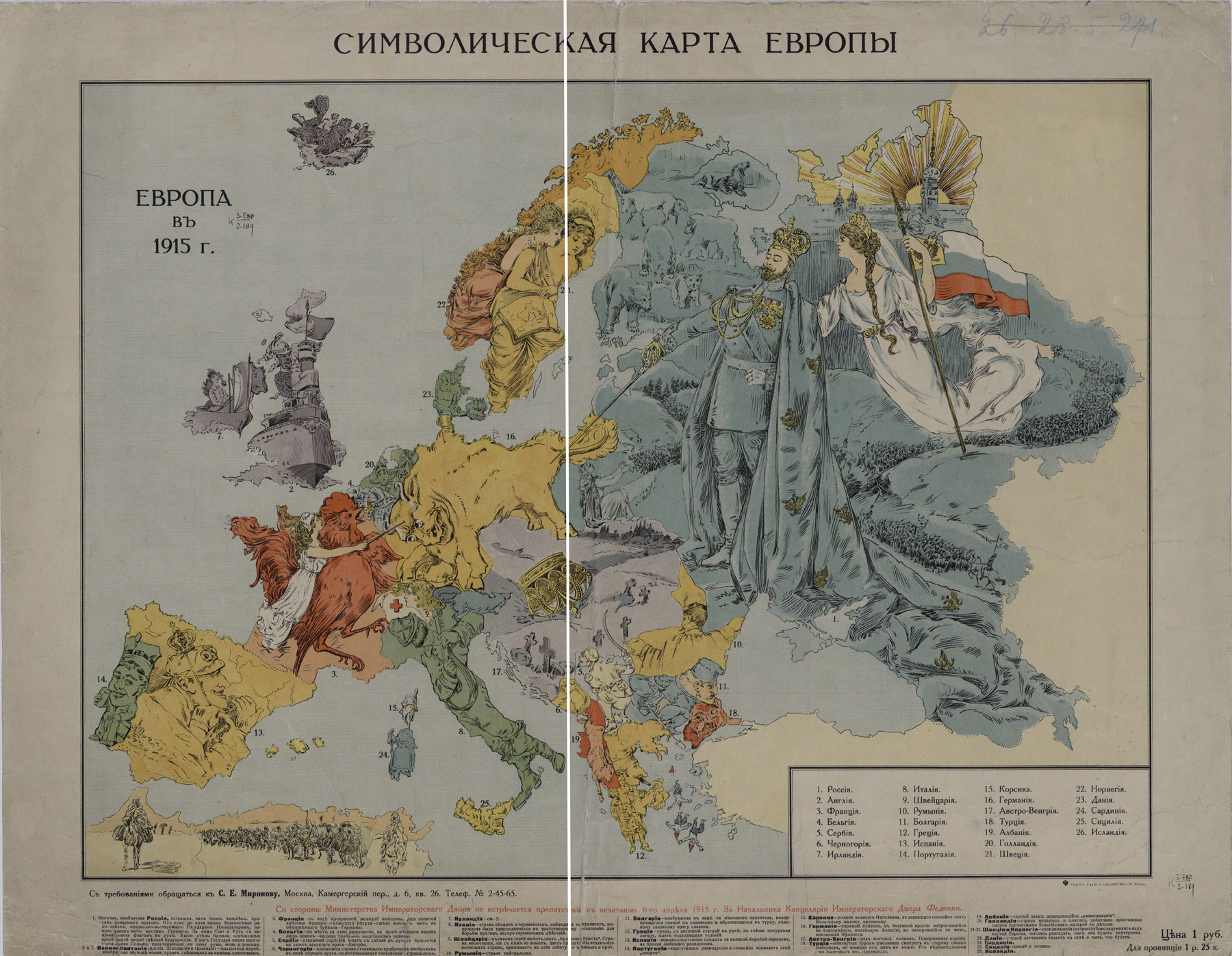
1. Symbolic Map of Europe. Europe in 1915.
Moscow, 1915.
K 3-Evr 2/189
The map depicts figures who symbolized the nations engaged in war. The central figure - Russian Emperor Nicholas II at the head of the Russian troops immediately attracts the attention of the viewers. France depicted as a young woman under the protection of its national symbol - the Gallic cock, it courageously defends against a mad buffalo - Germany. Turkey had just entered the war, but at the end of 1914 - beginning of 1915, was seriously defeated: it 'pleadingly looks at its guardians, but can not see any assistance from them". At the same time, the author of the map hastened to pass the desirable for reality, saying that the Turkish 'loyalists are already departing from the Dardanelles'. It is an apparent attempt to forestall the Dardanelles operation, which ended in the defeat of the Allies.
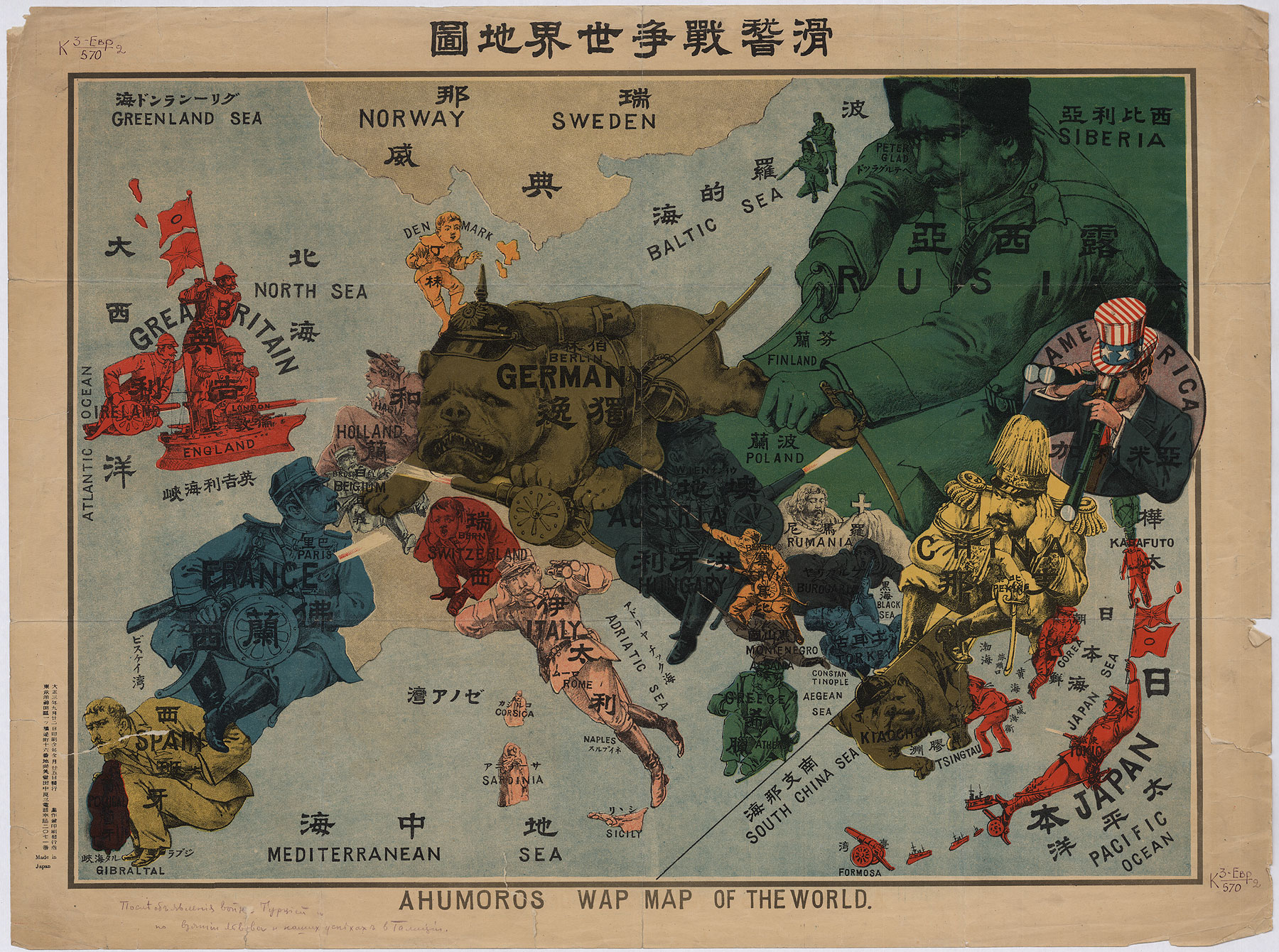
2. A Humoros War Map of the World.
Made in Japan, [1914].
K 3-Evr 2/570
The map is interesting because it reflects Japan's participation in the First World War in addition to the European events. On 23 August 1914, Japan entered the war to achieve, first of all, goals of strengthening its position in the mainland China, and in Southeast Asia. The map shows the attacks of the Japanese troops on Qingdao, the only German naval base on the Chinese coast. Qingdao surrendered on 7 November 1914. Also the map has a pencil inscription made, probably, by the former owner of map: 'After the declaration of war by Turkey and the capture of Lviv and our successes in Galicia'.
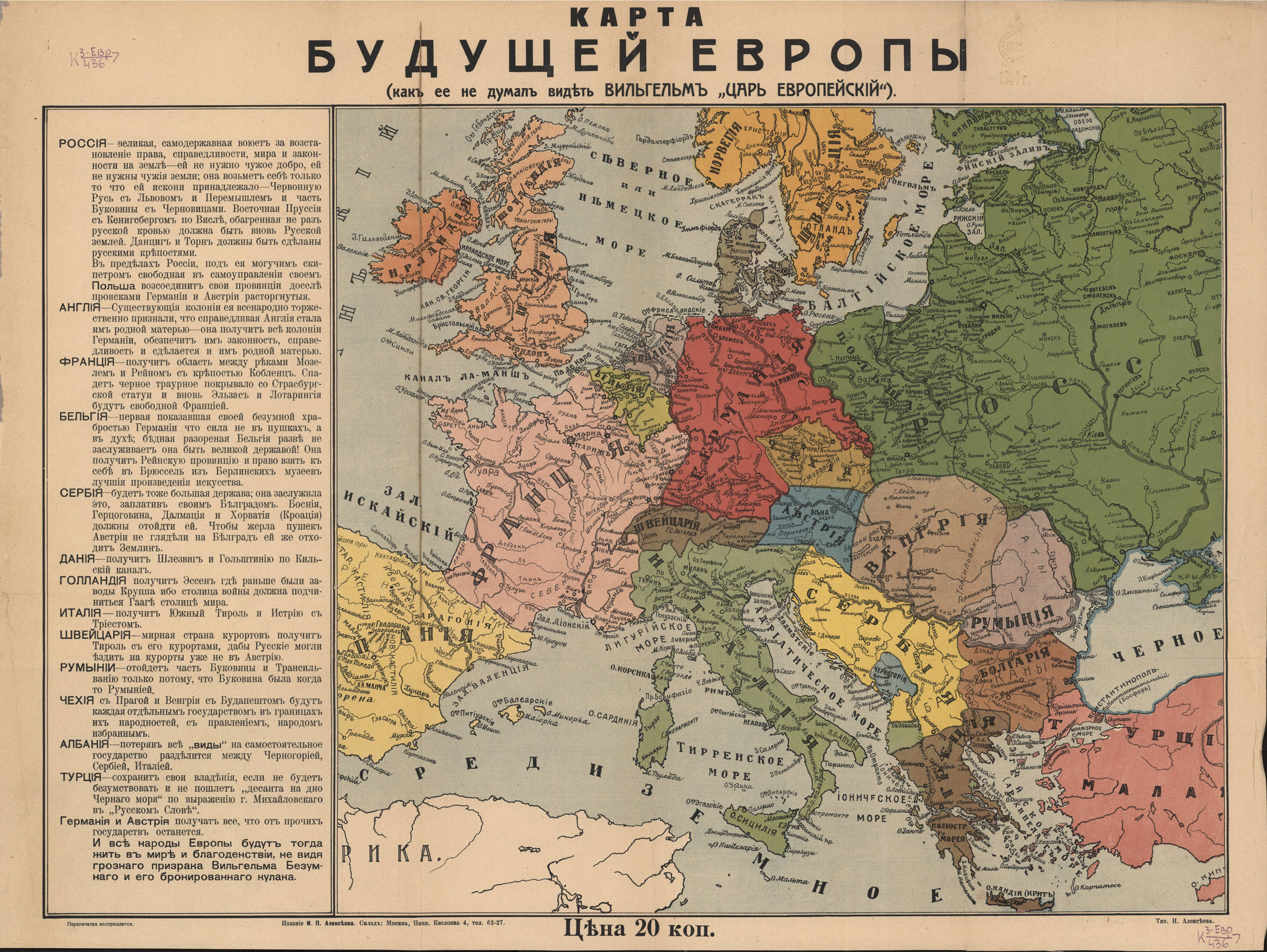
3. Map of the Future Europe.
[Moscow], [1914?].
K 3-Evr 7/436
The map shows how, in the opinion of the Russian citizens, should look Europe after the First World War. Especially noteworthy are explanations to the map.'Russia is a great, sovereign country that is fighting for the restoration of rights, justice, peace and the rule of law on the globe - it does not need someone else's property, it does not need other people's lands…'. The naive remarks, such as 'Switzerland - a peaceful country of resorts will obtain Tyrol with its resorts, so that the Russians could travel to the resorts already not in Austria' coexist with the prophetic words, 'Czechia with Prague and Hungary with Budapest will be each separate state within the borders of their nationalities, with a government elected by the people'.
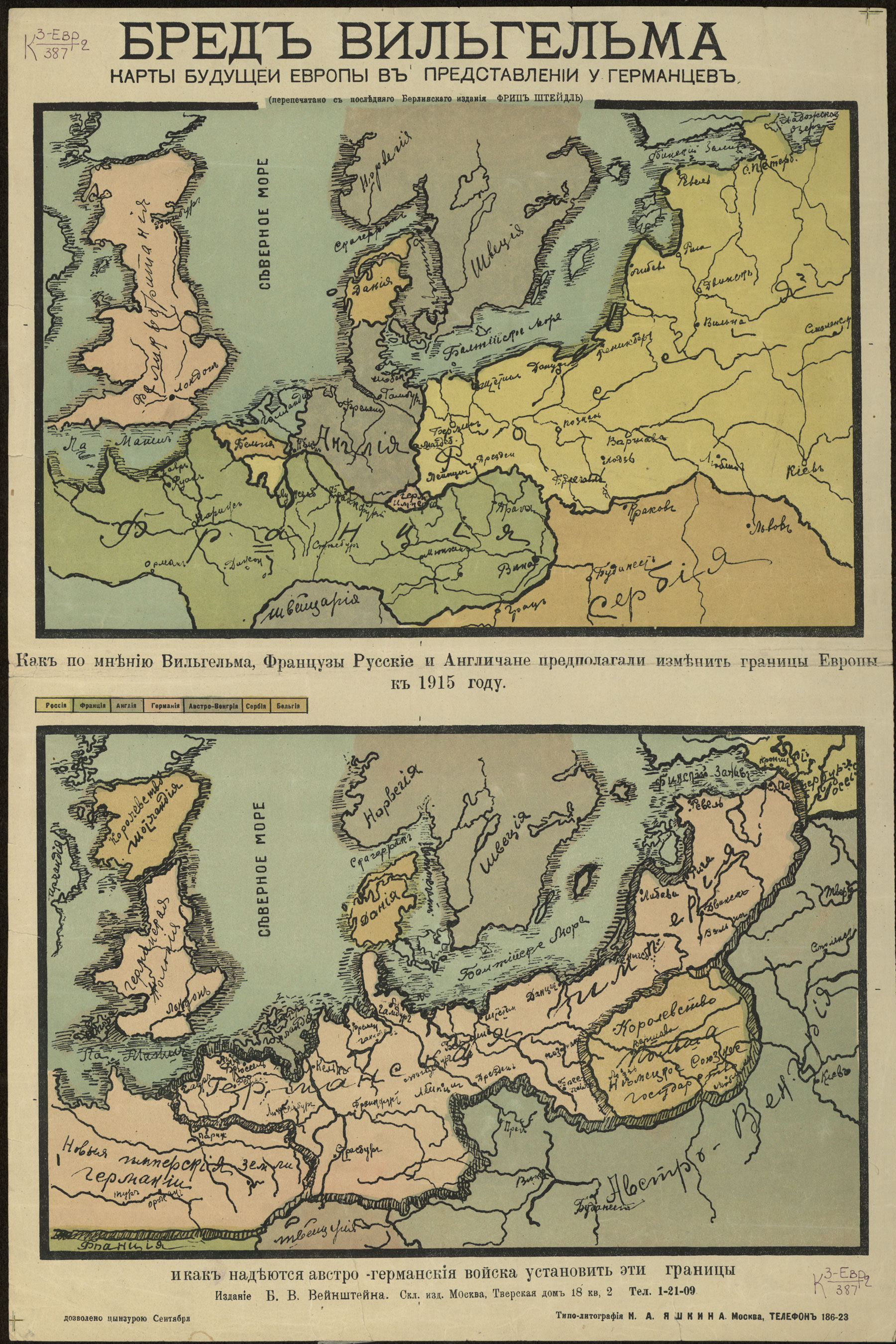
4. William's Ravings. Map of the Future Europe as it is viewed by the Germans. Reprinted from the last edition of the Berlin FRITZ STEIDEL.
Moscow, [1914?].
K 3-Evr 2/387
It is a striking example of propaganda maps. The upper part of the map was to instil terror into the German citizens at the sight of what the Entente countries supposedly wanted to do with Germany. On this map, the German territory is reduced to the size of Switzerland and is divided between Britain, France and Russia, and Russia has got the capital of Germany - Berlin.
The lower part of the map reassures: the valiant German troops will be able to expand the boundaries of the German Empire which will include most of the territory of France, Great Britain (the Germans do not claim to the territory of Scotland). Russia should be divided between Germany (the territory from the Baltic to St. Petersburg, inclusive) and Austria-Hungary (the area with Kiev, Smolensk and Tver) with the separation of an independent Polish kingdom. This part is of great importance for the propaganda purpose of encouraging the Russian people to make every effort to protect their Motherland.
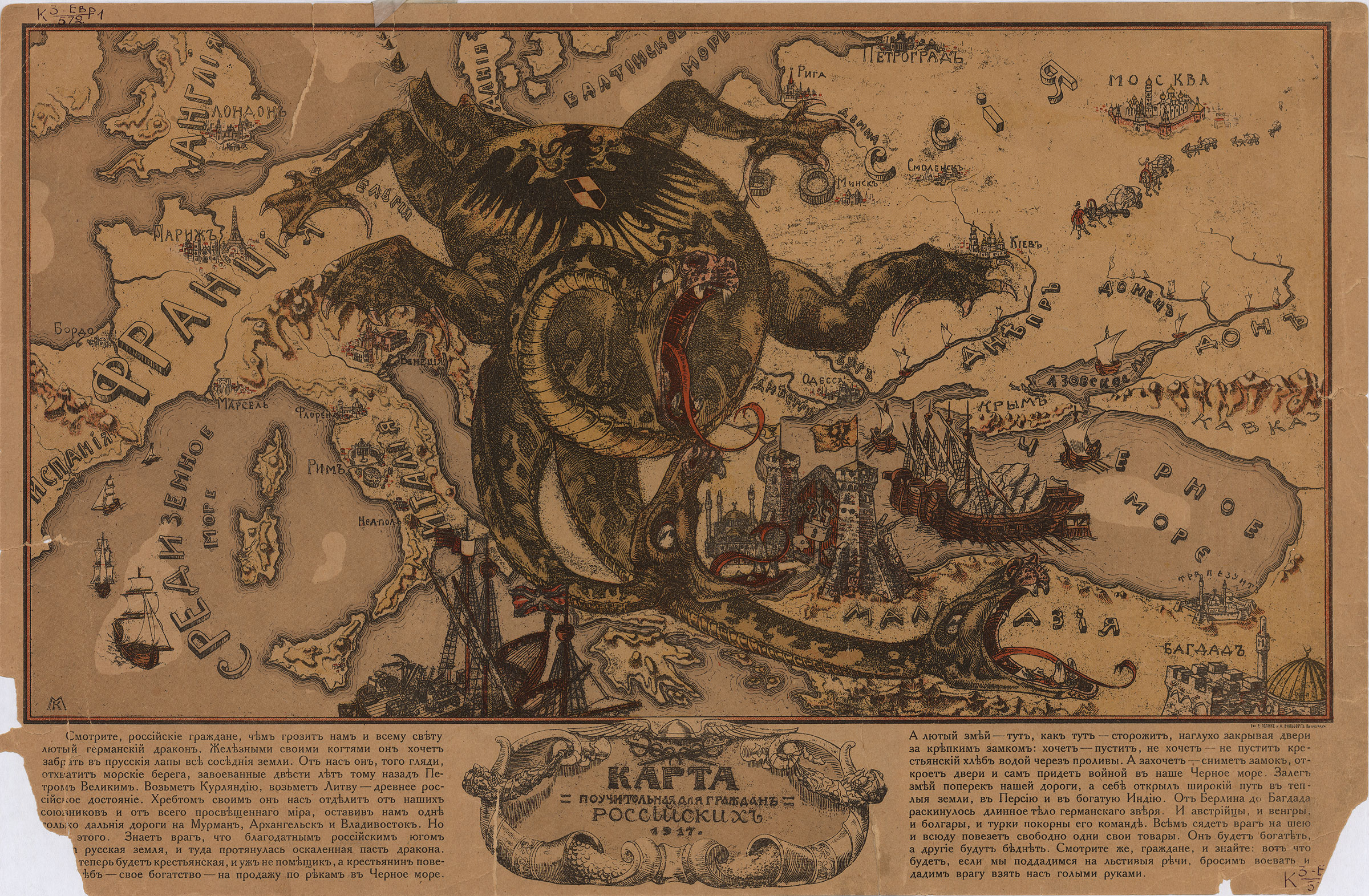
5. Map Instructive for Russian Citizens.
Petrograd : [before October 1917].
K 3-Evr 1/572, K 3-Evr 2/593
A typical example of a propaganda map is a map created in the next to last year of the First World War. Germany is represented in the image of a dragon lying on a map of Europe and closing the Black Sea Straits. 'Look, the citizens, and you should know what would happen if we succumb to the flattering urging, stop a fight and let the enemy take us with their bare hands'.
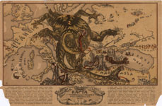
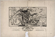
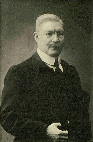
The other, black-and-white copy of the map, bears a dedication to Pavel Milyukov (1859–1943), a Russian politician and leader of the Cadet Party, with his pencil portrait. As Minister of Foreign Affairs of the first Provisional Government (March-May 1917) Milyukov voted for the continuation of the war till the final victory.
A Humoros War Mar of the World. Made in Japan, [1914]
K 3-Evr 2/570
View in
the Digital Library
William's Ravings. Map of the Future Europe as it is viewed by the Germans. Moscow, [1914?]
K 3-Evr 2/387
View in
the Digital Library
Map Instructive for Russian Citizens Petrograd : [before October 1917]
K 3-Evr 1/572
View in
the Digital Library
Map Instructive for Russian Citizens Petrograd : [before October 1917]
K 3-Evr 2/593
View in
the Digital Library
Pavel Milyukov(1859–1943)
