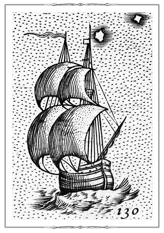
Marine ThemesMap of the Pacific Ocean from the atlas В«Theatre of the WorldВ». (Theatrum orbis terrarum. Antverpen, 1584. [P. 35].)
K 0-Mir 7 / 7
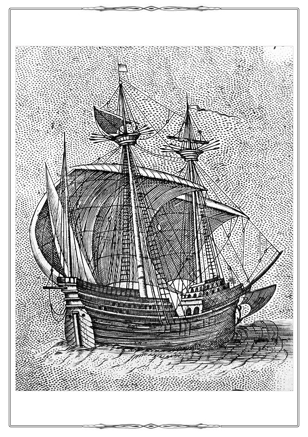
Electronic catalogueAn image in the center of the map depicts Ferdinand Magellan's (1480-1521) ship "Victoria" which completed the first circumnavigation of the world.
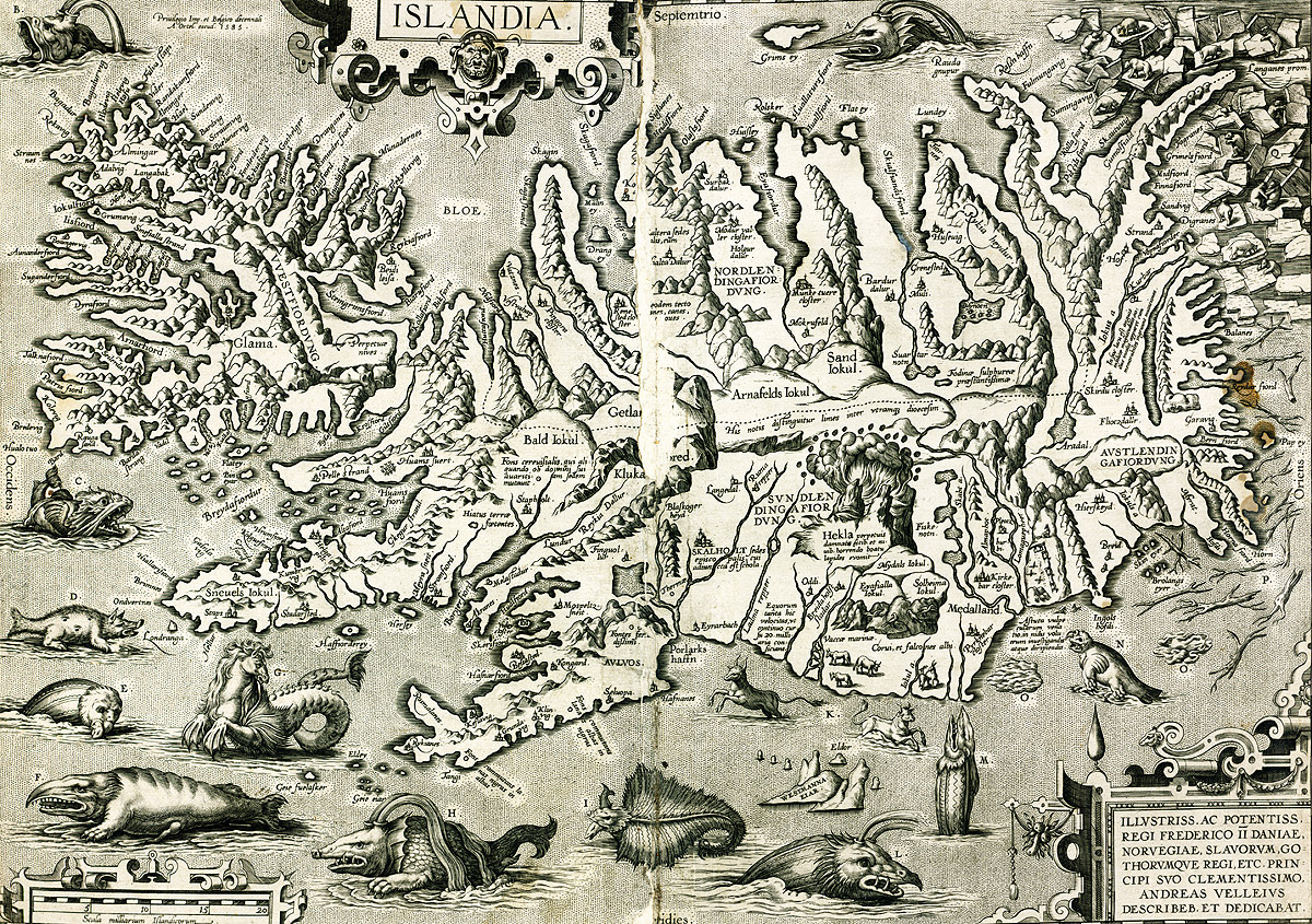
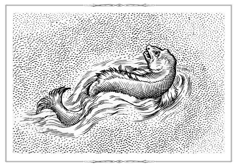
Marine ThemesMap of Iceland from the atlas В«Theatre of the WorldВ».
(Theatrum orbis terrarum. Antverpen, 1584. [P.268].)
K 0-Mir 7/7
Electronic catalogueThe map shows fantastic sea animals in the surrounding waters.
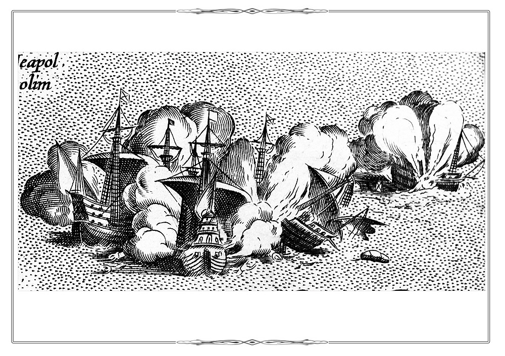
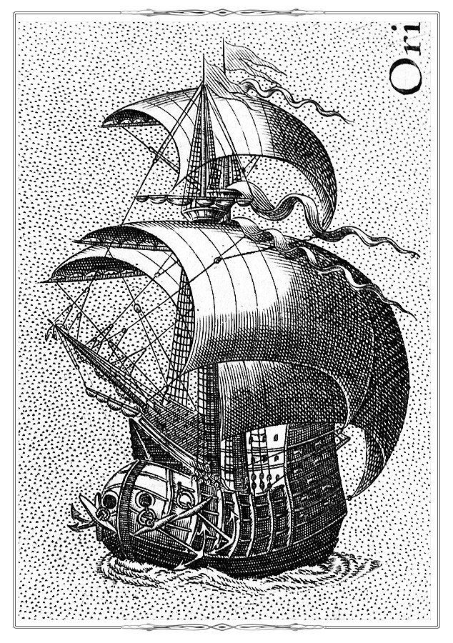
Marine Themes
Fragment [p. 286] from the atlas Theatrum orbis terrarum. Antverpen, 1584.
K 0-Mir 7/7
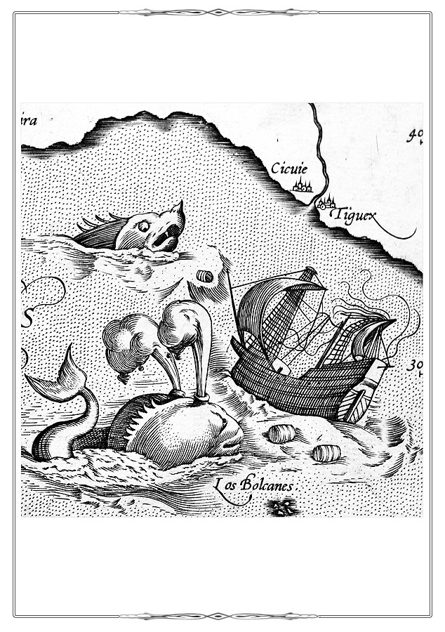
Marine ThemesFragment [p. 60] from the atlas Geographiae libri octo…. Amsterdam, 1605.
K 0-Mir 7/40
Electronic catalogue
Marine Themes
Fragment [p. 226] from the atlas Theatrum orbis terrarum. Antverpen, 1584.
K 0-Mir 7/7
Marine ThemesFragment of page 8 from the atlas Spiegel der seefart... Amsterdam, 1589.
K 0-Evr 7/2
Electronic catalogue
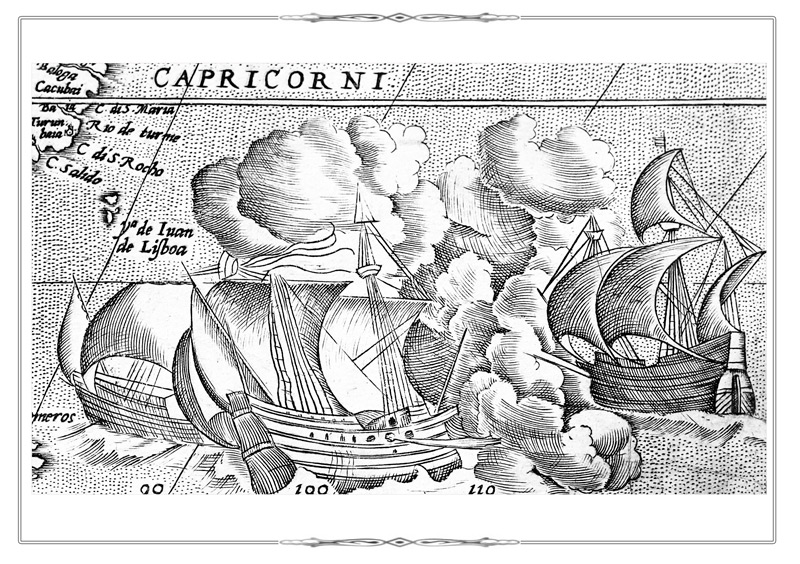
Marine Themes
Fragment [p. 286] from the atlas Theatrum orbis terrarum. Antverpen, 1584.
K 0-Mir 7/7
Marine Themes
Fragment [p. 61] from the atlas Theatrum orbis terrarum. Antverpen, 1584.
K 0-Mir 7/7
Marine ThemesFragment [p. 60] from the atlas Geographiae libri octo…. Amsterdam, 1605.
K 0-Mir 7/40
Electronic catalogue
Marine ThemesFragment of p. 16 from the atlas Spiegel der seefart... Amsterdam, 1589.
K 0-Evr 7/2
Electronic catalogue
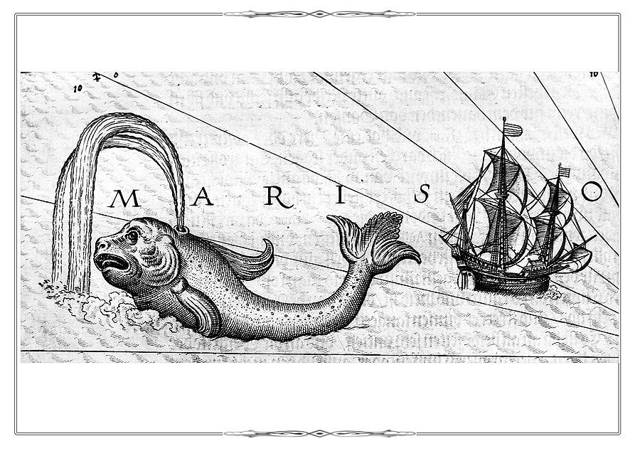
Marine Themes
Fragment [p. 296] from the atlas Theatrum orbis terrarum. Antverpen, 1584.
K 0-Mir 7/7
Marine ThemesFragment of p. 12 from the atlas Spiegel der seefart... Amsterdam, 1589.
K 0-Evr 7/2
Electronic catalogue
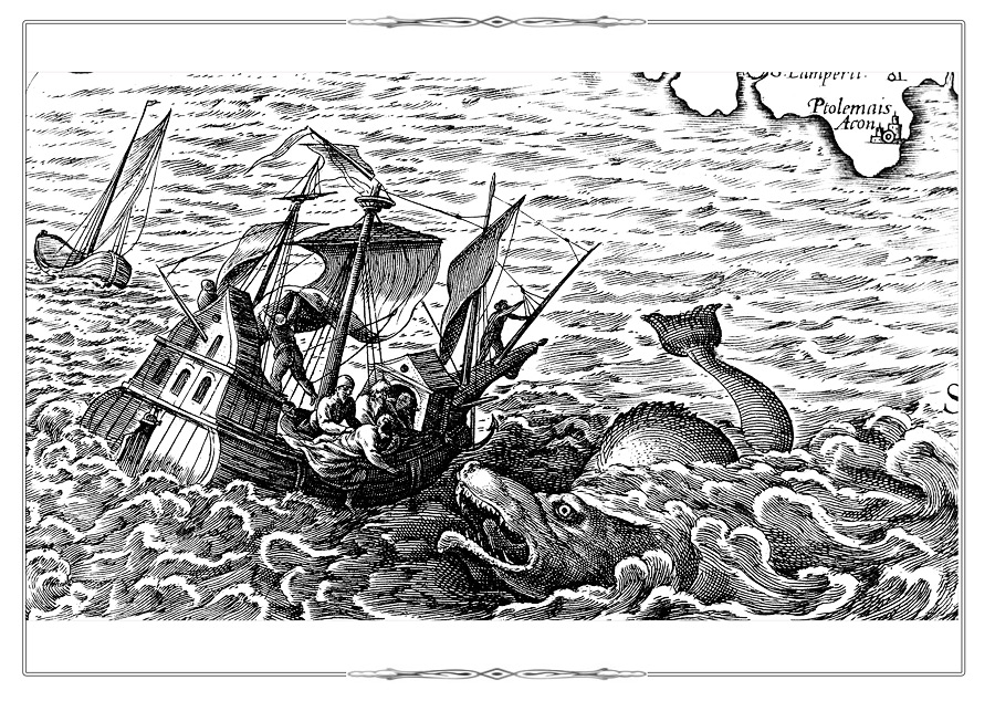
Marine Themes
Fragment [p. 330] from the atlas Theatrum orbis terrarum. Antverpen, 1584.
K 0-Mir 7/7
Marine Themes
Fragment [p. 9] from the atlas Theatrum orbis terrarum. Antverpen, 1584.
K 0-Mir 7/7
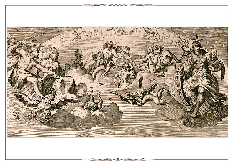
AllegoriesTheatrum orbis terrarum sive Atlas novus…Amsterdam, 1645-1650. Vol. I. F.A.
K 0-Mir 8/112
Electronic catalogue Map of the World from the first volume of the atlas «Theatre of the World…», fol. А.
In the margins are allegorical images of the planets (Moon, Mercury, Venus, Mars, Jupiter, Saturn) and the Sun; four elements (fire, air, water and land); seasons.
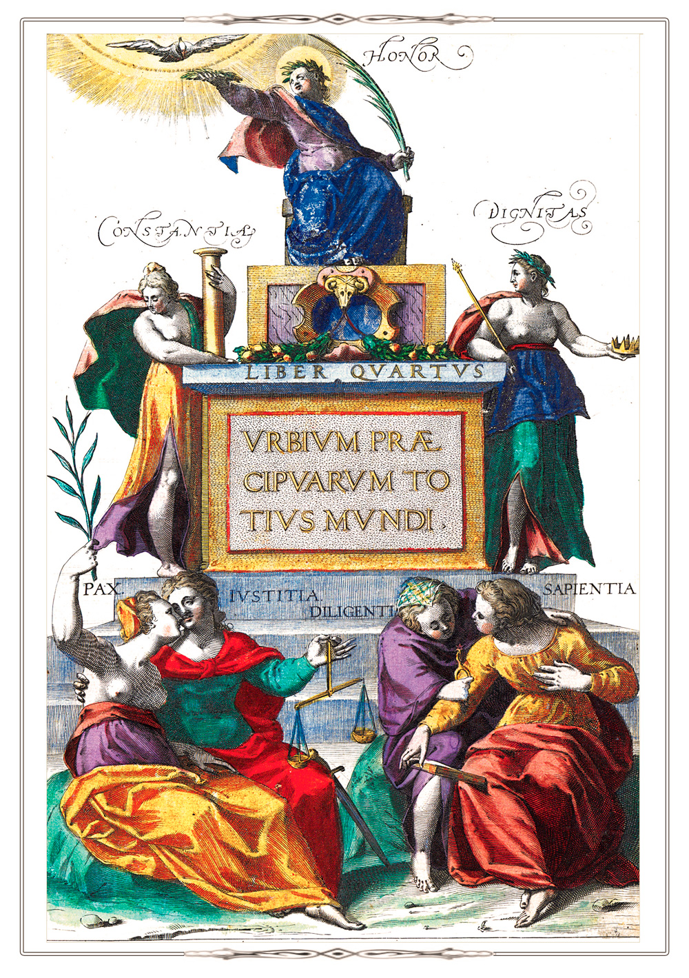
AllegoriesTitle page of the atlas Civitates Orbis Terrarum. Köln, 1572-1618. Vol. IV. Urbium praecipvarum totius mundi liber quartus 1588.
K 0-Mir 7/27.
Electronic catalogue Images on the title page glorify the triumph of human values. A figure of Honor is shown at the top of the page. Permanence and Dignity can be seen below on the left and right. The bottom of the page is decorated with personifications of Peace, Justice, Prudence (Economy, Thrift) and Wisdom.
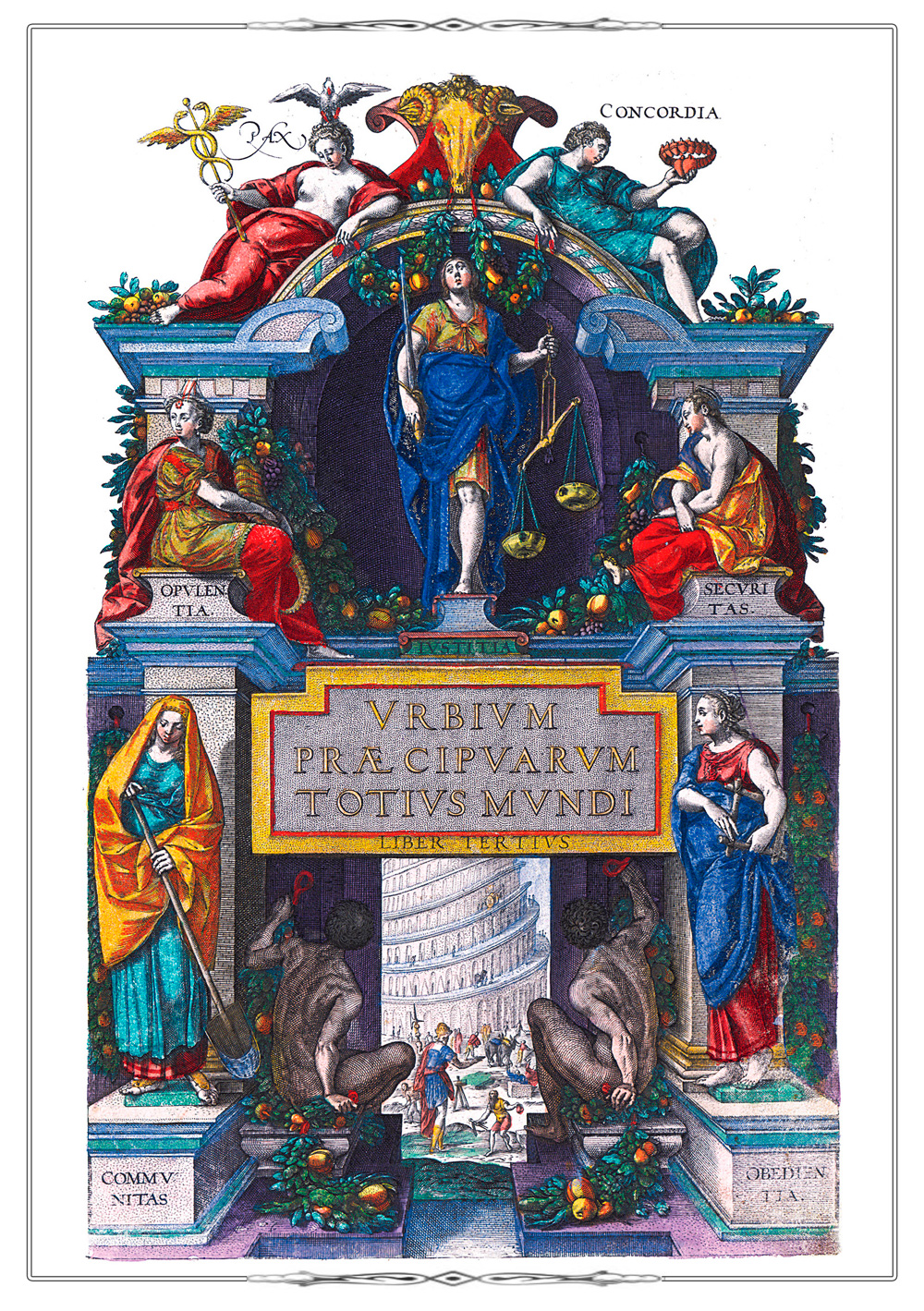
AllegoriesTitle page of the atlas Civitates Orbis Terrarum. Köln, 1572-1618. Vol. III. Urbium praecipvarum totius mundi liber tertius.1581.
K 0-Mir 7/27.
Electronic catalogue Title page of the atlas is decorated with images that reflect the general idea that the city society is governed by justice, peace, safety. At the top of the page are placed figures of Peace and Consent. The female personification of Wealth and Power can be seen below on the left. In the center is Justice. Security (Safety) is depicted to the right. At the bottom of the sheet are figures symbolizing Society and Conformity to Rules and Laws.
Allegories
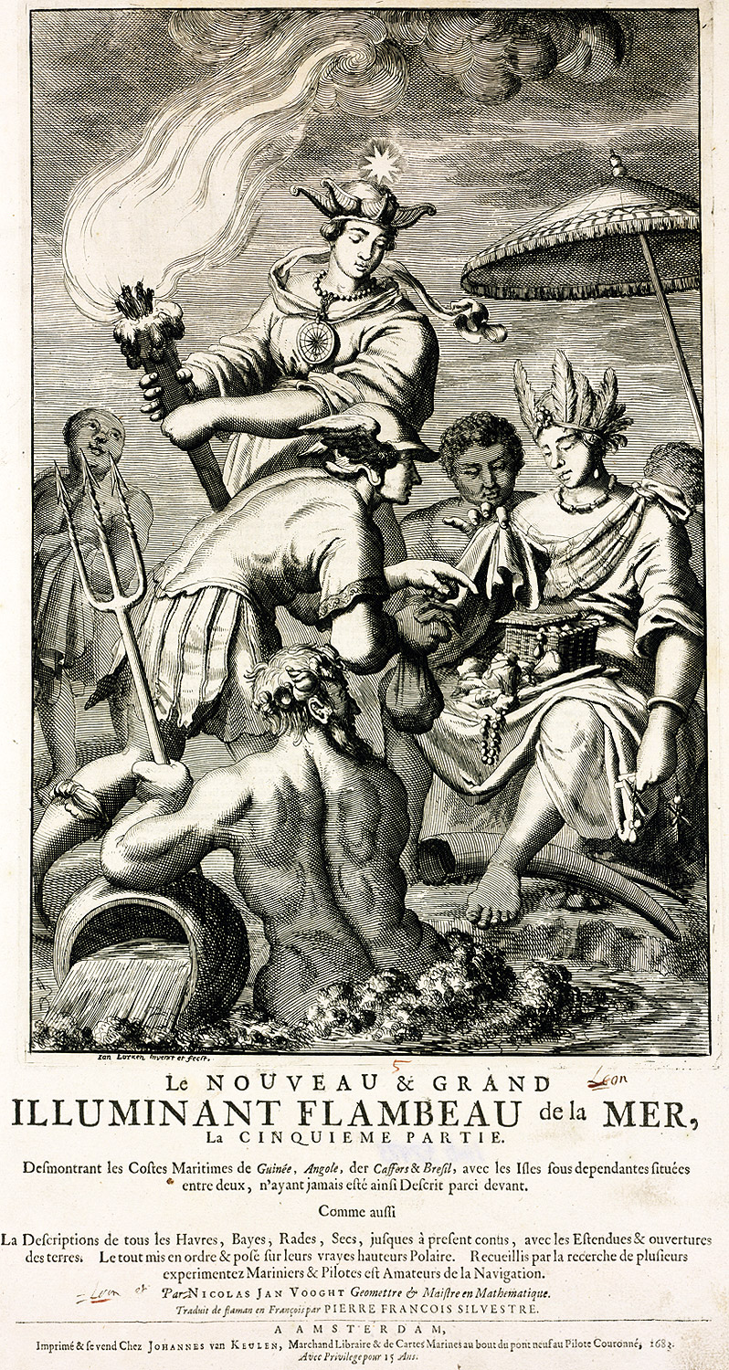
Title page of the atlas «The Nouveau Grand Sea Illuminating Torch…».
(Le Noveau et Grand Illuminant Flambeau de la mer…. Amsterdam, 1681-1683. Vol. V.).
K 0-Mir 8/161-5
The fifth volume contains charts of the coastal waters of Africa and Brazil.
In the center of the sheet is a symbolic image of the Pole Star used by navigators for finding directions. God of Commerce Mercury (Hermes), surrounded with natives, is shown below.
Scenes from Everyday LifeTabula Russiae ex mandato Foedor Borissowits delineate. Amsterdam, 1634. K 0-РњРѕСЃРєР• 2/28
Electronic catalogueMap of Russia. According to the map title, it is based on a map compiled by Fyodor Godunov, the son of Tsar Boris Godunov(1589–1605).
In 1613, it was first published as part of Mercator's «Аtlas sive cosmographicae…» (Amsterdam, 1619) by heirs of Jodocus Hondius (1563-1612).
Later, the map was repeatedly reproduced by other cartographers and placed in various atlases, like this copy of the map issued by Nicholas Visscher (1618-1679).
The map is decorated with views of the cities of Ivangorod, Arkhangelsk, the Moscow Kremlin, illustrations of a water mill and a Russian "black" bathhouse without chimney.
Scenes from Everyday Life
Fol.6 from the atlas Civitates Orbis Terrarum. Köln, 1572-1618.
Vol. 2. De praecipues totius urbibus liber secundus. 1575. (Reduced).
K 0-Mir 7/27
Bird's-eye View Plans of Conil de Frontera, Jerez de Frontera (Spain). They are notable for detailed images showing local people who work in traditional occupations: fishering and trading.
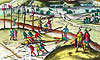
Scenes from Everyday LifeFragment [p. 40] from the atlas Geographiae libri octo…. Amsterdam, 1605.
K 0-Mir 7/40
Shepherds/Herdsmen.
Electronic catalogue
Scenes from Everyday LifeFragment [p. 52] from the atlas Geographiae libri octo…. Amsterdam, 1605.
K 0-Mir 7/40
Cannibals.
Electronic catalogue
Scenes from Everyday LifeFragment fol. 6 from the atlas Civitates Orbis Terrarum. Köln, 1572-1618.
Vol.5. Urbium praecipvarum mundi theatrum quintum. Köln, [after 1598].
K 0-Mir 7/31
Electronic catalogueThe picture emphasizes the importance of Cadiz as a big fishing port, a processing center for seafood as well as the leading center of silver jewelry manufacturing and a trade center.
Scenes from Everyday Life
Fragment [p. 275] from the atlas Theatrum orbis terrarum. Antverpen, 1592. [Z.275].
K 0-Mir 7/8
Picnic.
Decorative CartouchesCivitates Orbis Terrarum. Köln, 1588. Vol. III. Urbium praecipvarum totius mundi liber tertius 1588. F.56.
K 0-Mir 7/28
Hand Colored Copper Engraving.
Electronic cataloguePanorama of the Campania region of Italy from the В«Atlas of Cities of the WorldВ». On the left you can see figures of Abraham Ortelius (1527-1598) and the Dutch artist Joris Hoefnagel (1542-1601). A richly decorated cartouche of fruits, among which are exotic black grapes grown in Campania, symbolizes an abundance of the region.
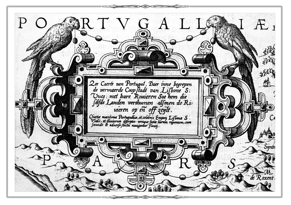
Decorative CartouchesFragment fol. 17 from the atlas from the atlas Spiegel der seefart... Amsterdam, 1589.
K 0-Evr 7/2
Electronic catalogue
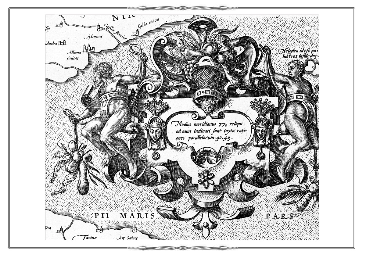
Decorative CartouchesFragment fol. 4 from the atlas Spiegel der seefart... Amsterdam, 1589.
K 0-Evr 7/2
Electronic catalogue
Decorative CartouchesFragment [p. 42] from the atlas Geographiae libri octo…. Amsterdam, 1605.
K 0-Mir 7/40
Electronic catalogue
Decorative CartouchesFragment [p. 60] from the atlas Geographiae libri octo…. Amsterdam, 1605.
K 0-Mir 7/40
Electronic catalogue
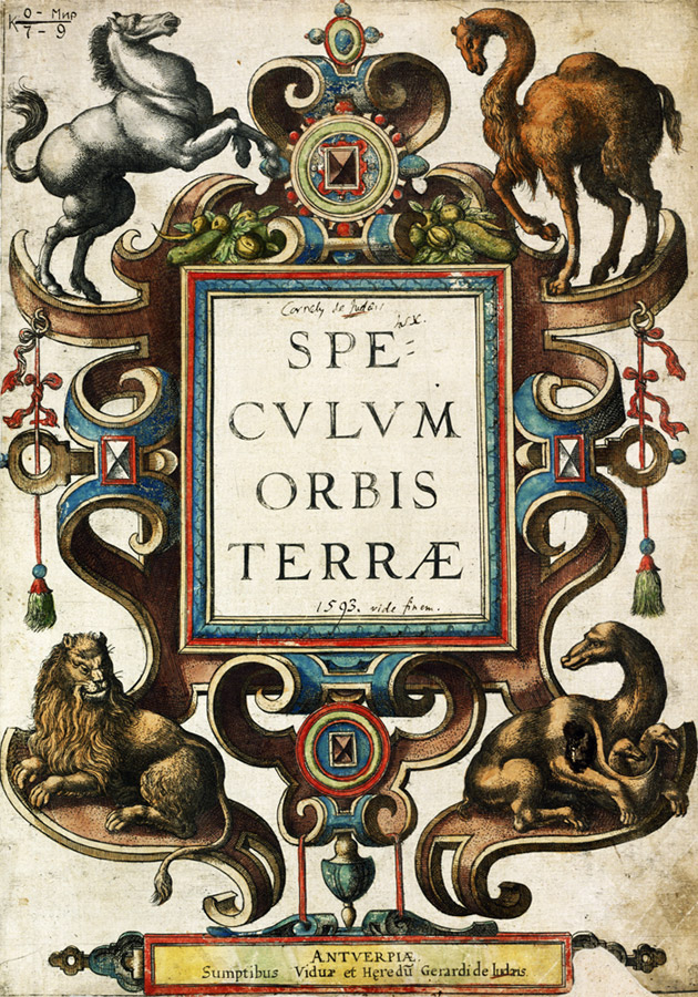
Decorative CartouchesTitle page of the world atlas В«Mirror of the WorldВ» (Speculum orbis terrae. Antverpen, [1593-1613].)
K 0-Mir 7/ 9
Electronic catalogue
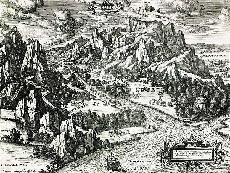
Ancient Mythology
Theatri Orbis terrarum parergon… Antverpen, 1624.
Рљ 0-РњРёСЂ 8/39
Panorama of the Vale of Tempe and Mount Olympus in Greece from the atlas В«Theatre of the WorldВ». [p. 275]. The altar of Jupiter is depicted on the top of the mountain, the mythical home of the supreme gods. The temple of Jupiter is shown in the bottom left corner.
Ancient Mythology
Fragment of the title sheet of the atlas Le Noveau et Grand Illuminant Flambeau de la mer…. Amsterdam, 1681-1683.
K 0-Mir 8/161-2
Pantheon of Greek Gods.
Ancient MythologyFragment of the title sheet of the atlas Civitates Orbis Terrarum. Köln, 1572-1618. Vol. II.
De praecipues totius urbibus liber secundus. 1575.
K 0-Mir 7/28.
Electronic catalogueThe Penates and Lares are good household gods who protected the unity and welfare in the family.
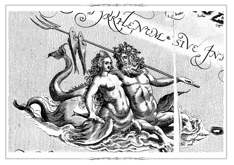
Ancient Mythology
Fragment [p. 194] from the atlas Theatrum orbis terrarum. Antverpen, 1584.
K 0-Mir 7/7
Triton and mermaid.
Ancient Mythology
Fragment p. 5 from the atlas Theatrum orbis terrarum. Antverpen, 1584.
K 0-Mir 7/7
The Rape of Europa.
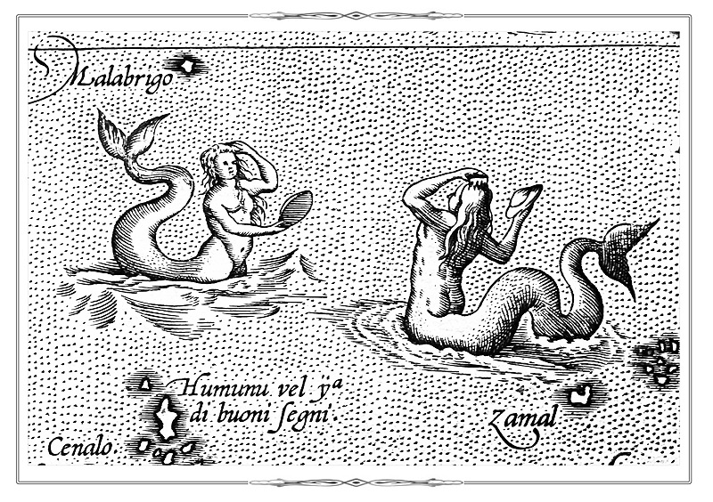
Ancient Mythology
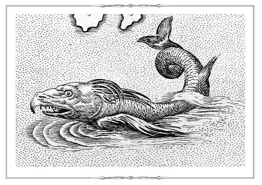
Fragment p. [286] of the atlas Theatrum orbis terrarum. Antverpen, 1584.
K 0-Mir 7/7
Mermaids.
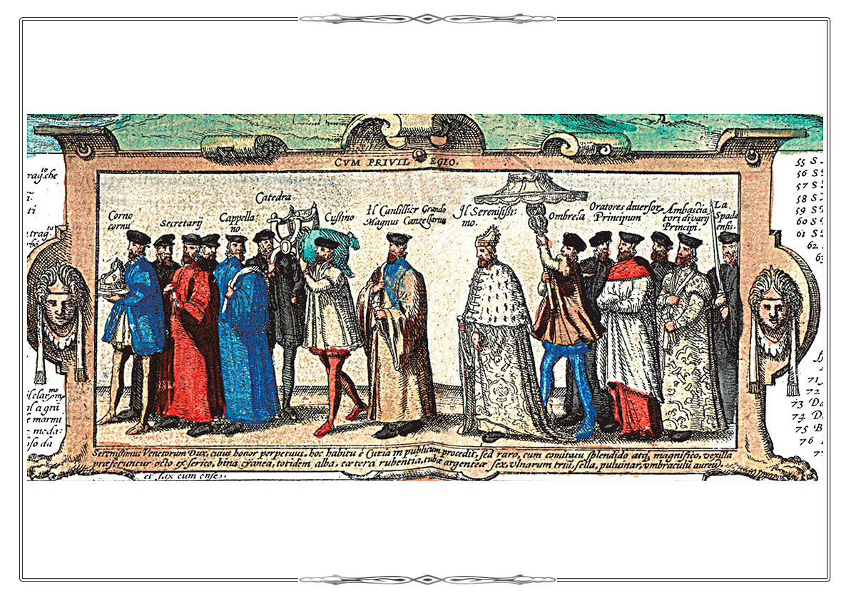
Scenes from HistoryCivitates Orbis Terrarum. Köln, [ after 1598]. Vol. V. Urbium praecipvarum mundi theatrum quantum ( 1598). Fol.7.
K 0-Mir 7/31
Hand Colored Copper Engraving.
Plan of Seville from the В«Atlas of Cities of the WorldВ». Vol.V. Fol.7.
Electronic catalogue
The picture depicts a scene of flagellation: convicted criminals were led through the whole city, and passing by people threw stones and sewage at them.
Scenes from HistoryFragment fol. 4 (a plan of Granada) from the atlas Civitates Orbis Terrarum. Köln, 1588. Vol.I.
K 0-Mir 7/27
The expulsion of the Muslims from Spain.
Electronic catalogue
Scenes from HistoryFragment fol. 43 (a plan of Venice) from the atlas Civitates Orbis Terrarum. Köln, 1588. Vol.I.
K 0-Mir 7/27
Grand Procession of the Doge of Venice.
Electronic catalogue
Scenes from HistoryFragment fol. 24 (a plan of Sankt Polten) from the atlas Civitates Orbis Terrarum. Köln, 1572-1618. Vol. VI. Theatrum praecipvarum totius mundi urbium liber sextus. 1617.
K 0-Mir 7/31
Electronic catalogueThe picture shows the suppression of the peasant anti-feudal uprising in Austria during 1595-1597.
Scenes from HistoryFragment fol. 48 from the atlas Civitates Orbis Terrarum. Köln, 1572-1618. Vol. II De praecipues totius urbibus liber secundus. 1575. K 0-Mir 7/28
Electronic catalogueFragment of a plan of Grodno, dating back to the Livonian War (1558-1583), features the meeting the Russian mission who arrived to attend the 1567 Seim assembled by Polish King Sigismund II Augustus (1520-1572).
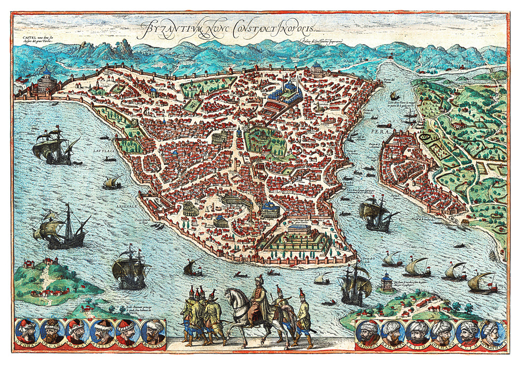
PortraitsCivitates Orbis Terrarum. Köln, 1588. Vol. I . F.51.
Plan of Constantinople (now Istanbul) from the В«Atlas of Cities of the WorldВ». Vol.I. Fol.51.
K 0-Mir 7/27
Electronic catalogueAt the bottom of the plan are portraits of Turkish sultans, starting with the founder of the Ottoman dynasty - Osman (Ottoman, 1259–1324/1326).
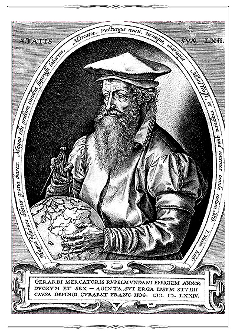
PortraitsFragment [fol. 6] from the atlas Geographiae libri octo…. Amsterdam, 1605.
Portrait of Gerard Mercator (1512-1594) after the engraving by Franz Hogenberg (1512-1594).
K 0-Mir 7/40
Electronic catalogue
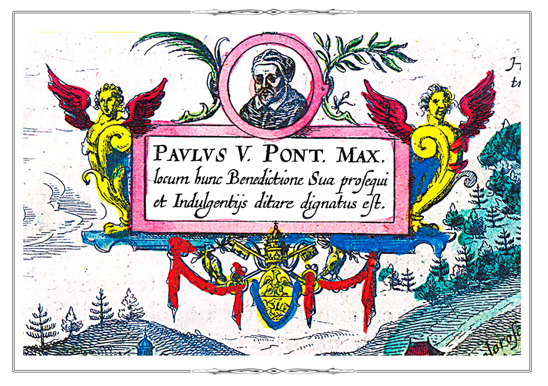
PortraitsFragment fol. 45 (a plan of the town of Kalwaria Zebrzydowska) from the atlas Civitates Orbis Terrarum. Köln, 1572-1618. Vol. 6.
Theatrum praecipvarum totius mundi urbium liber sextus. 1617.
Portrait of Pope Paul V (1550-1621).
K 0-Mir 7/31
Electronic catalogue
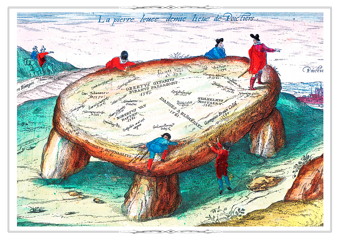
PortraitsFragment fol. 18 from the atlas Civitates Orbis Terrarum. Köln, 1572-1618. Vol. 5. Urbium praecipvarum mundi theatrum quintum. Köln, [after 1598].
K 0-Mir 7/31
Electronic catalogueDolmen of La Pierre-LevГ©e located near the town of Poitiers is remarkable for autographs of the great sixteenth century cartographers such as Mercator, Ortelius, Hogenberg, Braun who inscribed their names in the stone while travelling in France.
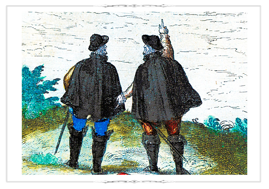
PortraitsFragment fol. 55 Civitates Orbis Terrarum. Köln, 1572-1618. Vol. III.
Urbium praecipvarum totius mundi liber tertius (1588).
K 0-Mir 7/27
Electronic catalogueAbraham Ortelius(1527-1598) and the Dutch artist J. Hufnagel (1542-1601). The engraving is inspired by memories of joint travels.
Vedute
Theatrum orbis terrarum. Antverpen, 1584. [Р .384].
K 0-Mir 7/7
View of the Escorial - an architectural complex consisting of a royal monastery, palace and residence of King Philip II of Spain – from the atlas «Theatre of the World». [P. 384].
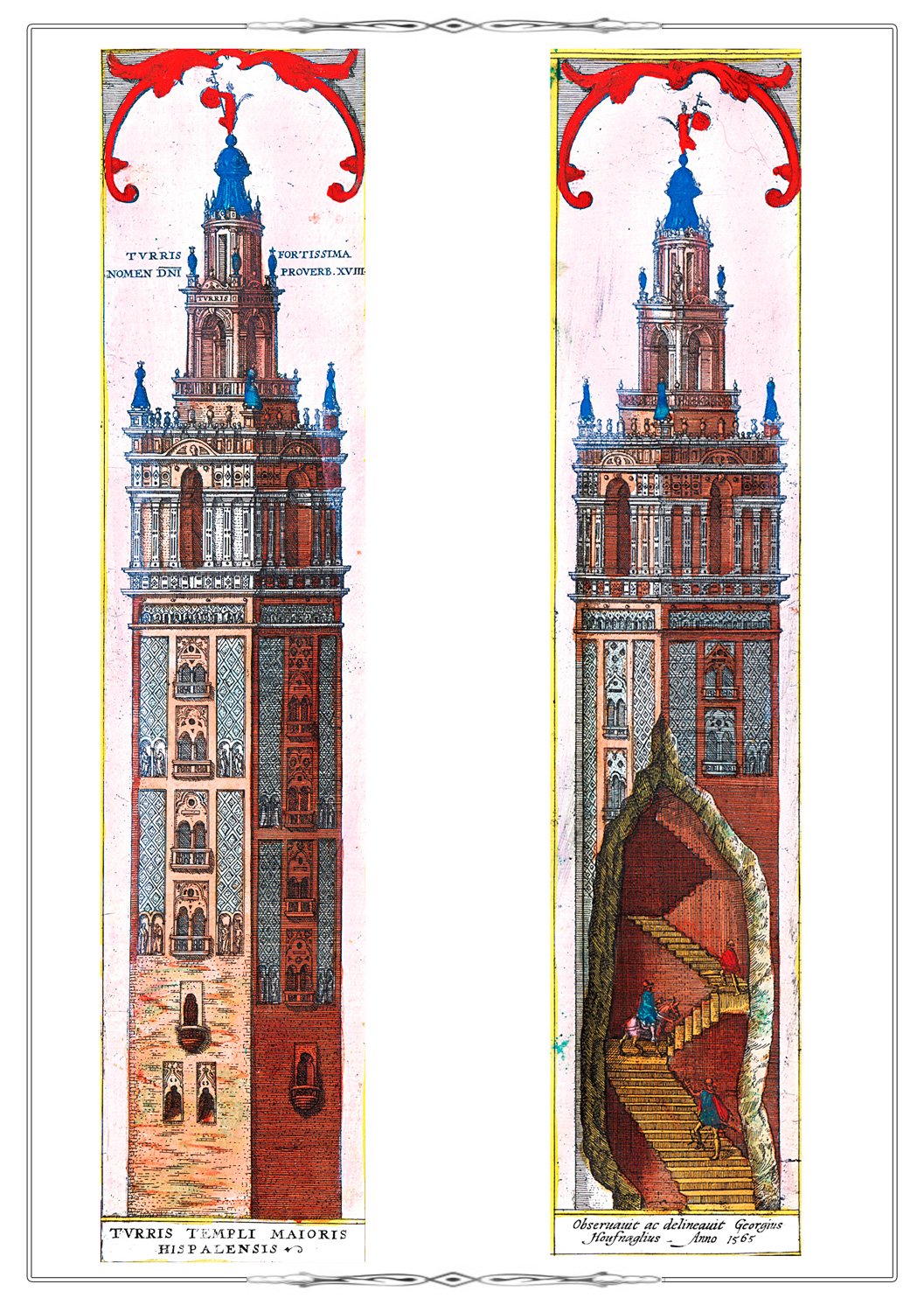
Vedute
Fragment fol. 8 from the atlas Civitates Orbis Terrarum. Köln, 1572-1618. Vol. V. Urbium praecipvarum mundi theatrum quintum. Köln, [after 1598].
K 0-Mir 7/31
Giralda tower - the symbol of Seville.
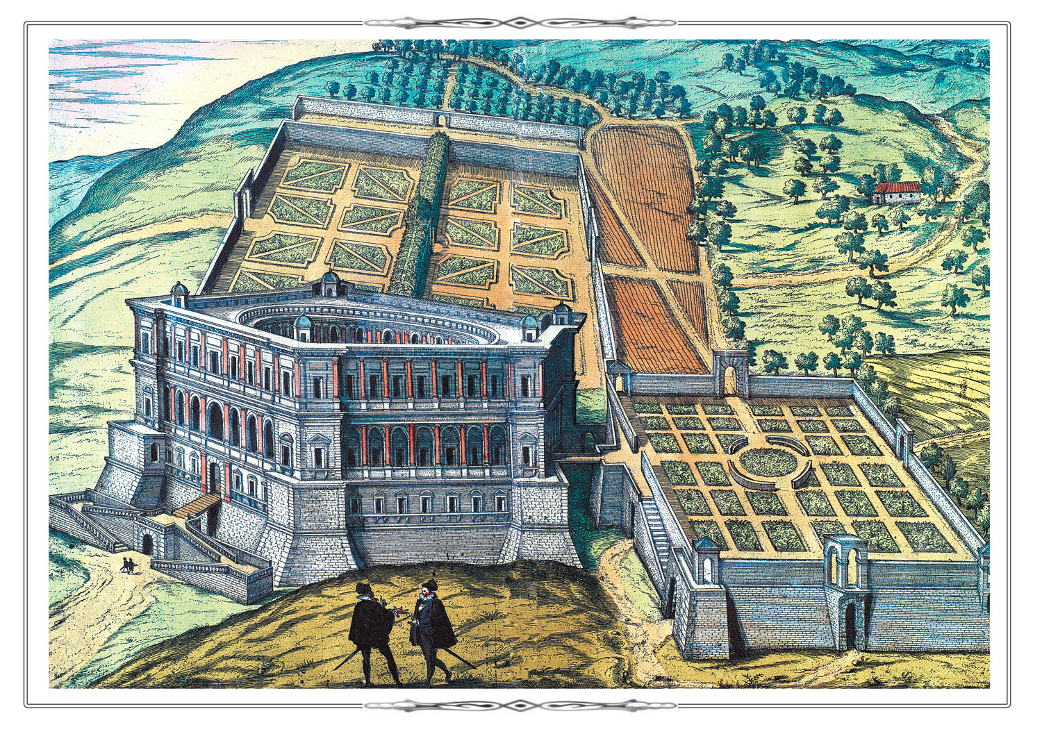
Vedute
Fragment fol. 61 from the atlas Civitates Orbis Terrarum. Köln, 1572-1618. Vol. V. Urbium praecipvarum mundi theatrum quintum. Köln, [after 1598].
K 0-Mir 7/31
Villa of the Italian nobleman, cardinal and diplomat Alexander Farnese (1545-1592) in Caprarola (Italy).
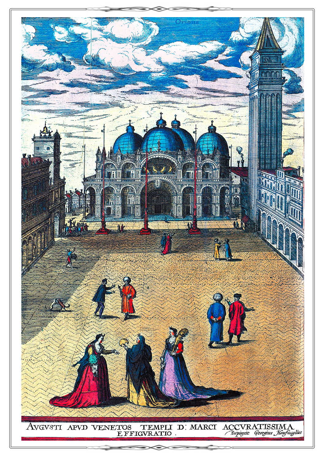
Vedute
Fragment fol. 60 from the atlas Civitates Orbis Terrarum. Köln, 1572-1618. Vol. V. Urbium praecipvarum mundi theatrum quintum. Köln, [after 1598].
K 0-Mir 7/31
St. Mark's Square in Venice.
VeduteFragment fol. 26 from the atlas Civitates Orbis Terrarum. Köln, 1572-1618. Vol. IV. Urbium praecipvarum totius mundi liber quartus 1588.
K 0-Mir 7/27.
Electronic catalogueKronborg Castle is also widely known as "Elsinore" immortalized by William Shakespeare in his play
Hamlet.
Bible ScenesCivitates Orbis Terrarum. Köln, 1588. Vol. I . F. 52.
Plan of Jerusalem from the В«Atlas of Cities of the WorldВ». Vol. I. Fol. 52.
K 0-Mir 7/28
Electronic catalogue The picture in the bottom left corner illustrates the biblical story about Moses' Ascent of Mount Sinai where the prophet received from God the two stone tablets inscribed with the Ten Commandments.
To the right is shown a high priest (Moses' brother Aaron became the first chief priest, according to the Bible). The vestments worn by high priests were very rich and elaborate, so the elements that make up these garments are described in detail in the text accompanying the illustration.
Bible Scenes
Fragment [p. 144] from the atlas Theatrum orbis terrarum. Antverpen, 1584.
K 0-Mir 7/7
Bible Scenes: the birth, crucifixion and resurrection of Christ.
Bible ScenesFragment fol. 6 (a plan of the city San Sebastian) from the atlas Civitates Orbis Terrarum. Köln,1588. Vol. I.
K 0-Mir 7/28
Electronic catalogueSan Sebastian (?-288) is a Roman legionary who believed in the teachings of Christ and was executed for it.
Bible ScenesFragment fol. V from the atlas Abrahami Ortelii Theatri orbis terrarium parergon… Antverpen, 1624.
0-РњРёСЂ 8/39.
Electronic cataloguePaul’s conversion to Christianity on the Damascus road when he was called to be an apostle.
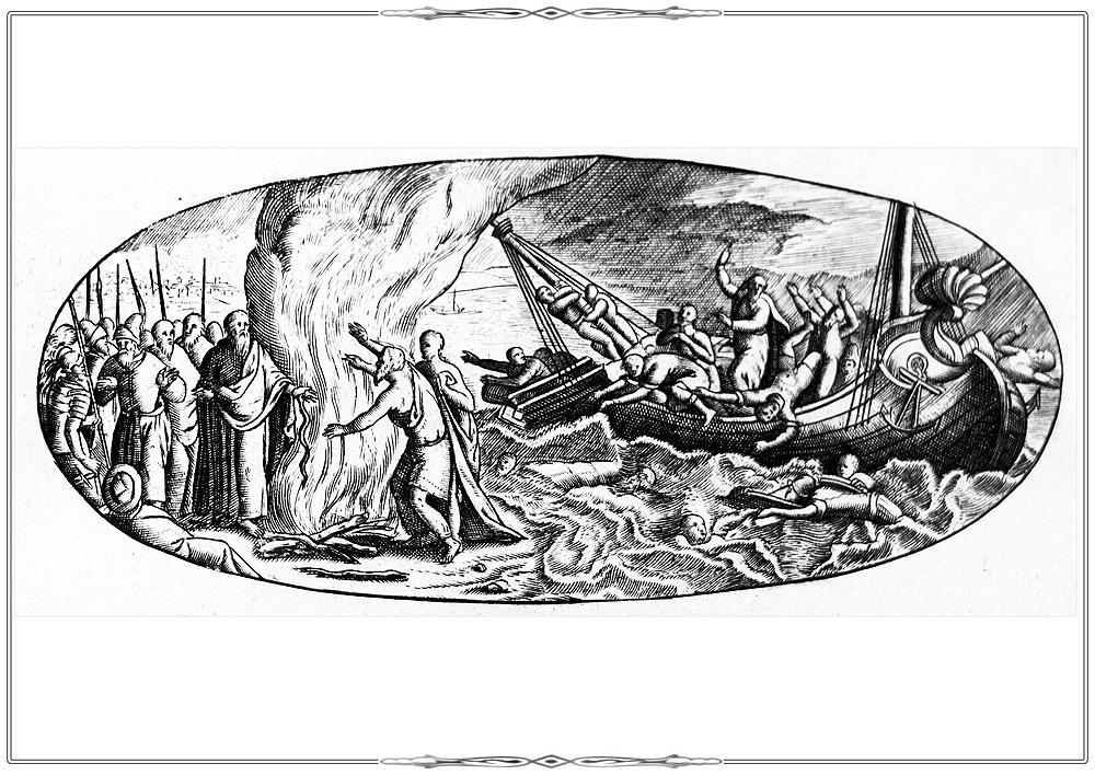
Bible ScenesFragment fol. V from the atlas Abrahami Ortelii Theatri orbis terrarium parergon… Antverpen, 1624.
0-РњРёСЂ 8/39.
Electronic catalogueScene of the Apostle Paul's shipwreck on Malta.
The Apostle Paul miraculously escaped the death during his journey. Now, the Feast of St. Paul’s Shipwreck is a public holiday celebrated in Malta.
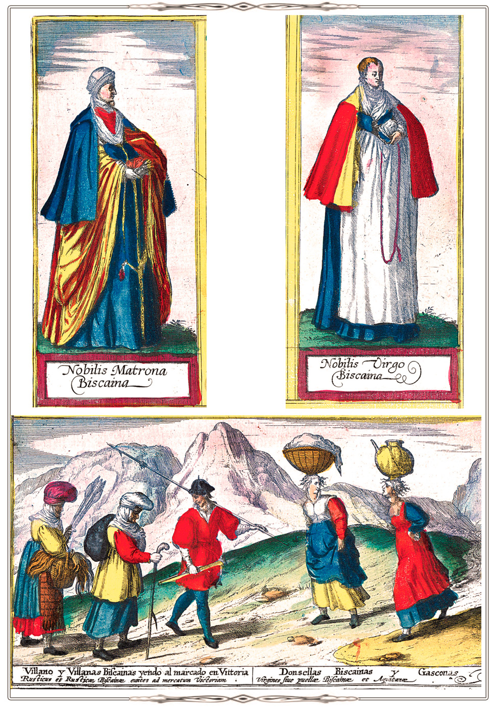
ClothesCivitates Orbis Terrarum. Köln, 1588. Vol. II. F. 47
K 0-Mir 7/28
Electronic cataloguePlan of Moscow from volume II of the В«Atlas of Cities of the WorldВ», fol. 47.
The garments of Russian soldiers are fairly accurately depicted at the bottom of the plan.
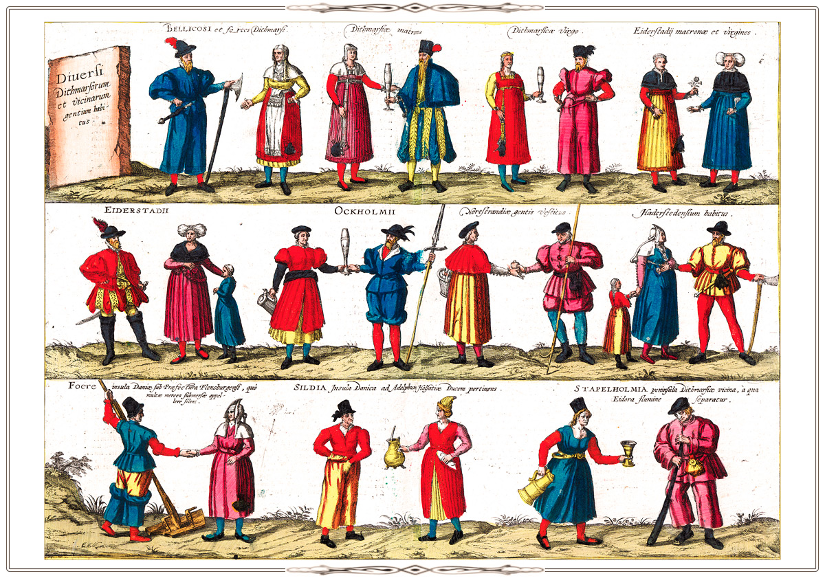
ClothesFragment of p. 16 from the atlas Civitates Orbis Terrarum. Köln, 1572-1618. Vol. V. Urbium praecipvarum mundi theatrum quintum. Köln, [after 1598].
K 0-Mir 7/31
Electronic catalogue
ClothesFragment of p. 37 from the atlas Civitates Orbis Terrarum. Köln, 1572-1618.
Vol.V. Urbium praecipvarum mundi theatrum quintum. Köln, [after 1598].
K 0-Mir 7/31
Electronic catalogue
ClothesFragment of p. 2 from the atlas Civitates Orbis Terrarum. Köln, 1572-1618. Vol. VI.
Theatrum praecipvarum totius mundi urbium liber sextus. 1617.
K 0-Mir 7/31
Electronic catalogue
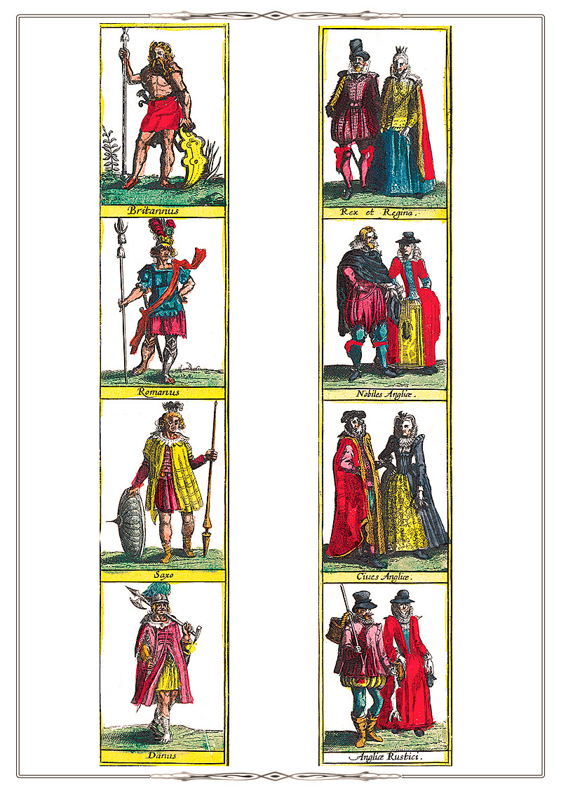
ClothesFragment of the title page of the atlas Civitates Orbis Terrarum. Köln, 1572-1618. Vol. V.
Urbium praecipvarum mundi theatrum quintum. Köln, [after 1598].
K 0-Mir 7/31
Electronic catalogue
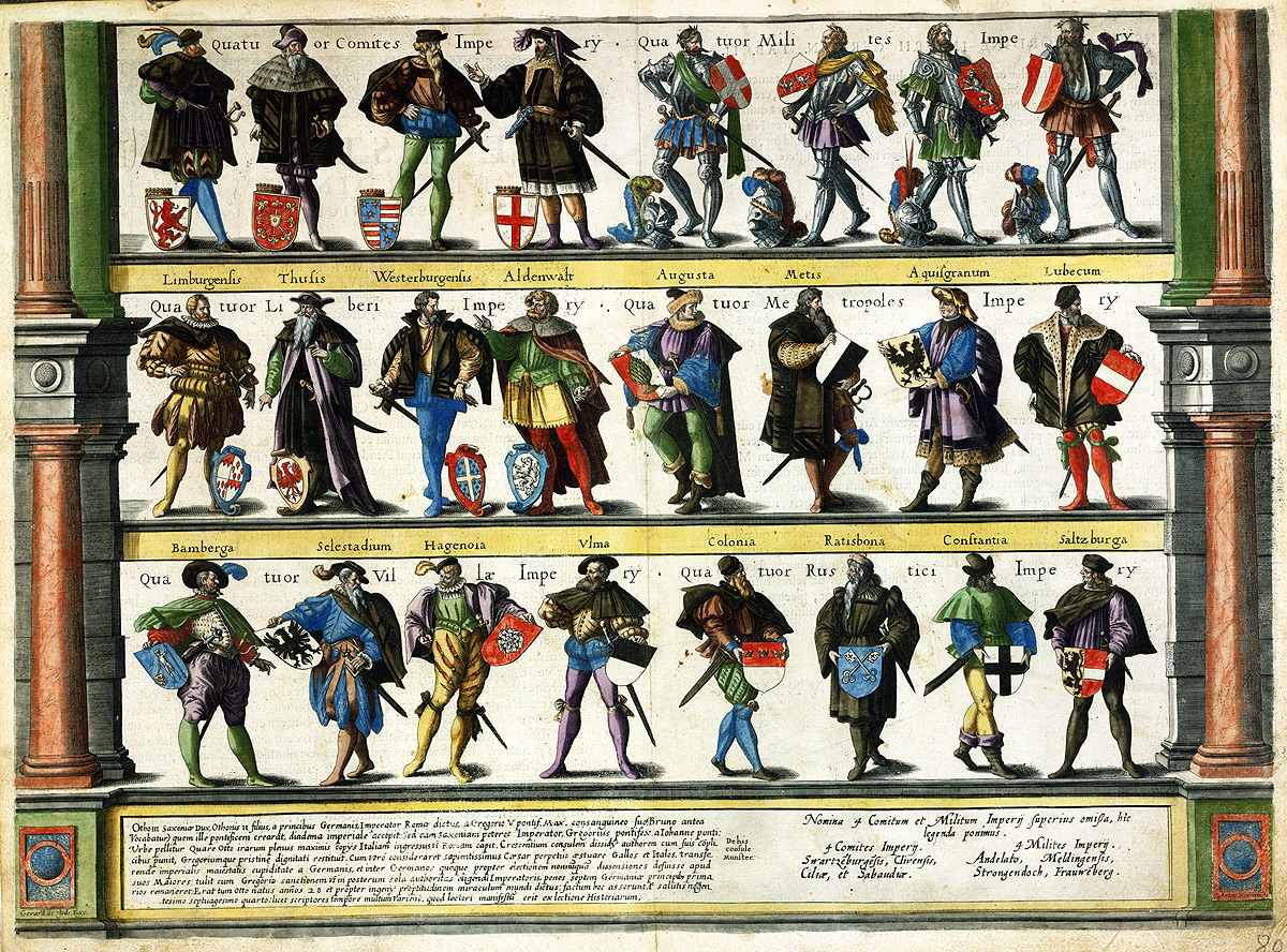
Images of RulersFolios Bb, Cc depicting the rulers of the Holy Roman Empire from the atlas Speculum orbis terrae. Antverpen, [1593-1613]. Fols. Bb, Cc.
K 0-Mir 7/9
Electronic catalogue
LegendsTheatrum orbis terrarum. Antverpen, 1570. Fol. 46.
K 0-Mir 7/11
Electronic catalogueMap of Russia from the atlas В«Theatre of the WorldВ». Fol. 46.
The map was compiled by the English merchant and diplomat Anthony Jenkinson, the British Ambassador in Russia. The well-studied European territory of the country is shown in detail.
The part of the map representing the region beyond the Ural Mountains is mostly filled in by pictures and texts on various legends and beliefs, because this territory was known much worse.
For instance, the map contains illustrations featuring worship of the Golden Woman (the female idol of the northen people), tribes who worship the sun etc.
A portrait of Tsar Ivan the Terrible is located in the upper left coner.
LegendsFragment p. xlij from the atlas Abrahami Ortelii Theatri orbis terrarium parergon… Antverpen, 1624.
0-РњРёСЂ 8/39.
The Golden Fleece
Electronic catalogue
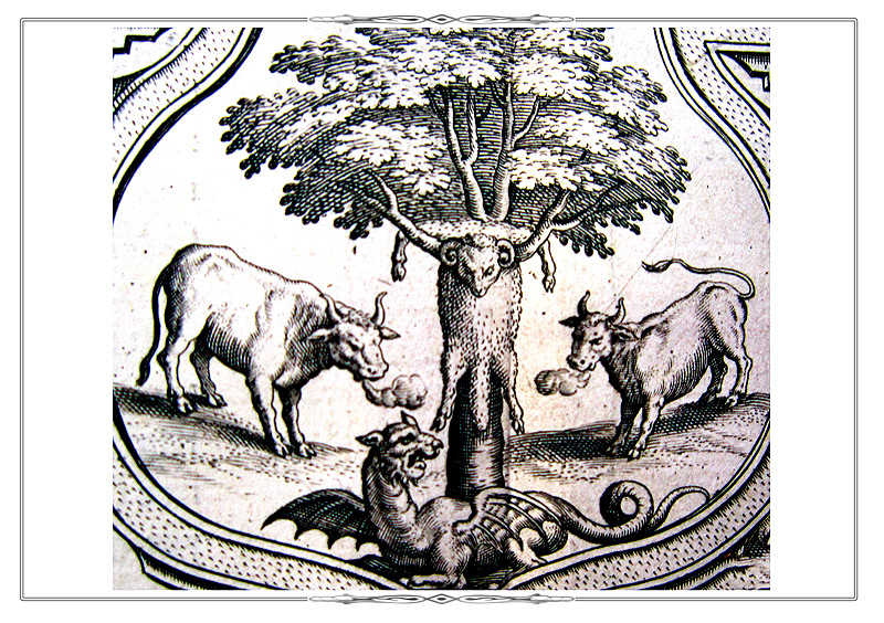
LegendsFragment p. 12 from the atlas Speculum orbis terrae. Antverpen, [1593-1613].
K 0-Mir 7/9
Electronic catalogueFragment shows a dragon on the territory of the unknown southern continent.
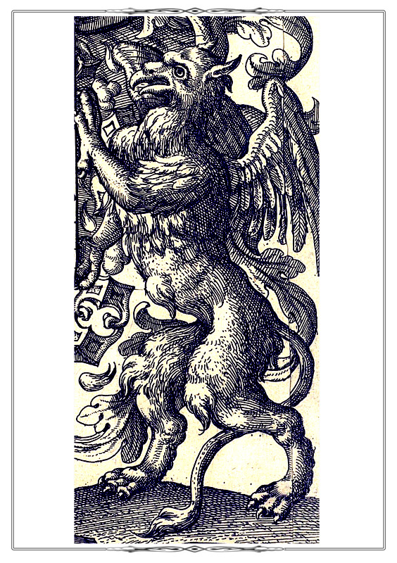
LegendsFragment of the reverse side of the title sheet of the atlas Abrahami Ortelii Theatri orbis terrarium parergon… Antverpen, 1624.
0-РњРёСЂ 8/39.
Gryphon.
Electronic catalogue
Coats of Arms and FlagsCivitates Orbis Terrarum. Köln, 1572-1618. Vol. III. Urbium praecipvarum totius mundi liber tertius (1588). F.23.
K 0-Mir 7/27
Electronic catalogue
Fol. 23 [Coats of Arms and Flags of cities, religious leaders and noble families from the province of Hainaut] from volume III of the В«Atlas of Cities of the WorldВ». The central image at the top of the page is the Coats of Arms of the Holy Roman Empire and the province of Hainaut (now the province in Belgium).
Coats of Arms and FlagsFragments of fol. 3 from of the atlas Civitates Orbis Terrarum. Köln, 1572-1618. Vol. III.
Urbium praecipvarum totius mundi liber tertius.1581.
K 0-Mir 7/27
Electronic catalogueThe coat of arms of the Great Britain and the coats of arms of the Earls of Chester are depicted on the left. On the right are the arms of Bishop of Chester and a former coat of arms of the Earldom of Chester.
Coats of Arms and FlagsFragments of fol. 42 from the atlas Civitates Orbis Terrarum. Köln, 1572-1618. Vol. VI.
Theatrum praecipvarum totius mundi urbium liber sextus. 1617.
K 0-Mir 7/31
Electronic catalogueImage of the patron saint of Krakow St. Florian, armorials of the city of Krakow, Polish kings (from the House of Vasa), the Grand Duchy of Lithuania.
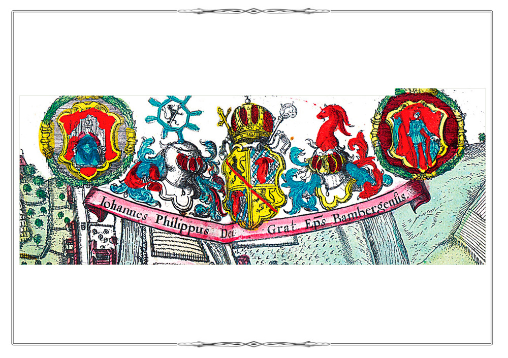
Coats of Arms and FlagsFragment fol. 35 from the atlas Civitates Orbis Terrarum. Köln, 1572-1618. Vol. VI.
Theatrum praecipvarum totius mundi urbium liber sextus. 1617.
K 0-Mir 7/31
Electronic catalogueCoats of arms of the bishop of Bamberg, Bavaria and the city of Bamberg.
Coats of Arms and FlagsFragment fol. 21 from the atlas Civitates Orbis Terrarum. Köln, 1572-1618. Vol. II. De praecipues totius urbibus liber secundus. 1575.
K 0-Mir 7/28
Electronic catalogueA fimale figure (Coat of Arms of Maastricht), holding the coats of arms of the bishop and the Kingdom of Spain.
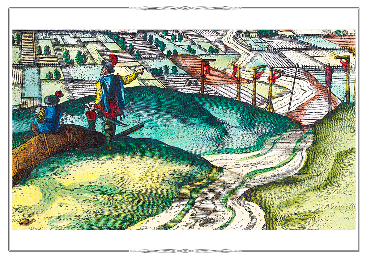
BattlesCivitates Orbis Terrarum. Köln, 1572-1618. Vol. VI. Theatrum praecipvarum totius mundi urbium liber sextus (1617) F. 11
K 0-Mir 7/31
Electronic catalogue
Plan of Ostend (now located in Belgium) from volume VI of the of the В«Atlas of Cities of the WorldВ», fol. 11.
The plan features one of the most dramatic events in the history of the city - a three-year siege of Ostend by the Spanish troops wich lasted from 1601 to 1604 and resulted in a Spanish victory.
The coat of arms of Ostend is in the upper left corner.
BattlesFragment fol. 35 from volume VI of the atlas Civitates Orbis Terrarum. Köln, 1572-1618. Vol. VI. Theatrum praecipvarum totius mundi urbium liber sextus. 1617.
K 0-Mir 7/31
Electronic catalogueFragment the city of PГЎpa which was repeatedly besieged by Turkish troops. Probably, it depicts the events of 1597 when the city was liberated from the Turkish invaders, and the survivors of the Turks were brutally executed (impaled).
BattlesFragment fol. 57 from volume II of the «Atlas of Cities of the World» (Civitates Orbis Terrarum. Köln, 1572-1618. Vol. II. De praecipues totius urbibus liber secundus. 1575.
K 0-Mir 7/28
Electronic catalogueMap of the island PeГ±Гіn de VГ©lez de la Gomera, through which the dividing line between the Spanish and Portuguese Possessions on the North African coast passed in the 16th century.
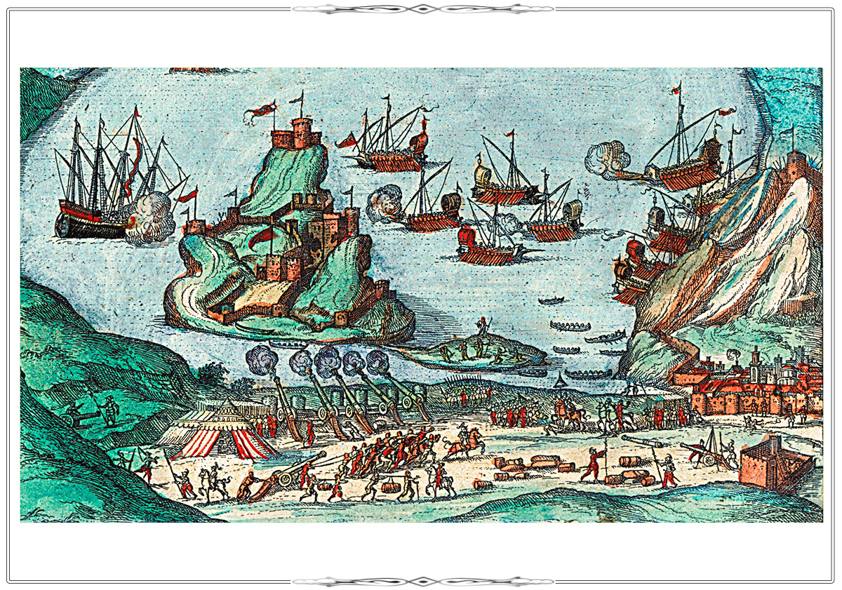
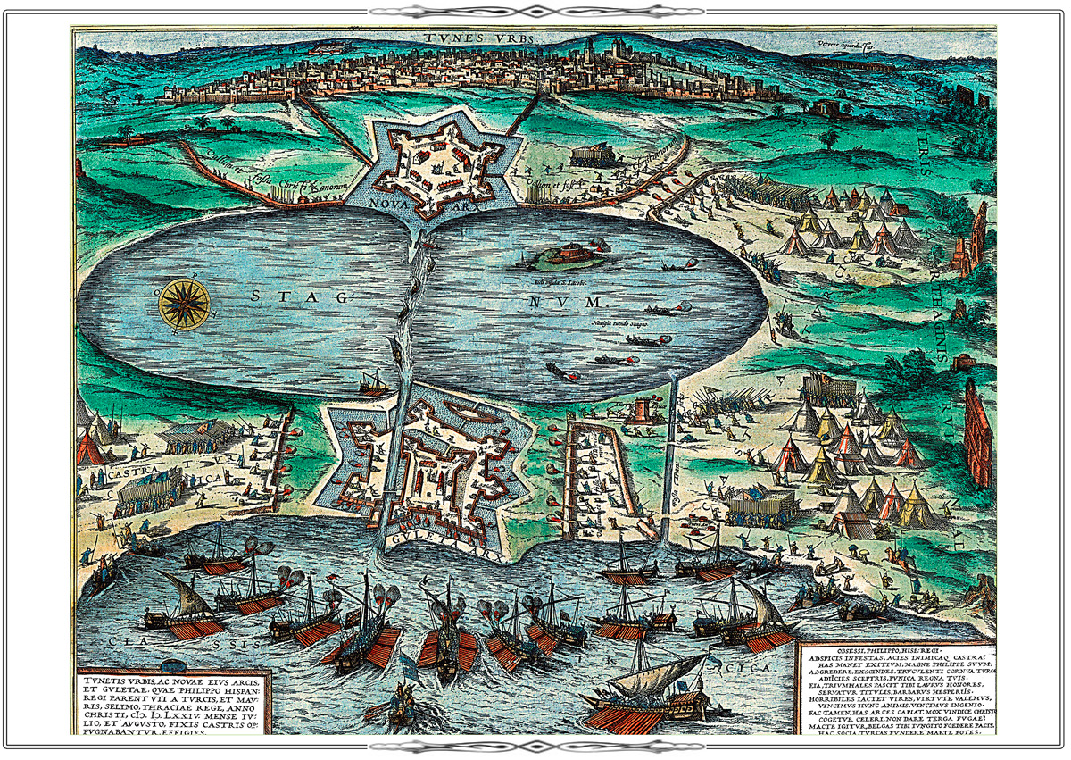
BattlessFragment fol. 58 from volume II of the atlas Civitates Orbis Terrarum. Köln, 1572-1618. Vol. II. De praecipues totius urbibus liber secundus. 1575.
K 0-Mir 7/28
Electronic catalogue
The plan of Tunis shows the battle between the troops of the Spanish King Philip II, protecting the city, and the Turkish military forces under the command of Sultan Selim in 1574.
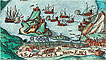
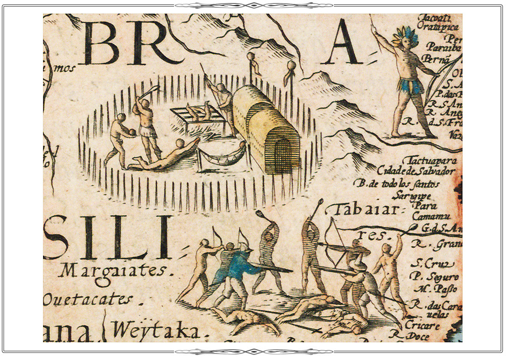
BattlessFragment fol. 12 from the atlas Speculum orbis terrae. Antverpen, [1593-1613].
K 0-Mir 7/9
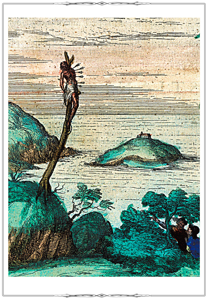
El. CatalogueSkirmish between Europeans and natives in Brazil.
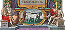
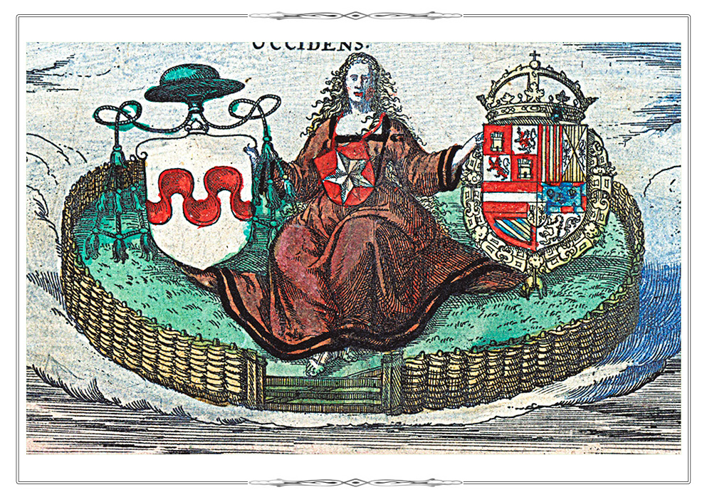
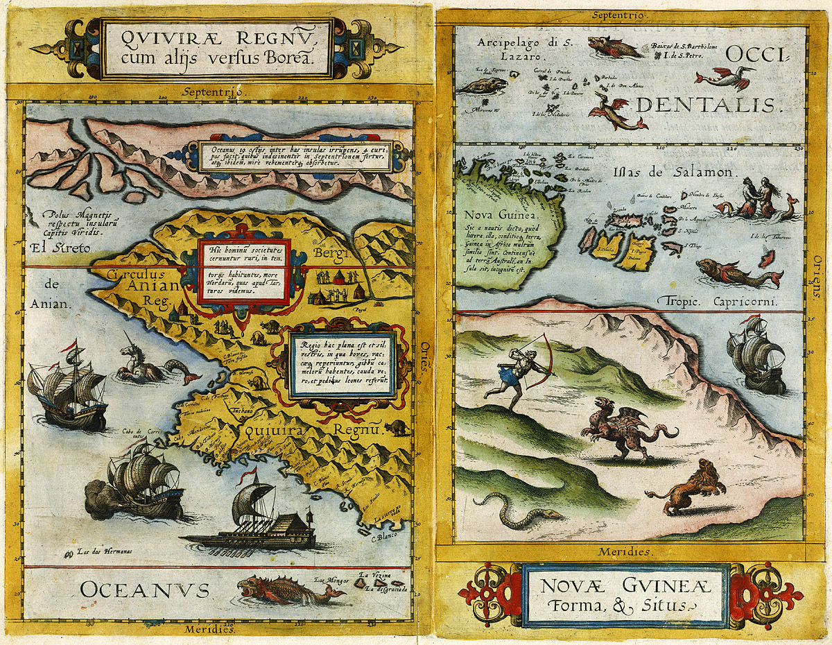
Legends Maps of North America (Quivira) and New Guinea from the world atlas В«Mirror of the WorldВ».
(Speculum orbis terrae. Antverpen, [1593-1613]. F.12.)
0 K-Mir 7/9
Electronic Catalogue
1. The mythical Quivira that never existed in reality was believed to be located in North America. According to legends, the inhabitants of this incredibly rich country use only gold and silver kitchen utensils.
2. The map shows the island of New Guinea and part of the unknown southern continent inhabited by monsters.
Portraits
Cover sheet of the maritime atlas В«Light of the Polar Star or Sea AtlasВ» (Klaer-Lichtende Noort-Star Рѕste Zee Atlas. Amsterdam, 1668.)
Рљ 0-Mir 8/160
On the right and left there are portraits of Pedro de Medina, the author of the book В«The Art of NavigationВ» (1545), and the English mathematician Edward Wright noted for his book В«Certaine Errors in NavigationВ» (1599).
Ancient Mythology
Cover Sheet of the Marine Atlas (Zee Atlas. Amsterdam, [1680])
K 0-Mir 8/159
On the right there is the figure of Atlant holding a celestial globe on his shoulders.