Theater of War Maps
I. Kiselev
Theater of War Maps are the most numerous group of maps showing the areas where the fighting took place. They represented both separate sectors of the front, and the entire European theater. A whole series of maps containing indexes were published on a larger scale, they covered almost the entire territory of the warring powers.
1. Twenty-five Verst Map of Europe of 1914.
Moscow: I.Mayevsky Book Publishing, 1914.
K 3-Evr 6/425
In total, this series consisted of 10 maps. They contain detailed indexes. The Eastern (Russian) front was shown on maps of the Prussian-Polish region, Lithuanian and the Baltic, as well as the Galician regions. After Turkey had joined the war, the series was added with maps of the Russian-Turkish region and the West Black Sea region with the straits.
The following maps were issued in this series:
No.1 Prussian-Polish Region
No.2 Galician Region
No.3 Franco-German Region
No.4 Danubian Region
No.5 Russian-Turkish Region
No.6 Balkan Region
No.7 West Black Sea Region with the Straits
No.8 Austro-Italian Region
No.9 English-German Region
No.10 Lithuanian and Baltic Region
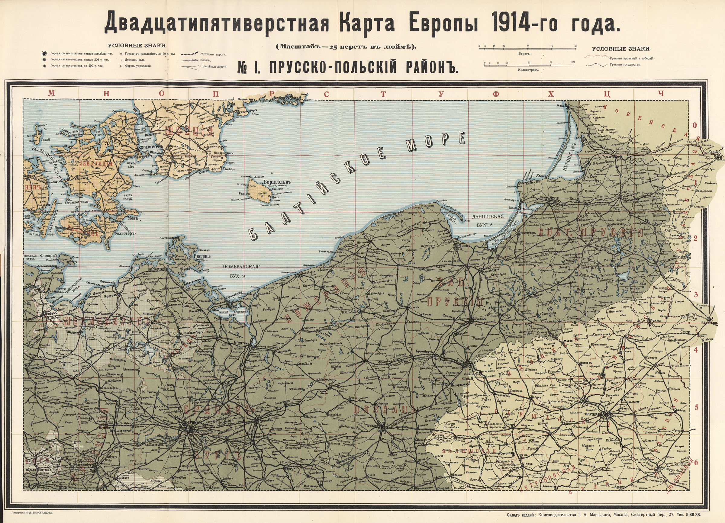
No.1 Prussian-Polish Region
The map covers the most difficult and dangerous sector of the Eastern Front, where bloody battles of the Russian troops against the German army took place, including the Battle of Gumbinnen and others.
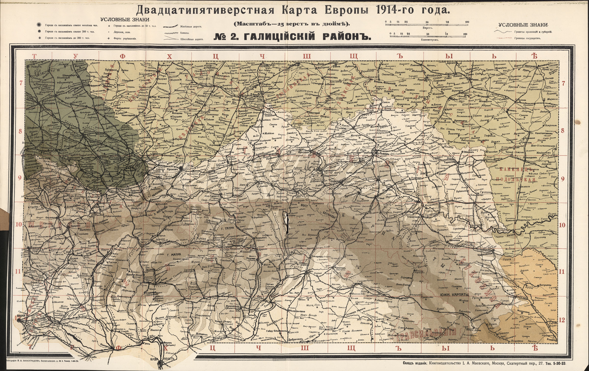
No.2 Galician Region
In this regione, the Russian army carried out a number of the outstanding operations, including the Battle of Galicia and Brusilov Offensive.
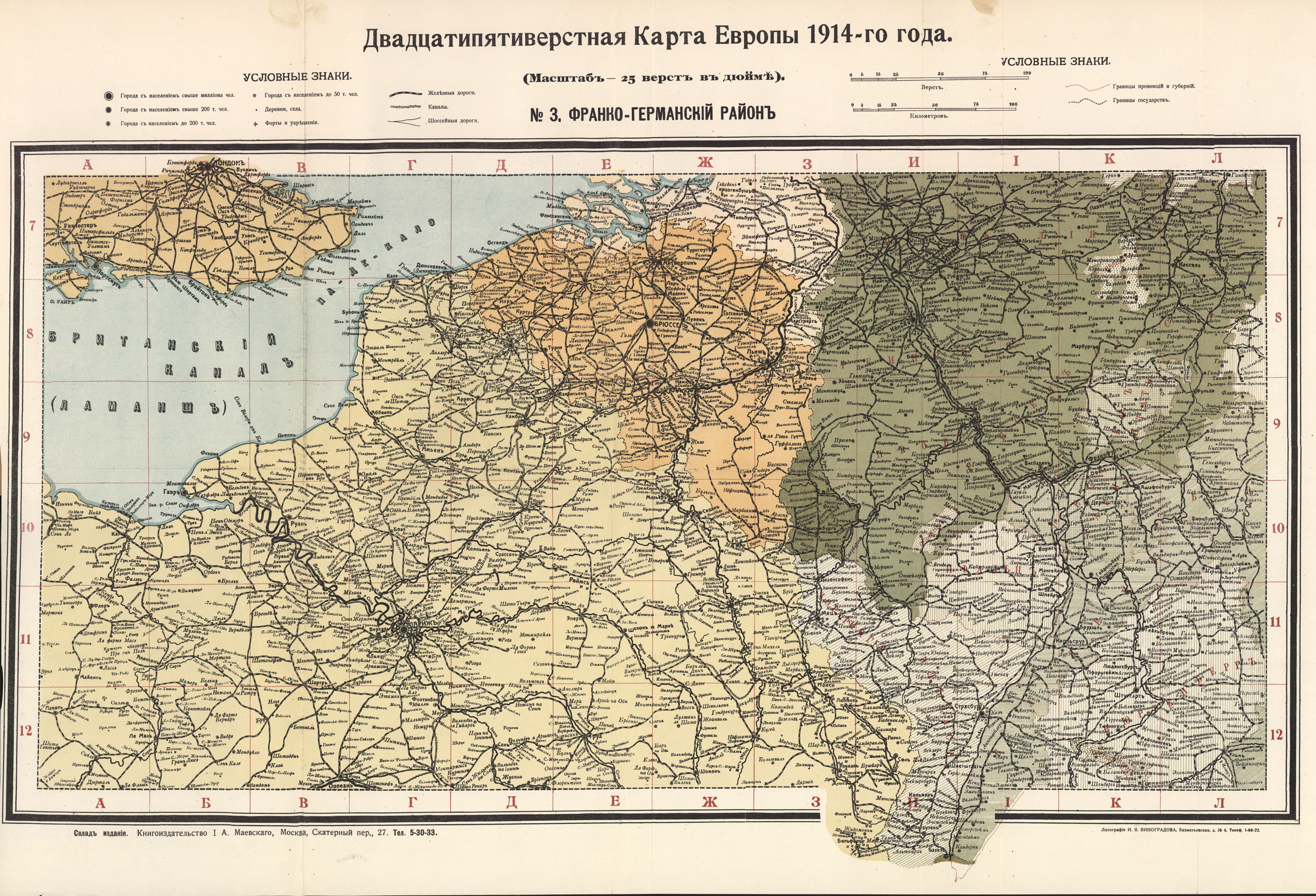
No.3 Franco-German Region
It is the area of the Western Front where the most important battles of the First World War took place, starting with the breakthrough of German troops through Belgium to the French border. Here all the major battles of the French-German front were fought, such as the Battle of the Marne, the Battle of Ypres where German troops were the first to use poison gas, the battle of Verdun - one of the bloodiest operations of the First World War.
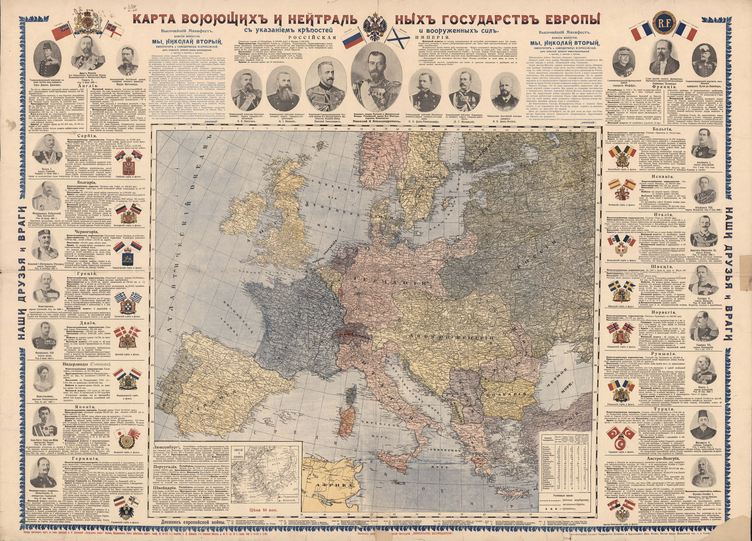
2. Map of Warring and Neutral States of Europe: showing forts and armed forces.
Moscow : RTPID (typography-lithography of the Russian Printing and Publishing Association), [1914].
K 3-Evr 4/60
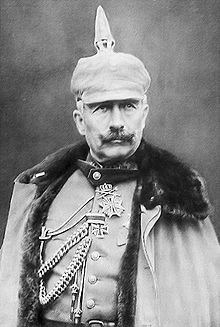
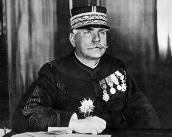
Map is interesting because it features not only the theater of war in Europe, but also statistics on the countries involved in the World War I. Besides statistics, the map contains comments about the entry into the war of the fighting parties, as well as neutral countries' attitude towards the war. The map also include portraits of heads of states and commanders of armies and navies, including the President of the French Republic Raymond Poincaré (1860–1931), Emperor of Germany
Wilhelm II (1859-1941), Commander of the French Army General
Joseph Joffre (1852-1931), the British Admiral John Jellicoe (1859-1935) and others.
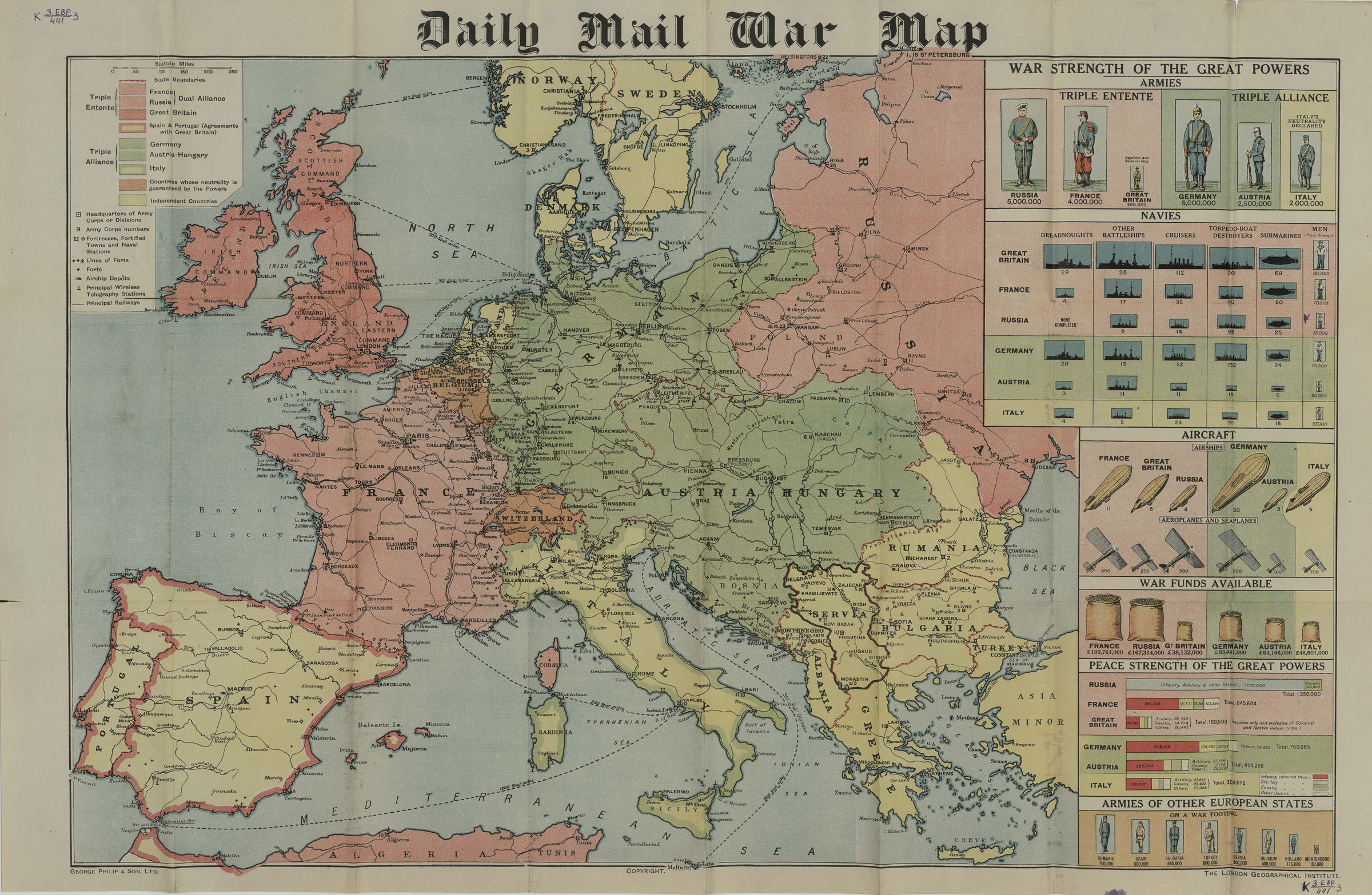
3. Daily Mail War Map.
London, [1914].
K 3-Evr 6/441
Map of the European theater of war during the First World War. It covers the area where military actions took place. The map shows the main railways and important radio stations, some castles and fortified forts lines such as the Verdun fortified region. The publication also contains comparative graphs of the number of different types of weapons, troops and military stockpiles of the opposing sides.
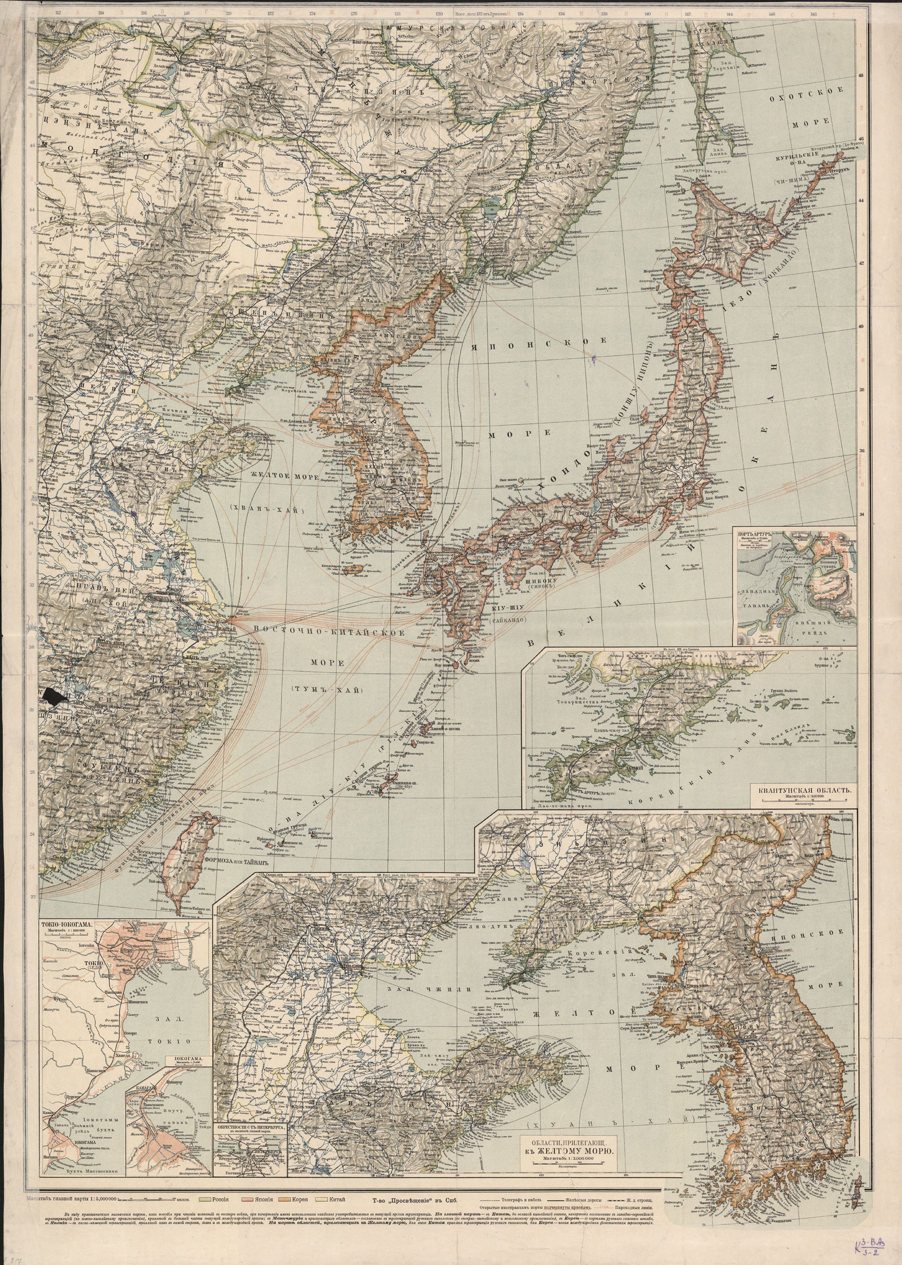
4. To the German-Japanese War. Map of the theater of war.
Saint Petersburg : Prosveshcheniye Publisher, [1914].
K 3-ВАз 3/2
The map deals with the participation of Japan in World War II. It shows the theater of war in Southeast Asia. Japan entered the war on 23 August 1914, laying siege to the German port of Tsingtao. During the war, taking advantage of the weakness of the German influence in the region, Japan made a real race to capture the German colonies in the Pacific. Only by the end of 1914, after difficult negotiations with the United Kingdom, Japan received complete freedom to act to the north of the Equator.
Twenty-five Verst Map of Europe of 1914.Moscow: I.Mayevsky Book Publishing, 1914
K 3-Evr 6/425
No.1: Prussian-Polish region.
View in the
Digital Library
Twenty-five Verst Map of Europe of 1914.Moscow: I.Mayevsky Book Publishing, 1914
K 3-Evr 6/425
No.2: Galician region.
View in the
Digital Library
Twenty-five Verst Map of Europe of 1914.Moscow: I.Mayevsky Book Publishing, 1914
K 3-Evr 6/425
No.3: Franco-German Region.
View in the
Digital Library
German Emperor Wilhelm II
(1859-1941)
Commander of the French Army, General Joseph Joffre (1852–1931)
Map of Warring and Neutral States of Europe: showing forts and armed forces.
Moscow : RTPID (typography-lithography of the Russian Printing and Publishing Association), [1914]
K 3-Evr 4/60
View in the
Digital Library
To the German-Japanese War. Map of the Theater of the WarSaint Petersburg : Prosveshcheniye Publisher, [1914]
K 3-ВАз 3/2
View in the
Digital Library