500th Anniversary of Gerardus Mercator
Mercator Projection
At that time, Flanders suffered serious religious conflicts between the Protestant reformers and the Catholics who had a traditional outlook. In Leuven, there was drawn up a list of 43 residents deemed to be heretical. Mercator was also included in this list. In February 1544, he was arrested and placed in one of the casemates. Through the intercession of some influential persons, Mercator was released after seven months of imprisonment, though, many of those with whom he was in the jail were executed. Mercator's life still remained precarious, and he decided to leave the Netherlands.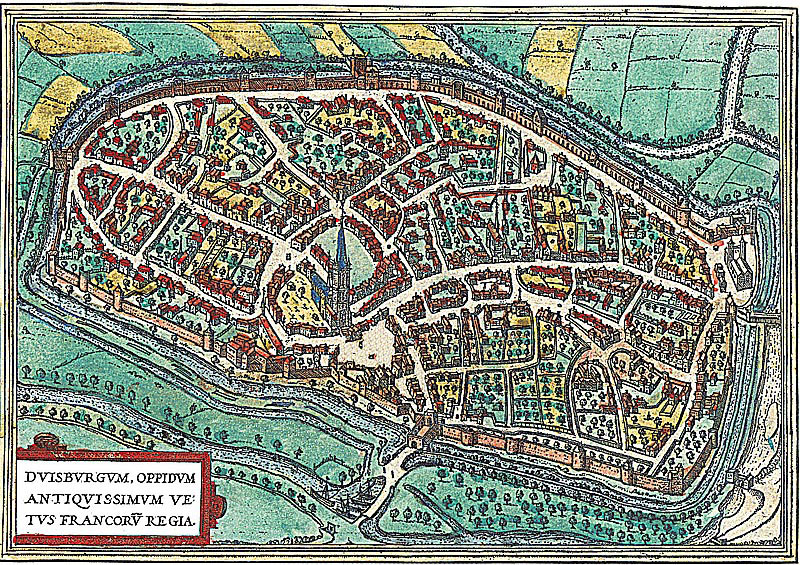
He moved to the German city of Duisburg at the invitation of the Duke of Cleves who planed to found an university. Subsequently, it was in Duisburg where Mercator will create his largest works.
These chiefly comprise three monumental wall maps that have survived only in single copies:
- 1554 Map of Europe
- 1564 Map of British Isles
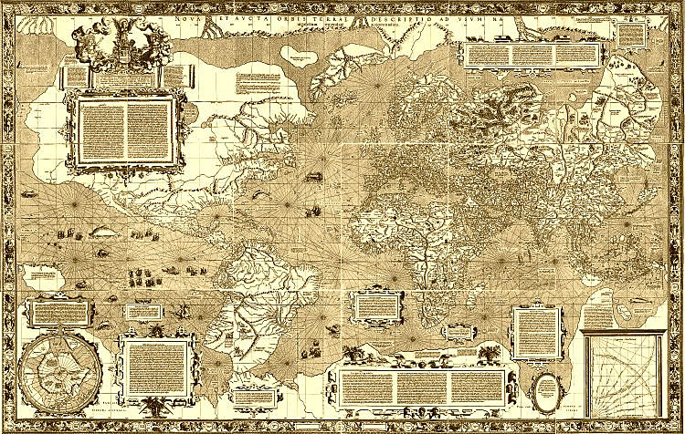
- 1569 World Map «New and More Complete Representation of the Terrestrial Globe Properly Tested and Adapted for Use in Navigation»
The latest work should be mentioned in particular. As its name implies, it was intended primarily for mariners. Mercator, which never made voyages, nevertheless saw the great disadvantage of charts, existed at the time,- namely - the inability to easily plot the ship's route on a flat map, even using the goniometer and a compass, because the angle between two lines on the sphere of the Earth have not the same angle on the flat map. Mercator's great invention consisted in the fact that he found a way to construct charts, on which the course of the ship is a straight line, and the azimuth is not distorted.
This method is now called Mercator projection and applied for nautical charts worldwide. A slight modification of the Mercator projection is used for topographic maps of land, produced in the U.S., Canada, France, Germany and other countries. Google maps and most of the navigation devices which are now familiar to every driver are also based on a close variant of it.