Lichtenstein
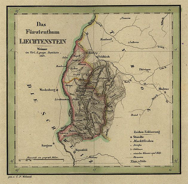 Das Fuerstenthum Liechtenstein. Gez. v. C.F. Weiland. Weimar, 1834.
1 leaf, 310 х 370 mm. Engrave, hand-coloured.Scale [1:310 000].
К 2-Цев 1/ 372. The map of Liechtenstein. Legend: settlements, separate buildings, roads.
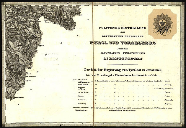 Karte der gefursteten Grafschaft nebst Vorarlberg und dem angrenzenden Souverainen Furstenthum Liechtenstein astronom. vermessen topogr. aufgenom. reduziert u. gez. im Jahre 1823 vom dem K.K. Osterreich.
Gen. Quart. Gest. u. Geschrieben v. C. Stein. Wien, [1823]. 24ff., title page, 1 collapsible leaf 270 x 390 mm. Gravure. Glued upon the fabric. Folded and put in the case 280 x 210 mm. Scale [1:150000]. K 2-Цев 6/ 664.
Map of the county of Tyrol, the province of Vorarlberg and grand duchy Liechtenstein. The map shows highways, settlements, fortresses, post stations, ruins, cloisters, churches, chapels, cemeteries, wind mills, separate buildings, mines, industrial units, trigonometrical points; marches, vegetation, vineyards, relief.