General Maps of the Russian Empire
In the 18th century, general small-scale maps much prevailed over special large- and medium-scale ones. In the vast majority, these are maps of the entire state, several neighbouring provinces or individual provinces. Their scales ranged from 1: 3,000,000 (1 cm = 30 km) to 1: 12,000,000 (1 cm = 120 km). But the most common scales, found on the 18th century maps, are 1: 7,000,000 (1 cm = 70 km) and 1: 9 million (1 cm = 90 km). This means that 1 cm on the map represents 70 or 90 km on the earth’s surface, relatively. Some of them were part of the atlases, the rest were published as independent works. The maps from atlases were additionally printed on separate sheets, which contributed to their wider distribution.
To create maps, the following sources were used:
- Materials of the first instrumental survey of the territory of the state, that began in 1715;
- the results of the General Land Survey conducted since 1765;
- from the second half of the 18th century, explanations for special requests sent to provincial administrations during administrative reforms
- results of numerous expeditions and hydrographic works throughout the centur.
Mapping was carried out in special state departments. The Geographical Department of the Petersburg Academy of Sciences, Geographical Department of the Cabinet of His Imperial Majesty issued general maps not only in Russian, but also in Latin and French, because of the mutual interest of European states and Russia in dissemination of information about its territory.
The general maps show general geographic information: the boundaries of states and individual territories, administrative boundaries within the Russian Empire; administrative centers, other cities and settlements; hydrography; relief; vegetation. The water resourses are most accurately depicted, including rivers, lakes (sometimes with an indication of the quality of water), even excavated tanks and wells are marked in drylands. The thematic elements are also widely represented: military and economic objects (fortresses, redoubts, sentries, defensive lines, factories); the settlement of the indigenous peoples (in the Asian part of the state); territories of nomadic peoples; a variety of historical information (national or personal priority of geographical discoveries, ancient settlements ("ruins"), the Great Wall of China, etc. All thematic information, with the exception of clearly localized objects, is represented in the form of inscriptions.
The maps suffer from an obvious shortcoming: they do not show roads except the highway from St. Petersburg to Moscow. Perhaps this is explained by a systematic publication of Postal Carrier Route Maps which mainly depicted roads and postal stations in the 18th century.
For the 18th century society, the General Maps were new information resources, which made it possible to view the entire country. But the importance of maps was not limited to their geographical contents. Much attention was paid to decoration of the maps. The thematic cartouches and drawings glorified the military and economic power of Russia; glorified the reigning persons; , reminded of historical events; told about economic activity and scientific researches as well as showed the arms of provinces, governorships, cities. These are historical documents and works of engraving art that preserve for us the appearance of Russia in the 18th century,and testify to the priorities of state policy and social life of that time.
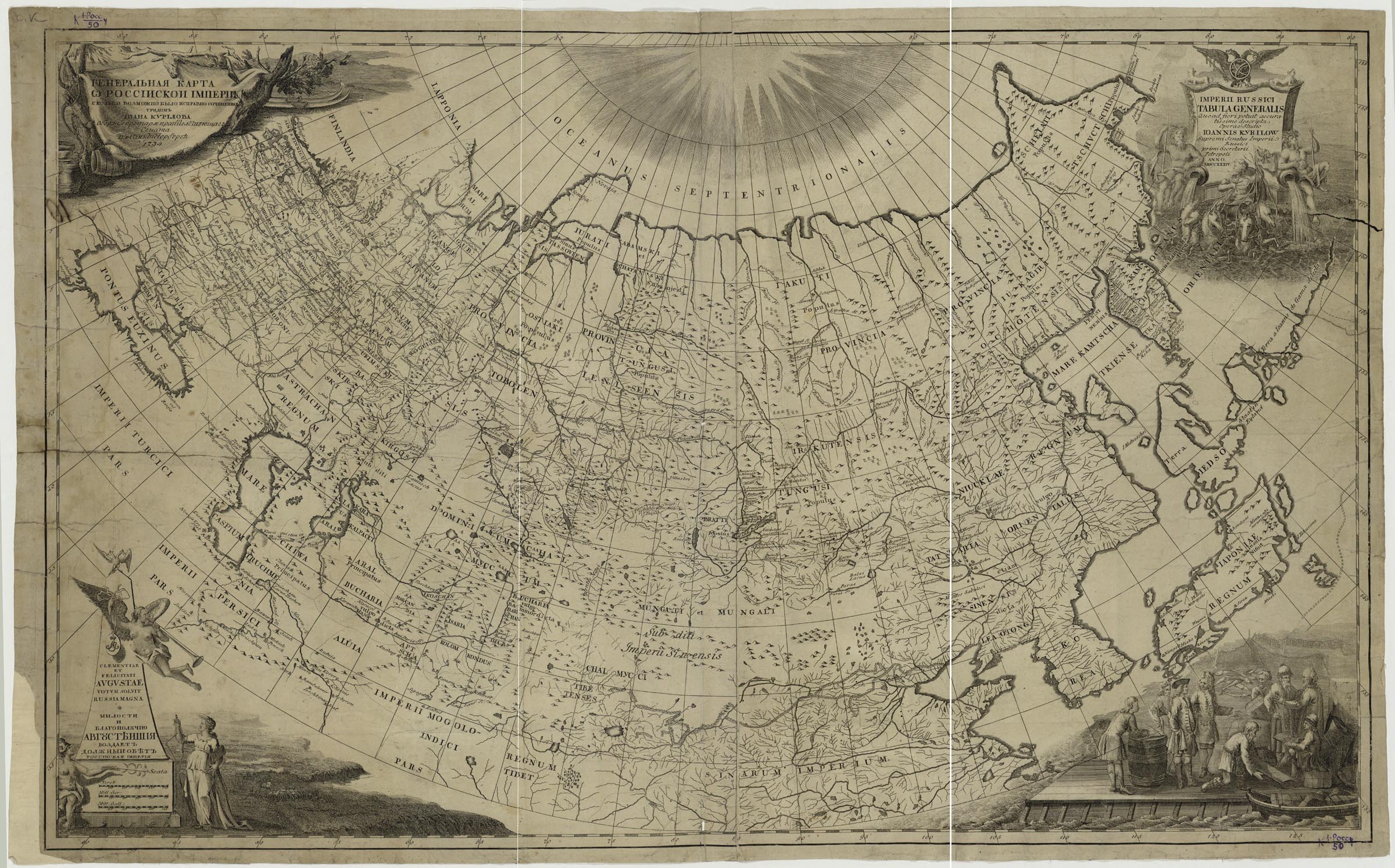
The first general map of the state to be created in Russia on a scientific basis: using the system of astronomical reference points, a grid of conic projection, the latest expedition data, materials of the first instrumental surveys of individual territories of the country.
A cartouche with the title contains: a fragment of the procession of Neptune, allegorical images of rivers, a two-headed eagle with a broadsword and a cross, an armillary sphere. The figure on the lower right side shows the scene of trade with the aborigines, in the background is fishing tackle, fish.
K 1-Ross 4/50
Electronic resource
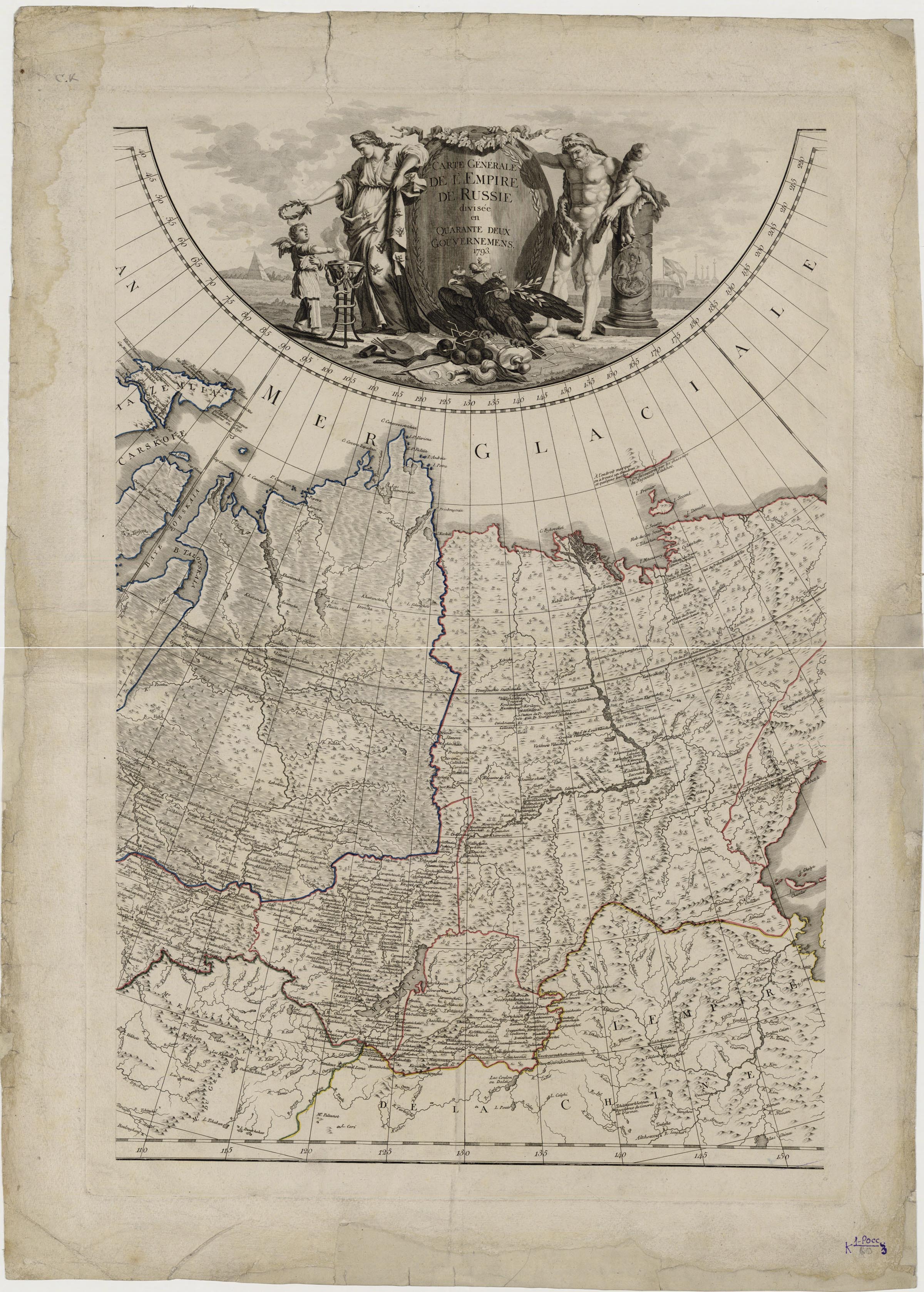
The figure on the right continues the cartographic image and characterizes the coastal water area of the Arctic Ocean by artistic means. The features of the natural zone (ice hummocks) are shown, representatives of the animal world (bear, polar birds) as well as the most significant fisheries (scenes of hunting after the sea beast) are depicted. The map include an inscription about the year of publication of the map, the beginning of its creation under Peter the Great and its finishing under Elizabeth I, its destination for public use. From the publication: Atlas of Russia consisting of nineteen special maps… Saint Petersburg : Academy of Sciences, 1745.
K 1-Ross 4/52
Electronic resource
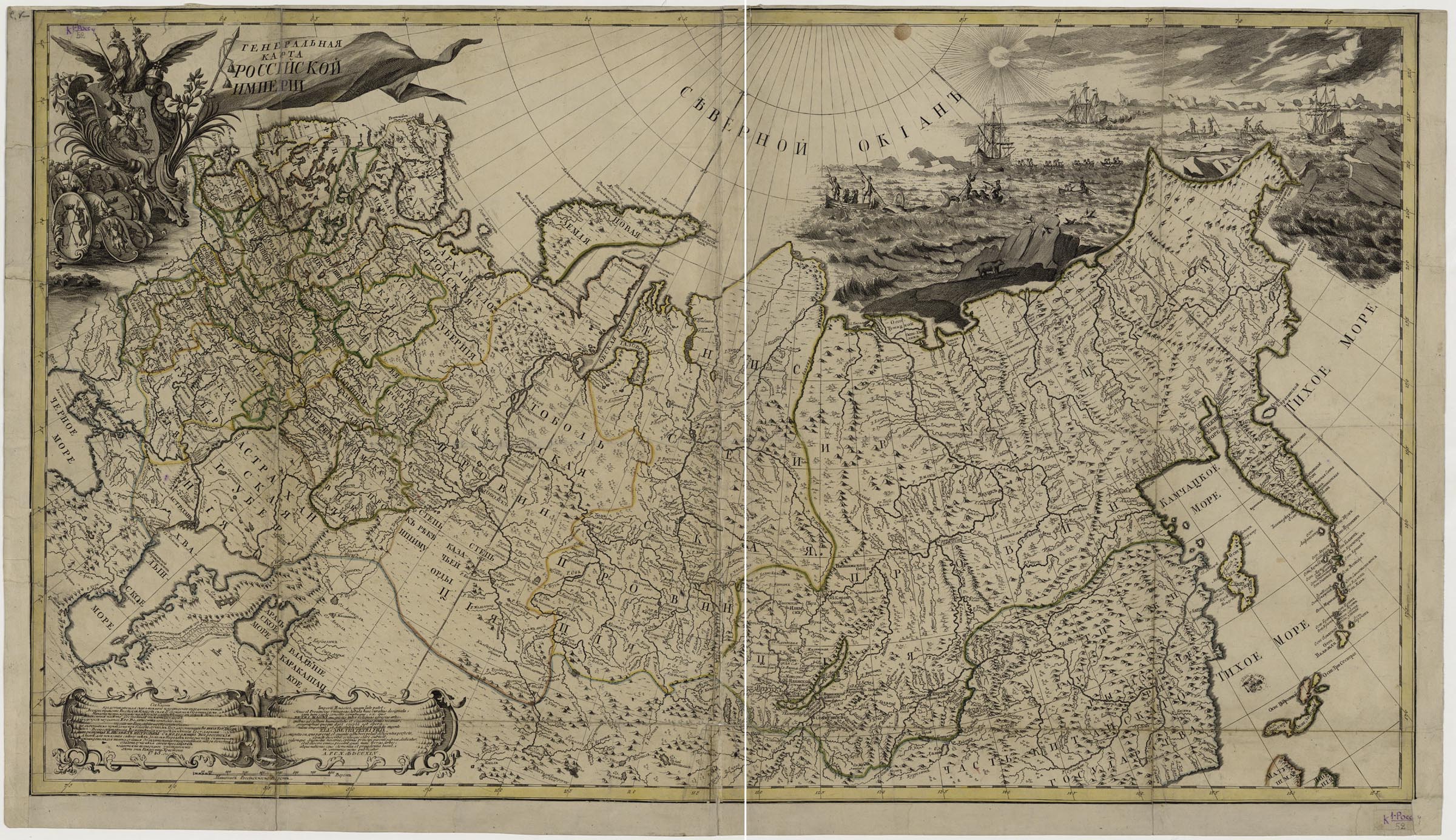
Mappa Generalis Totius Imperii Russici. / [Engraved by Georg-Johann Unverzagt, Mikhail Makhaev. – Saint Petersburg : Geographical Department of Academy of Sciences], 1745.
From the publication: Atlas russicus mappa una generali… Petropoli : Typis Academiae Imperialis Scientiarum, 1745.
K 1-Ross 8/40
Electronic resource
The map marks the 50th anniversary of the Academy of Sciences and displays the results of explorations made during academic expeditions of 1768-1774. There is a similar map in Russian, but in the Maps Department of the National Library of Russia has a copy in Latin.
At the top is a drawing depicting a female figure hovering in the clouds, with a quadrant, - an allegory of [Geography], and cherubs (one supports a scroll with a title, the second measures the distance between two points on a stand globe). In the bottom right corner is a drawing that symbolizes the successes of Catherine's reign: against the background of a stone cliff, there is a sitting female figure in the crown and mantle - Catherine II. Mercury, with a caduceus and a laurel branch, is examining a map consisting of two sheets. One of the leaves depicts the territory of the Black Sea coast, where repeated Russian-Turkish wars were conducted. The drawing also contains a shield with the coat of arms of the Russian Empire, military paraphernalia. The background shows a Turkish fortress, a sailing ship. An eagle, with a wreath and symbols of power, is soaring above them.
K 1-Ross 4/26
Electronic resource
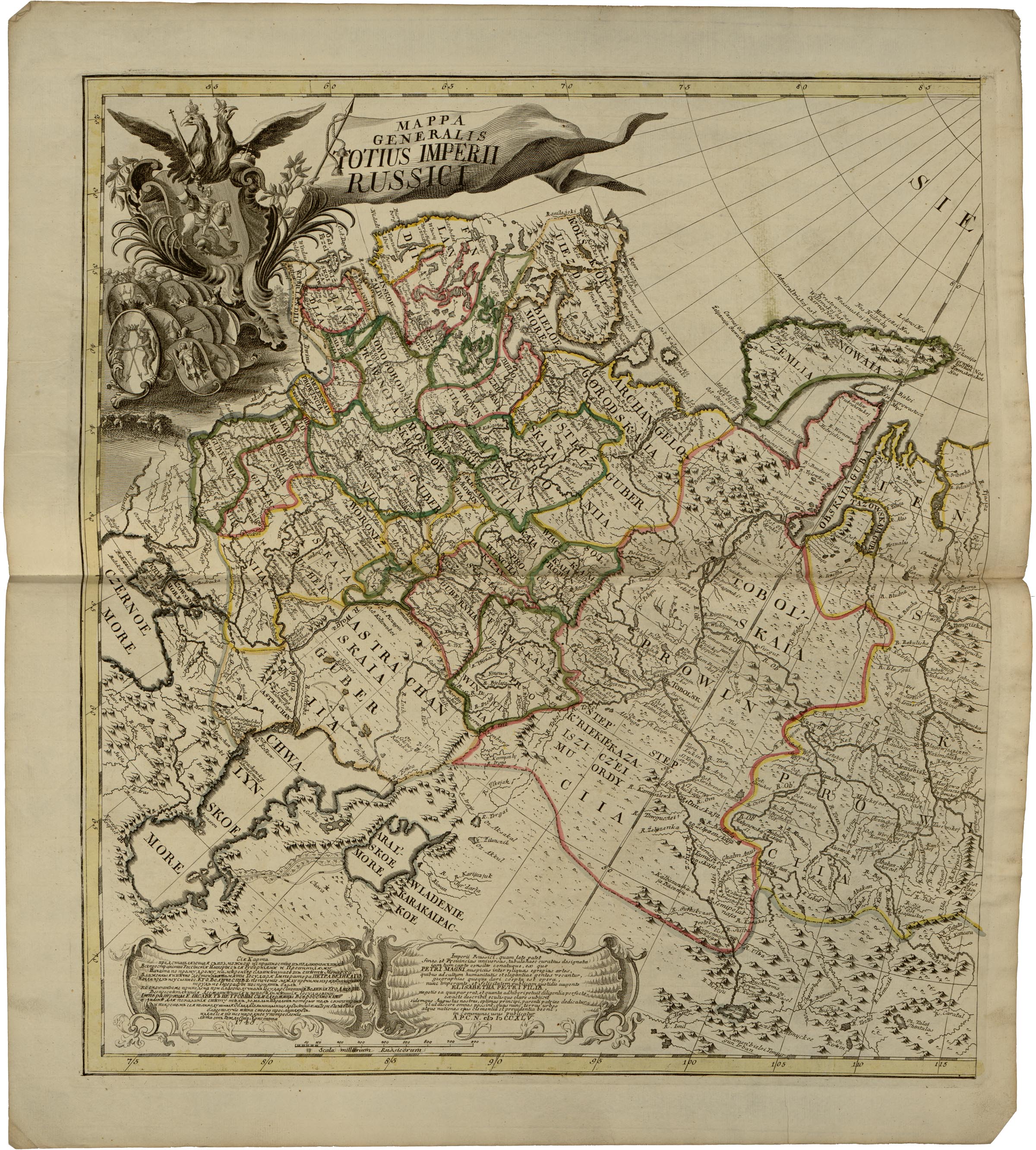
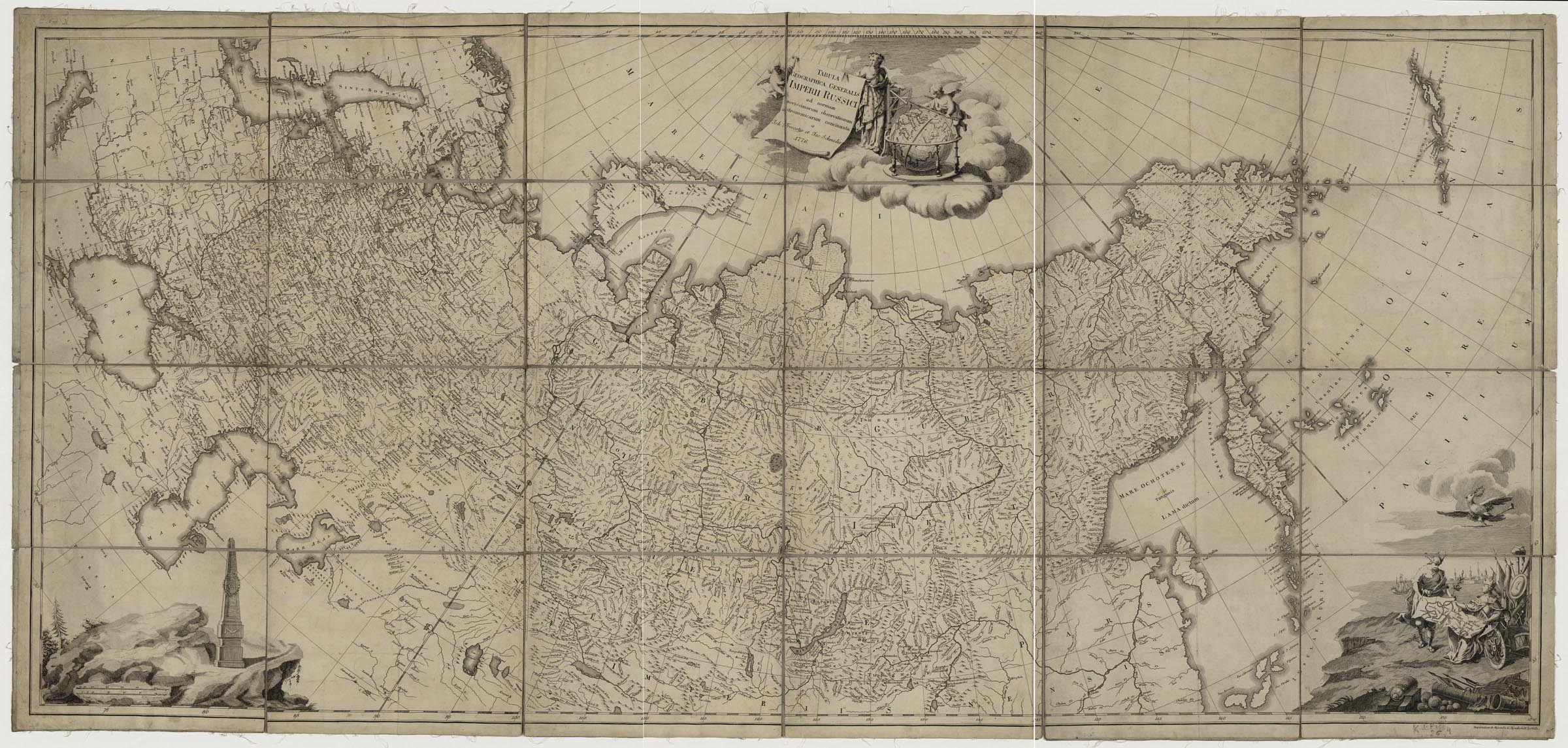
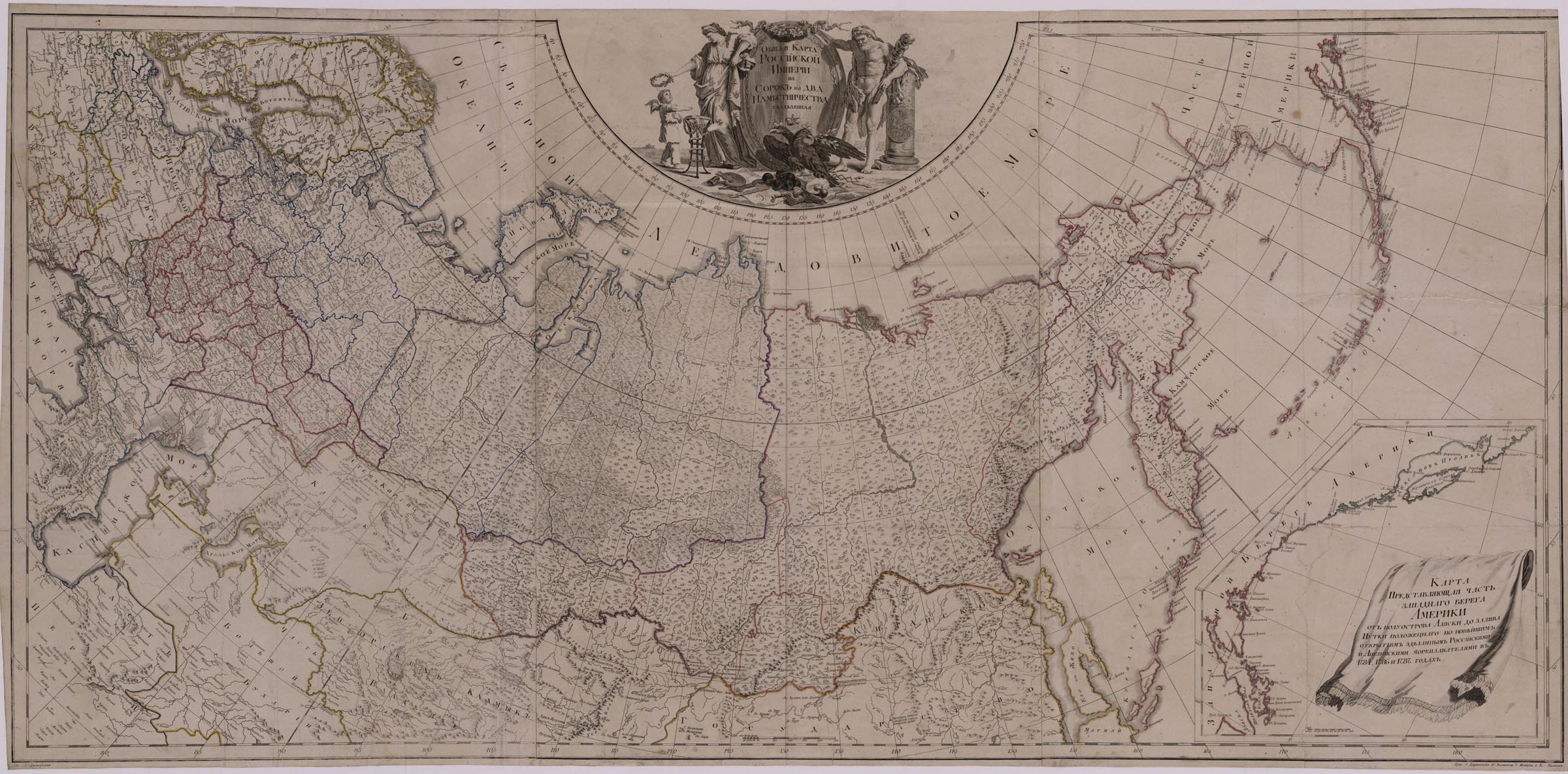
Work on the map was started in 1781. The map was compiled taking into account the materials of land surveying and was the largest general map of the country in the 18th century. After the completion of the map, Prosecutor-General A. Vyazemsky (one of the supervisors of the General Land Survey that began in 1765) submitted it to the Academy of Sciences. According to academicians, the map had many mistakes and was inferior to the «General map of the Russian Empire…» of 1776, created in the Academy of Sciences.
Drawings: a sitting female figure in the crown and mantle is the allegory of the Empire. She is facing another female figure surrounded by radiance, hovering in the cloud and holding in her hands the shield with the monogram of Catherine II and the wand with the symbol of "the eye of the Omniscience". There are numerous signs of Russia's success in military, economic, educational fields: military armature, a caduceus, barrels, packaged bales of goods, an anchor, a fragment of the colonnade, a stand globe,an armillary sphere; measuring and surveying instruments, household equipment. You can also see a landscape depicting a tree in the foreground, the crown of which contains 40 shields with the arms of the provinces and the dates of their founding. There are books with inscriptions on their spins: "Order of 1776, Cadastral Survey of 1766, Establishment of 1775", symbolizing the launch of the Catherine II's General Cadastral Survey.
K 1-Ross 4/24
Electronic resource
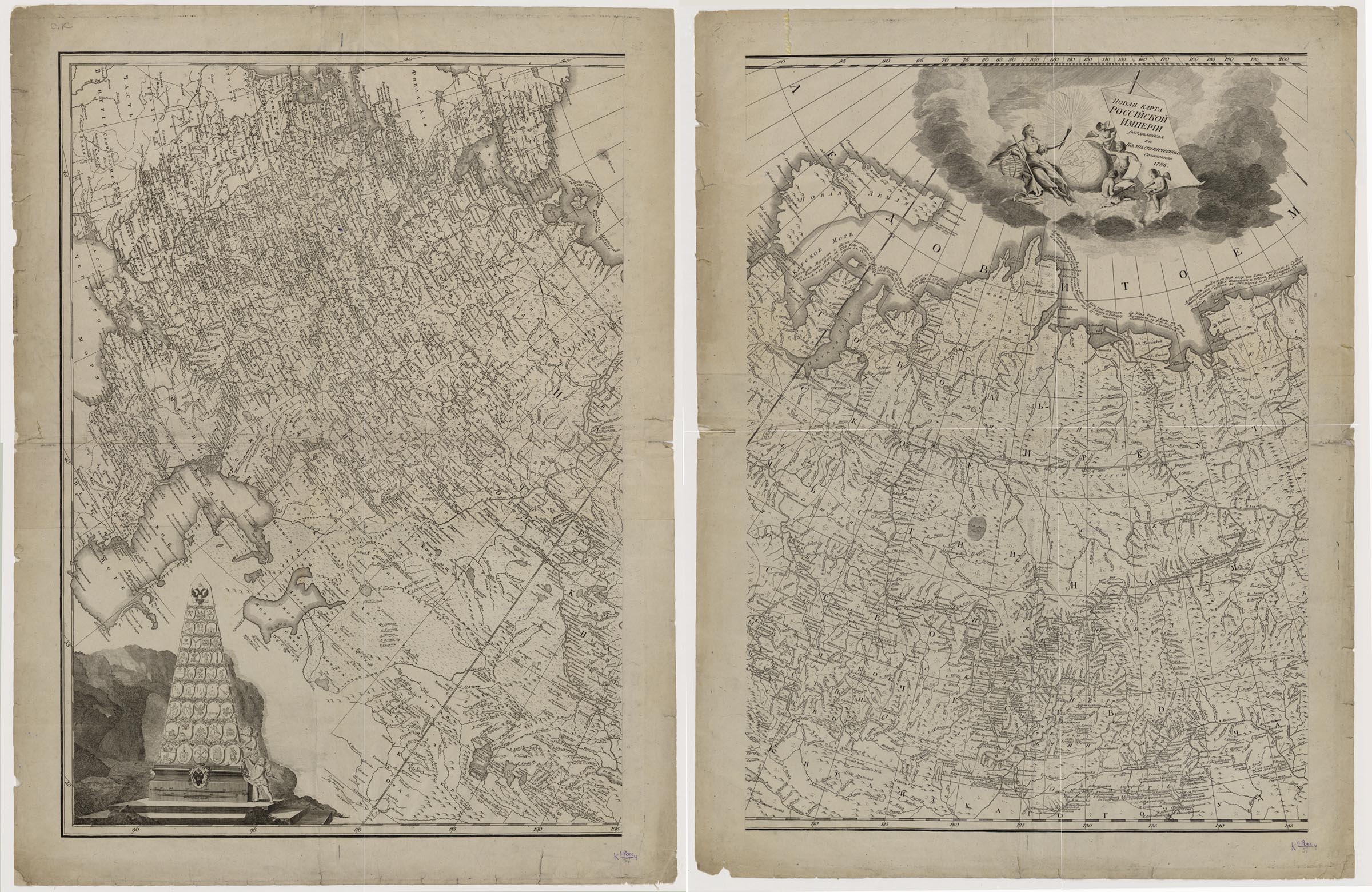
The general map of Russia of 1786 replaced the general map of the Russian Empire of 1776. It was created on the base of new astronomical data that included observations in the central part of the state. The map reflects the changed administrative structure of the state after the reform of Catherine II, carried out in 1775-1785. Using this map, the academician G. Kraft calculated the area of the Russian Empire for the first time.
The cartouche, with the title, contains the drawings: a women's figure, floating on the cloud, with the attributes of enlightenment (a model of the globe, a book, measuring instruments), cherubs taking measurements on the globe with contours of continents. In the left bottom corner is the obelisk with the coat of arms of the Russian Empire and the emblems of the governorships and provinces. In the right bottom corner is a sitting female figure in the crown - Catherine II with a map on her knees, Mercury with a caduceus, around him is the military armature, packed bales and rolls of goods (symbols of military might and trade successes of Russia).
K 1-Ross 4/57
Electronic resource
Nova Tabula geographica Imperii Russici in Gubernia divisi. Edita 1787. – [Saint Petersburg : Geographical Department of Academy of Sciences], 1787.
K 1-Ross 4/58
Electronic resource
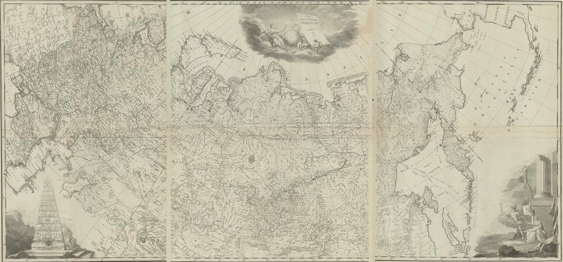
The map was compiled on the basis of the New Map of the Russian Empire… of 1786. It is a part of the publication: General and Special Maps… of 1787. P. [1].
The map was used for creating the map: Map of the Russian Empire [produced after 1795.] K 1-Ross 2/56.
Electronic resource
The cartouche with the title contaibs drawings: a female figure in a mantle with images of two-headed eagles - the allegory of the Empire; Hercules with a club, leaning on a half-column, on which St. George the Victorious is depicted; a crowned two-headed eagle with a laurel branch and arrows of Jupiter, in front of him a shield with the coat of arms of Moscow in the frame of the Maltese cross, an open book, a palette with brushes, the defeated Turkish flag and bunchuk (symbols of military victories and the development of Russian science and art).
A supplementary map shows part of the western coast of America from the peninsula of Alaska to the Gulf of Nutki, based on the latest discoveries made by Russian and English navigators in 1784, 1786 and 1787. There are depicted: shoreline, names of islands, capes, gulfs.
K 1-Ross 8/75
Electronic resource
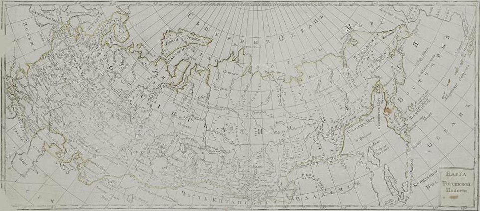
Carte Générale de l'Empire de Russie divisée en Quarante deux Gouvernemens 1793. Comp: par Alexandre Vilbrekht / Alexander Wilbrecht. – [Saint Petersburg : Geographical Department of the Cabinet of His Imperial Majesty], 1793.
K 1-Ross 3/60
Electronic resource
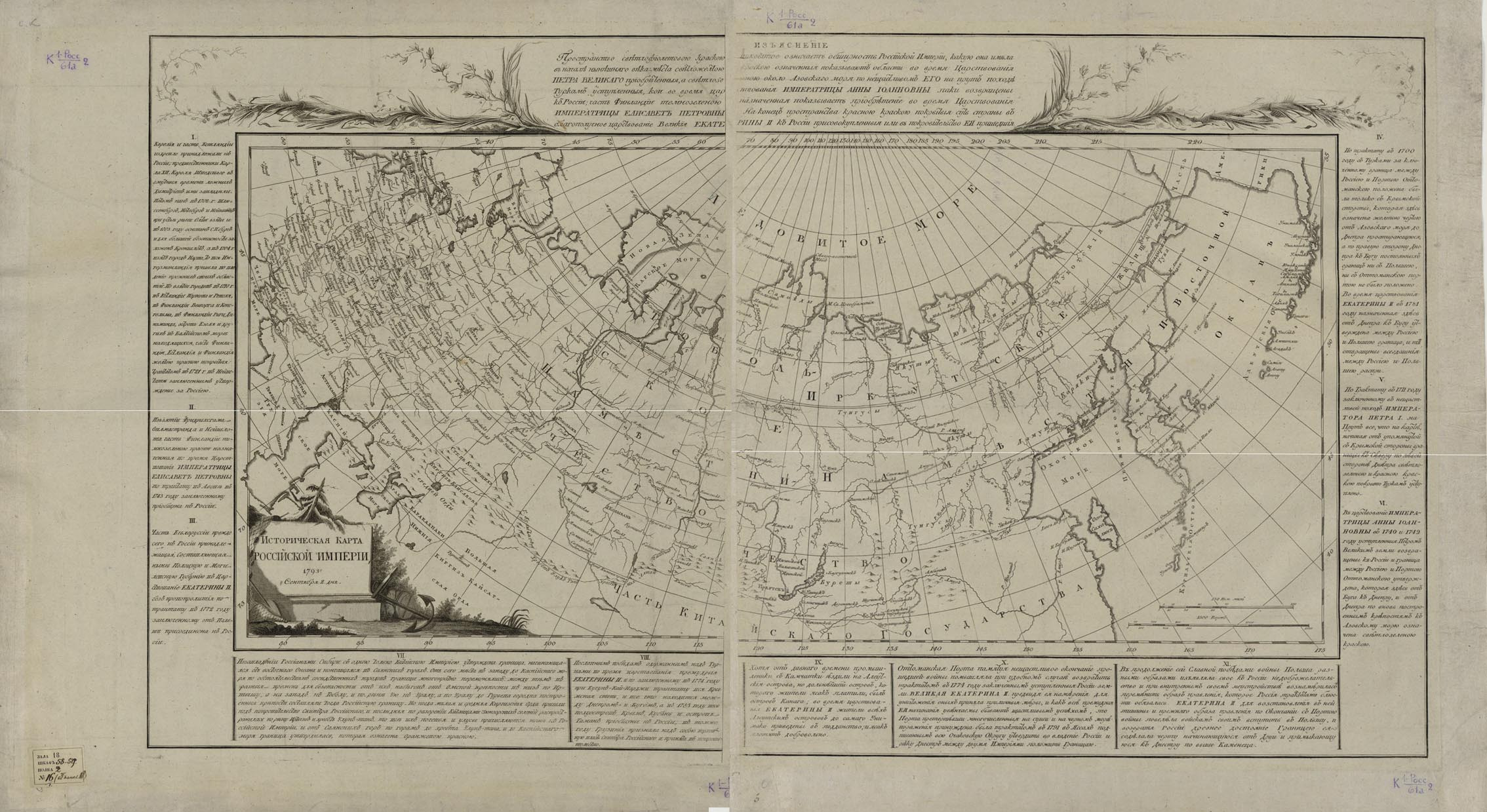
"An Explanation" is a statement about the colours of the territories annexed to Russia during the period beginning at the reign of Peter I and extending to that of Catherine II.
Text beyond the framework: brief historical references (I-XI) on the forming of state borders from 1702 to 1793 during the reigns of Peter I, Anna Ioannovna, Elizaveta I, Catherine II, specifying the colour of the boundaries described on the map, the dates and names of the treaties establishing new boundaries. More attention is given to the border with the Chinese Empire.
K 1-Ross 2/61.
Electronic resource
It is the re-engraving of the edition: Map of the Russian Empire of 1787, with the change in the position of the western state border after the third partition of Poland, as well as with minor changes in the system of settlements and the usage of other fonts.
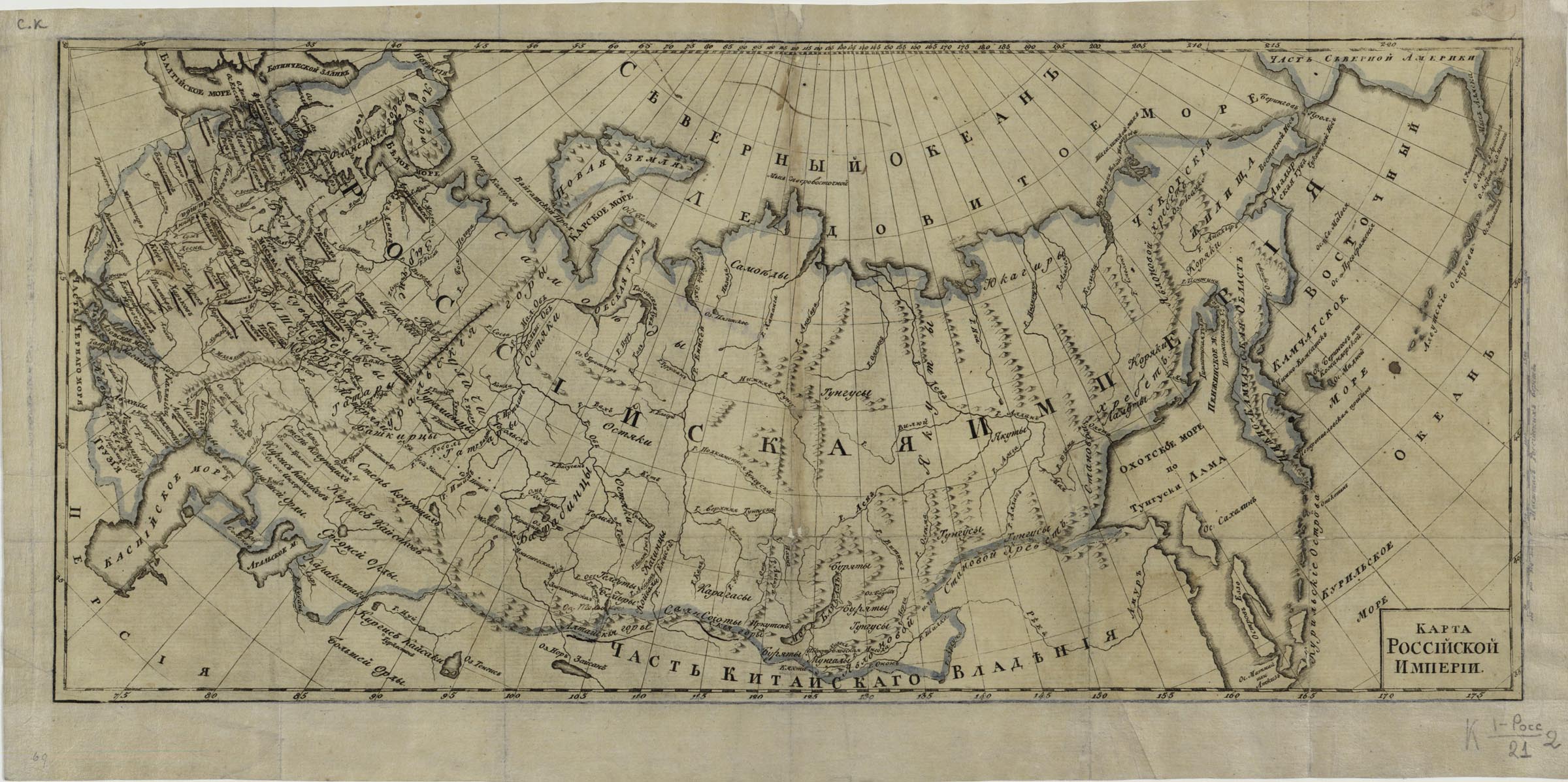
K 1-Ross 2/21
Electronic resource
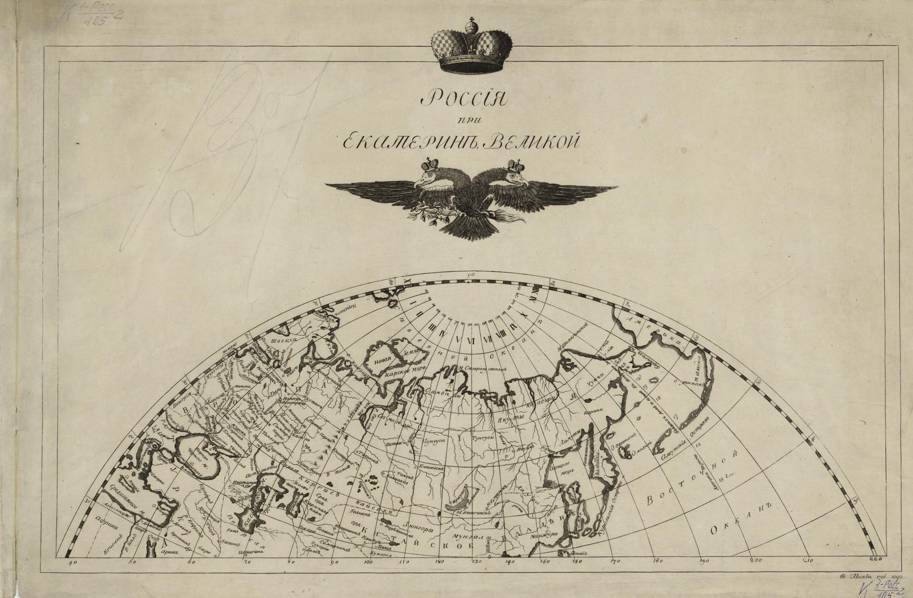
The image is made in the form of a hemisphere. Based on the content, the map obviously had a teaching purpose. K 1-Ross 2/105.
Electronic resource
K 1-Ross 3/65
Electronic resource
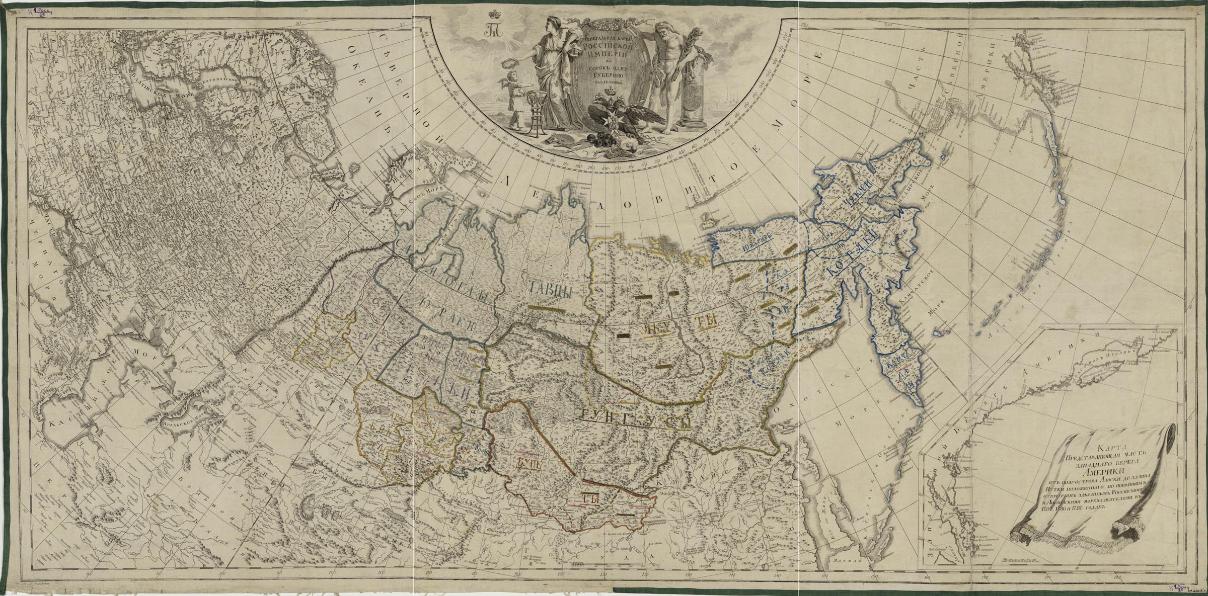
It is the reprint of the General Map of 1793. The map is distinguished by the presence of the monogram of Paul I in the cartouche and by the display of the internal borders of the empire, according to the administrative reform of Paul I. It was part of the publication: Russian Atlas of Forty-three Maps… of 1800.
A supplementary map: A map representing part of the western coast of America from the Alaska peninsula to the Nutki Bay, based on the latest discoveries by Russian and English navigators in 1784, 1786 and 1787.
The cartouche contains the title and drawings: a female figure in a mantle with images of two-headed eagles - [Catherine II], Hercules with a cudgel, leaning on a half-column, on which the Saint George the Victorious is depicted. There are also shown a crowned two-headed eagle with laurel branch and arrows of Jupiter; before the eagle is a shield with the coat of arms of Moscow over the Maltese cross; an open book, a palette with brushes, the defeated Turkish flag and a bunchuk; the monogram of Paul I in the radiance under the crown.
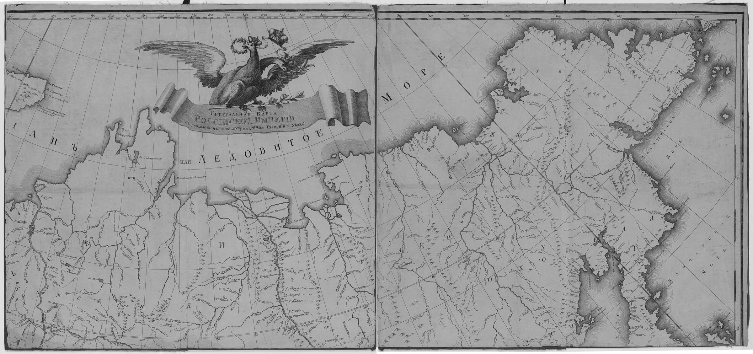
The borders and the names of the peoples inhabiting the Asian part of Russia are marked with different colours. K 1-Ross 4/25.
Electronic resource