20th and 21st Century Plans
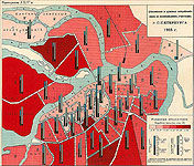 The Cartographic Department store plans of St. Petersburg on various subjects, published in the 20th century.
For example, among them are materials reflecting the consumption of wine in St. Petersburg. At the beginning of the 20th century, there were more than 3 thousand pubs and taverns in the capital. In absolute consumption of wines, areas with the largest population stood out: the third Spassky district, the third Alexander Nevsky district, the second Petersburg district. In 1903, the highest wine consumption per person was 3.5 buckets per person in the second Spassky district, due to concentration of a large number of commercial and industrial establishments in this territory. The plan was issued in the publication «Album of Cartograms and Diagrams for the Production, Sale and Consumption of Wine and Beer». ( St. Petersburg, 1905).
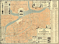 The plan «Plan of St. Petersburg Showing Hotels, Rooming Houses, Restaurants», published in 1903, shows a central part of the city, where the most part of consumers services were located. On the left there is a numbered index of service enterprises with addresses and names of their owners. Along the edges of the frame and on the plan there are written advertisements.
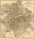 K 3-Pb 4/41
The special «Taximeter Plan of Saint Petersburg for Cabmen» was compiled in 1904 because of great demand for the services of cabs. It based on the Ilyin plan published on the same scale in the late 19th and early 20th centuries. The plan was divided into sections of 85 sazhens (one sazhen is equal to seven feet). A section was equal to the distance that a cab covered in one minute. The fare during the day and at night is also given.
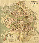 In 1908, the Preparatory Commission of the City Council chaged the engineer K. Griboyedov with an initial project of sewerage system on Vasilyevsky Island, and then of the municipal sewage lines. This project was presented on the «Plan of St. Petersburg. Sewerage Project. 1909».
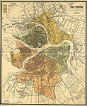 The «Plan of Petrograd presented stages of the project of reconstruction of lighting», published in 1916, reflects the project for the transformation of the lighting in Petrograd (the former name of St. Petersburg).
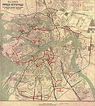 There are series of project plans for development of underground and surface transport in St. Petersburg - in the near future and the long term.
Among them is the «Plan of the City of Petrograd Showing a Freight Bypass Line» designed by the engineer Tokarski. The plan presents a project of a railway which was supposed to go around the city to divert goods traffic from it. Its continuation was planned to build along the embankments of the Moika River and, partially, the Fontanka River.
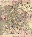 At the turn of centuries, Saint Petersburg began planning out the future electric tramway network. The «Plan of the City of Petrograd Showing the Tram Lines at 1, 2 and 3 Stages» was published by the printing house De Kölsch specializing in the production of thematic plans. The plan shows: existing and planned tram lines, electric power stations and substations, tram parks. In 1907, the electric tramway network opened in Saint Petersburg, the tram network then further was developed in 1914, the third stage of the network construction was planned.
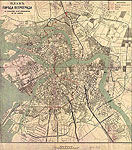 The «Plan of the City of Petrograd Showing Projects of Underground Tracks in the First Variant» represents one of the last pre-revolutionary underground construction projects. Proposals for the construction of the subway St. Petersburg began to be received in the 90s of the 19th century.
The first project was developted in 1901. The plans show only the most intense projects that were designed after 1914.
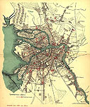 Remarkable are plans of the city, reflecting how the city changed in the twenties and thirties of the last century.
Among them is the «Plan for the City of Leningrad, Divided into Districts, Compiled according to the Latest Official Sources» (Leningrad, 1922-1925).
The plan shows the administrative divisions of the city. Tram lines with terminal points, public institutions, architectural monuments and landmarks, and industrial enterprises are marked. Each sheet contains indices of large state institutions, factories, and landmarks. The «List of streets, alleys, squares and so on» and the «List of renamed streets, bridges, gardens, parks etc.» are attached to the plan.
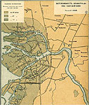 The map «Inundated Areas in Leningrad during Floods» from the «Atlas of Leningrad Oblast and the Karelian Autonomous Soviet Socialist Republic» deals with an urgent problem of floods. (Leningrad, 1934) The map shows the areas of the city that experiences flooding when water levels rise over 4 meters, 2.5 meters, 1.5 meters above normal.
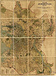 The «Plan of Leningrad of 1939» shows areas of the city, lines and destinations of bus, trolleybus lines; railways; gardens and squares, parks and forests, orchards, fields and vacant areas. There are signed names of the historic districts of the city.
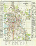 Among materials related to the Second World War is noteworthy «Mil.-Geo.-plan von Leningrad» – a copy of the plan of Leningrad, released in Germany in April 1941. The plan shows the location of 556 military facilities (barracks, military warehouses, headquarters), as well as many industrial facilities. The plan fully reflects the high level of preparedness of the fascist troops for a war with the USSR.
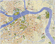 Modern city plans are received by the Department of Cartography regularly, on average, about 4-6 publications per year. For example, the «Map of the Center of St. Petersburg», published by ZAO "KARTA", came in our library in 2002. It is designed for tourists. The map is composed by students - members of the cartographic expedition organized by the City Palace of Youth Creativity. It incudes perspective drawings depicting the best sites and landmarks in the city, and provides additional information for travelers, in particular, suggestes walking routes around the city.

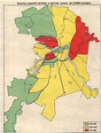 It should be noted that in addition to general geographic plans, the Cartographic Department stores modern thematic atlases. For example, the «Environmental Atlas of St. Petersburg» is the world's first atlas to give ecological characteristics of a big city. The atlas includes maps of the landscape; climatic conditions; air, water and soil pollution; radiation situation; noise level; electromagnetic fields as well as maps of environmentally oriented sickness rates of the population.