
Publishing activity of A. Ilyin's Cartographic Establishment
- Maps and Atlases
- Maps on Postcards
- Postcards
- Publications Catalogues
- Books and Illustrative Material
Maps and Atlases
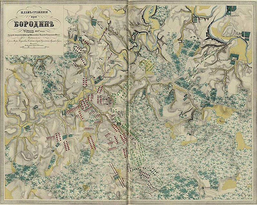
Historical and Military Atlas of the 1812-1815 Wars. The War of 1812.
(For the 2nd and 3rd special classes). Compiled by the General Staff Lieutenant Colonel V. Poltoratsky. St. Petersburg: Lithography of the Military Topographic Depot, (maps nos. I - III) was printed by Stepanov's Lithography, (map nos. IV - [XV]) - by the Lithography of Poltoratsky and Ilyin, text - by the B. Bezobrazoff Press, 1860.
1 vol. (15 double pages of maps (of which 3 pages with flaps), 12 double pages of text). 54x36 cm. Colour. (Teaching materials for military schools).
К 3-Евр 8/422 (K 3-Eur 8/422)
It is the first atlas published by the Cartographic Establishment of A. Ilyin.
Plan of the Battle of Borodino.
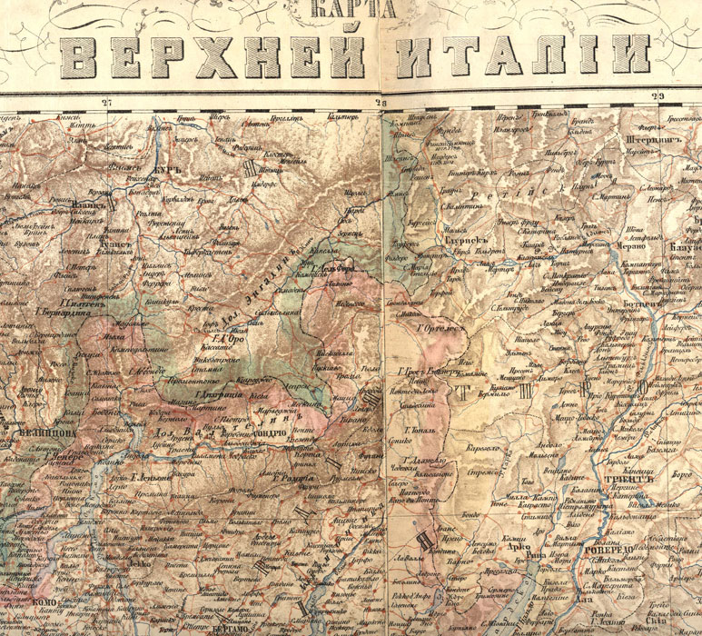
Map of Upper Italy.
Compiled by the General Staff Lieutenant-Colonel Poltoratsky and Captain Ilyin. Lithography by G. Shinkevich .- 1:840 000.- St. Petersburg: Printed by the Lithography of Poltoratsky and Ilyin. 1859.
2 sheets pasted together. 52x94 cm. Colour.
К 3-Ит 4/8 (K 3-It 4/8)
It is the first map published by the Cartographic Establishment of A. Ilyin.
[Statistical Plans of St. Petersburg].
-1:35 280.- St. Petersburg: A. Ilyin's Cartographic Establishment, [1868].
16 sheets. 26x34cm. Colour.
From the book: "Saint Petersburg. Research on the History, Topography and Statistics of the Capital. " St. Petersburg, 1868. Vol. 3.
К 3-Пб 7/247 (K 3-Pb 7/247)
16 plans
1. Density of population.
2. Average occupancy of houses.
2а. Average occupancy of the apartments.
3.Numerical ratio of the sexes.
4. Distribution of the natives of the capital.
5. Distribution of foreigners.
6. Distribution of hereditary nobles.
7. Distribution of personal nobles.
8. Distribution of urban classes.
8а. Distribution of honorary citizens and merchants.
9. Distribution of the peasants.
10. Distribution of literates.
11. Distribution of Catholics.
12. Distribution of Protestants.
13. 13. Distribution of children.
14. Distribution of married people.
Electronic version
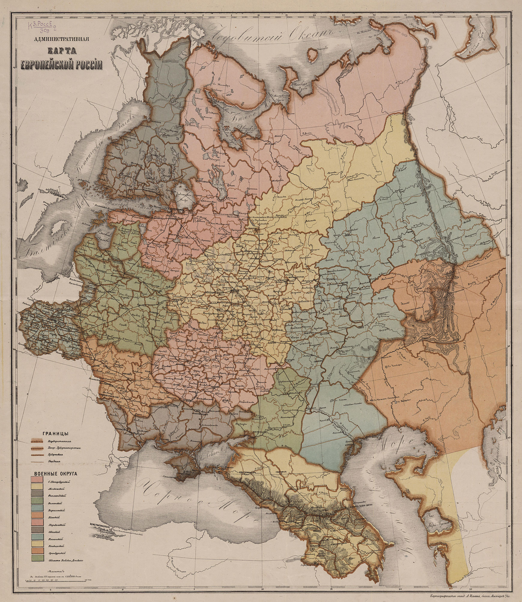
Administrative Map of European Russia.
-1:7 350 000.- St. Petersburg: A. Ilyin's Cartographic Establishment, [1869-1875].
1 sheet. 62x49 cm. Colour.
К 3-РоссЕ 2/309 (K 3-RossE 2/309)
Detailed Atlas of the Russian Empire with Plans of Major Cities.
St. Petersburg: A. Ilyin's Cartographic Establishment, 1871.
1 vol. (70 pl.) 53x38 cm. Hand-coloured borders.
>К 3-Росс 8/306 (K 3-Ross 8/306)
This atlas comprises general maps representing Russia's provinces, territories and regions, with plans of the most important cities. In addition, it includes several thematic maps of Russia (orohydrographical, ethnographical, administrative, etc.). The atlas is the only large publication of this kind.
Electronic version
Map of the Territory Now Occupied by St. Petersburg,
made in 1698, before it was gained by Peter the Great, including contemporary Swedish fortifications. - [St. Petersburg]: A. Ilyin's Cartographic Establishment: [1872].
1 sh. Lithograph, 22х27 сm.
К 3-Пб 1/235 (K 3-Pb 1/235)
In 1698, the commandant of the Nyenschantz fortress, Swedish baron Avraam Cronjort made a map showing the Neva delta. In five years after that Saint Petersburg was founded. In 1737 the map was revised by Ch.J. Schwartz employed at the Academy of Sciences in Petersburg. The Russian version was prepared by the architect R.E. Schwartz in 1872 and published at A. Ilyin's Cartographic Establishment.
Electronic version
Map of Judicial Districts of European Russia.
Based on information of the Department of Statistics at the Ministry of Justice for 1873. -1:7 350 000.- St. Petersburg: A. Ilyin's Cartographic Establishment, after 1873.
1 sh. 62x50 cm. Colour.
К 3-РоссЕ 2/290 (K 3-Ross 2/290)
Electronic version
Plan of the Sanitary Condition of St. Petersburg.
Made by Doctor of Medcine Y. Guner from his own survey.- 1:19 320 .- St. Petersburg: A. Ilyin's Cartographic Establishment, [1877].
1 sh. 69x90 cm. Colour.
Around the edges of the map is a list of hospitals, orphanages, and other institutions with their addresses.
К 3-Пб 5/36 (K 3-Pb 5/36)
The plan was made by Professor Y. Guner in 1877 for his work on the problems of the sanitary condition of St. Petersburg.
It was the first plan to be issued at the scale of 1:19 320 which was subsequently used by Ilyin to publish most plans of St. Petersburg.
Electronic version
Map of Tver Province [Maps]:
Shown are boundaries of districts, parishes, mobile field stations, military recruitment centres, Zemstvo (local government) schools, post and trade routes, postal and Zemstvo stations / Compiled by the local government of Tver Province. - St. Petersburg: A. Ilyin's Cartographic Establishment: 1879.
1 map (2 sheets): colour; 76x46 (87x68) cm.
3-Цтр 3/29 (3-Tstr 3/29)
Electronic version
Geologic Map of the Shoreline of Lake Baikal.
Produced by I.D.Cherskii from the 1877-80 survey. St. Petersburg, from the Proceedings of the Imperial Russian Geographic and Imperial St. Petersburg Mineralogical Societies. St. Petersburg: A. Ilyin's Cartographic Establishment, [after 1880].
2 sheets in common frame, 70x84 cm. Colour.
К 3-Байк 3/31 (K 3-Baik 3/31)
Electronic version
Fire brigade named after Peter the Great, established under the patronage of Her Imperial Majesty Empress Maria Fedorovna.
Plan of the fire brigade area.- 1:21 000 .- St. Petersburg: A. Ilyin's Cartographic Establishment, [1881-1884].
1 sheet. 84x63 cm. Colour.
К 3-Пб 3/130 (K 3-Pb 3/130)
The plan shows the location of the fire stations, observation posts, reservoirs, signal towers, telegraph and the area that the fire brigade after Peter the Great served.
Electronic version
Plan of St. Petersburg.
Compiled from the Shubert plan of 1828, hydrographic charts of the Neva and its estuary. From the Proceedings of the Hydrographic Department of the Ministry of the Navy and reconnaissance survey made in 1882-83 by the retired colonel M.S. Vorotnikov.-1: 12 600 .- St. Petersburg: A. Ilyin's Cartographic Establishment, 1883.
4 sheets in the common frame. 62x78 cm. Colour.
К 3-Пб 2/23 (K 3-Pb 2/23)
It is a future plan.
Electronic version
Plan of the city of Kazan;
Made by S. Monastyrsky. St. Petersburg: A. Ilyin's Cartographic Establishment, [1884]. 1:42 000.
1 sheet. 22x24 (26x29) cm. Colour
К 3-План 1/618 (K 3-Plan 1/618)
Electronic version
Plan of Warsaw.
St. Petersburg: A. Ilyin's Cartographic Establishment: 1886.
1 sheet: 58х54 (71х54) cm. Colour.
К 3-План 2/434 (K 3-Plan 2/434)
Electronic version
Plan of St. Petersburg.
Compiled from the latest data.-1: 19 320. - St. Petersburg: A. Ilyin's Cartographic Establishment, [1885 - 1887].
1 sheet. 70x60 cm. In the cover. 18x14cm. Colour.
К 3-Пб 6/267 (K 3-Pb 6/267)
Teaching Atlas of Russian History
/ compiled and published under the editorship of E. Zamyslovskii. - Third Edition. - St. Petersburg: A. Ilyin's Cartographic Establishment: 1887.
[2] pages. 22 sheets of maps.
К 3-Росс8/35б (K 3-Ross 8/35b)
Electronic version
Map of Samara Province [Maps]
/ Compiled in 1887 by the members of the Samara Province Statistical Committee P.A. Richter and I.F. Stanevich; Lthographer I. Makhotin. - Samara: Samara Province Statistical Committee: A. Ilyin's Cartographic Establishment: 1888.
1 map: 3 colours, glued to a fabric backing; 76х71 (82х77).
К 3-Прив 3/16 (K 3-Priv 3/16)
Electronic version
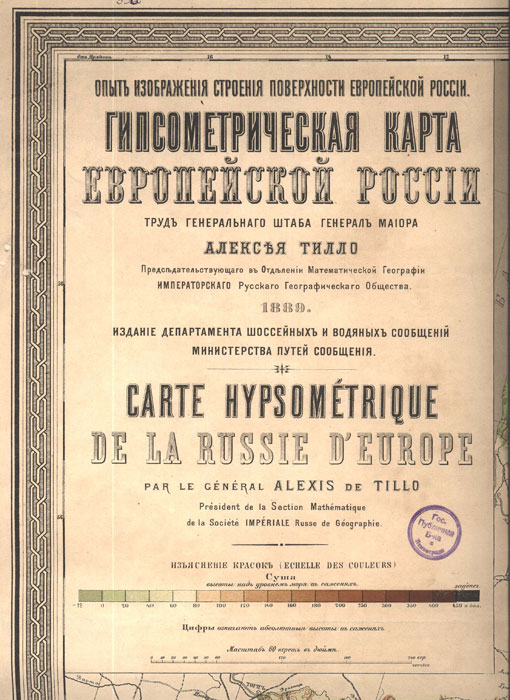
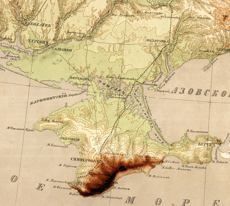
Hypsometric (Layered) Map of the European Part of Russia.
This is an experience of representing surface structure of European Russia. The work of the General Staff Major-General Alexei Tillo, chairman at the Department of Mathematical Geography of the Imperial Russian Geographical Society. 1889. The publication of the Department of Highway and Water Transport of the Ministry of Transport.- 1:2 520 000 .- St. Petersburg: A. Ilyin's Cartographic Establishment, 1889.
3 sheets in common frame. 61x93 cm. Colour. Title is also in French.
Text: Explanation to the hypsometric map of European Russia. Works by A.A. Tillo.
Table: Echelle des hauteurs.
К 3-РоссЕ 3/33 (K 3-RossE 3/33)
The map has fundamentally changed the conception of the structure of the European Plain. For its creation, A. Tillo was awarded the Gold Medal of the Russian Geographical Society.
Plan of St. Petersburg.
St. Petersburg: St. Petersburg City Government, A. Ilyin's Cartographic Establishment, 1889
1 sheet. 66х61 cm. Colour.
Plan was made by St. Petersburg City Government and shows all institutions and lands under its jurisdiction, fire alarms are also given. Supplement: "A list of the city buildings, medical institutions, elementary schools, offices of justices of the peace, and the city lands shown on the plan."
К 3-Пб 6/175 (K 3-Pb 6/175)
Electronic version
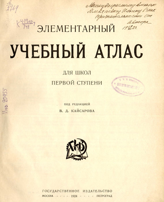
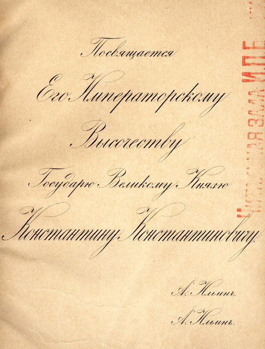
Teaching atlas.
30 tables. A. Ilyin. Saint Petersburg: A. Ilyin's Cartographic Establishment, [1892]
1 vol. (59 pages) 38х25 cm. Colour. Dedication to His Imperial Highness the Grand Duke Konstantin Konstantinovich. Signed by two A. Ilyin.
К 3-Мир 7/315 (K 3-Mir 7/315)
Map of Railways, High Roads, Inland Waterways;
Compiled by the Statistics Department of the Ministry of Transport. - Saint Petersburg: Publication of the Ministry of Transport: 1893; A. Ilyin's Cartographic Establishment.
1 sheet: 168 х150 cm. Colour.
К 3-РоссЕ 7/538 (K 3-RossE 7/538)
Electronic version
Map of Population of the Ussuri Region, based on data from January 1, 1899
/ Compiled by I.V. Danilchenko and A.A.Rittikh. - Saint Petersburg: A. Ilyin's Cartographic Establishment: 1899. - Scale [1:630 000].
1 sheet: 140х63 (146х68) cm. Colour, glued to a fabric backing.
К 3-Дв 4/166 (K 3-Dv 4/166)
Electronic version
The Great Siberian Railway Chelyabinsk-Baikal.
- Saint Petersburg: A. Ilyin's Cartographic Establishment: [189?]. Scale: [1:4 200 000]. .
1 sheet; 20х70 (25х75) cm: Lithograph. Colour.
К 3-Сиб 2/70 (K 3-Sib 2/70)
Electronic version
Map of the Russian Empire, Constructed According to the Latest Information.
[Maps]. - Saint Petersburg: A. Ilyin's Cartographic Establishment: [18.?].
1 map (6 sheets): colour, glued to a fabric backing; 69х136 (79х145) cm, folded 40х25 cm.
К 3-Росс 7/84 (K 3-Ross 7/84)
Electronic version
Map of the Eparchies of the Russian Orthodox Church.
European Russia. [Maps] / Compiled by A. Dobryakov. - Saint Petersburg: A. Ilyin's Cartographic Establishment: [19.?].
4 sheets in common frame; 85х64 (90х72) cm. Colour.
К 3-РоссЕ 4/184 (K 3-RossE 4/184)
Electronic version
Map of the Eparchies of the Russian Orthodox Church (Asian part) with a map of the world transport lines.
Saint Petersburg: A. Ilyin's Cartographic Establishment, [19.?].
4 sheets in common frame: 53х73 (62х83) cm. Colour.
К 3-Сиб 3/39 (K 3-Sib 3/39)
Electronic version
Taximeter Plan of Saint Petersburg for Cabmen.
Compiled from the latest data. -1:19 320.-Saint Petersburg: O. Klingelhofer, A. Ilyin's Cartographic Establishment,1904.
1 sheet. 85х63 cm. Colour.
К 3-Пб 4/41 (K 3-Pb 4/41)
The special taximeter plan was compiled because of great demand for the services of cabs . The plan was divided into sections of 85 sazhens (Russian sazhen is equal to seven feet). A section was equal to the distance that a cab covered in one minute. The plan provides the daytime and night time taxi fares.
Electronic version
Plan of the city of St. Petersburg showing streets, embankments, squares etc. and names assigned to them from March 7, 1880 to September 1, 1904;
as well as all the city properties, waters and sandbanks at the mouth of the Neva River. Compiled in 1904 by order of St. Petersburg City Government according to the resolution of the City Duma (Assembly). Engraver P. Makhotin.-1:12 600.- Saint Petersburg: A. Ilyin's Cartographic Establishment, [1904].
4 sheets in common frame. 48х50 cm. Colour.
К 3-Пб 3/45 (K 3-Pb 3/45)
The plan shows in detail the actual built-up areas and scheduled buidling projects; the city properties is also mapped.
Electronic version
Map of Transport Lines of Asian Russia.
- Saint Petersburg: Department of Statistics and Cartography of the Ministry of Transport, A. Ilyin's Cartographic Establishment: 1911. Scale: 1:4 200 000.
1 sheet; 83х170 (93х180) cm. Glued to a fabric backing, folded to fit a "25х38 cm" folder: Lithograph. Colour.
К 3-Сиб 7/83 (K 3-Sib 7/83)
Electronic version
Petrograd and its Suburbs.
-1:25 200.- Petrograd: A. Ilyin's Cartographic Establishment, 1915.
1 sheet.71х62 cm. Colour.
К 3-Пб 2/202 (K 3-Pb 2/202)
The plan shows the areas of service of the fire brigades and the extent of fires of the city, indicates levels of fire severity, the fire stations that are not included in the brigades.
Electronic version
Map of Petrograd Province
/ Compiled by Evaluation Department of Petrograd Province Zemstvo (Government). - Petrograd: Petrograd Province Zemstvo, A. Ilyin's Cartographic Establishment: 1916.
7 sheets in common frame: Multicoloured; 52х71 cm.
К 3-Зап 4/117 (K 3-Zap 4/117)
Electronic version
Moscou capitale de Russie.
Grave Paris per P.F. Tardieu.-Paris, 1809.
К 2-М 1/30 (K 2-M 1/30)
Electronic version
Plan de Petersbourg. Grave Paris per P.F. Tardieu.-Paris, 1809.
К 2-Пб 1/35 (K 2 Pb 1/35)
Plans of Saint Petersburg and Moscow, engraved by the Paris engraver P.F. Tardieu. These are miniatures executed on porcelain, in mahogany frame. Miniatures were purchased by the publisher A.Ilyin in Paris and were housed in his office.
Electronic version